Antarctica's icy shores lay unknown and uncharted for centuries, only being officially sighted and discovered in 1820. For many years, debate raged over who could claim the title as being the first to sight the Antarctic mainland, with the American sealer, Nathaniel Palmer, and the British naval officer Edward Bransfield both claiming to be the discoverer of Terra Australis in November and January of 1820, respectively. However, both may have been beaten to the prize, in the case of Bransfield, by mere days.
Bellingshausen's Journey to Antarctica
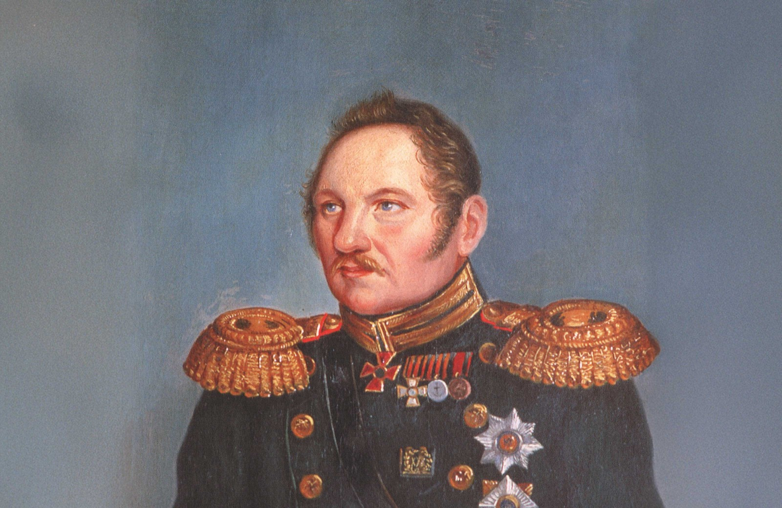
Like many figures associated with early Antarctic exploration, Fabian Gottlieb von Bellingshausen's background was naval. He was a naval officer in the Imperial Russian Navy, having entered service at a young age during a period when the Russian Empire sought to expand its maritime presence on the global stage.
Bellingshausen gained early expedition experience as a junior officer on Russia’s first circumnavigation of the globe (1803–1806), led by Adam Johann von Krusenstern. Serving as a lieutenant and cartographer aboard the Nadezhda, he participated in hydrographic surveys, astronomical observations, and, crucially, gained experience in long-distance navigation across the Atlantic, Pacific, and Indian oceans. He also published several maps and charts of many newly discovered regions.
In part due to his prior experience in circumnavigation and his military service in the Baltic and Black Sea Fleets, in 1819, Bellingshausen was appointed leader of a Russian circumnavigation expedition, the first specifically tasked with exploring the Southern Ocean and the supposed land in the extreme south. This would come to be known as the first Russian expedition to Antarctica following his triumphant return.
The expedition, in part planned and requested by Tsar Alexander I, departed Kronstadt, St Petersburg, with two ships: the Vostok, commanded by Bellingshausen, and the Mirny, under Captain Mikhail Lazarev. Their objective was to explore the southern latitudes, search for land, and improve geographic knowledge and understanding. For unknown reasons, the expedition was organized hastily, and Bellingshausen could not secure a proper scientific team with dedicated naturalists in time. Instead, all scientific work was conducted by the expedition's officers and Ivan Simonov, an astronomer and geodesist.
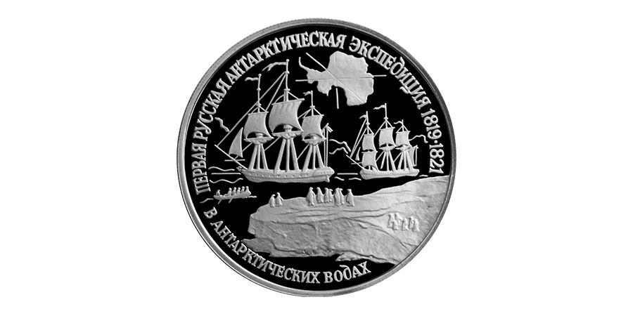
By Банк России, Public Domain, Link
Antarctica and the extreme south remained a mystery in 1819. While many sub-Antarctic islands were known, and indeed frequented by sealers and whalers, the presence of a continent was still speculative. It was influenced heavily by the then-in-vogue notion of Terra Australis. In 1773, Captain James Cook had crossed the Antarctic Circle and, after encountering thick, impassable sea ice, reported that while a polar continent may yet exist, it would be impossible to reach. It was with this prior knowledge from the Age of Discovery that the expedition set out, stopping in Copenhagen and Great Britain before crossing the Atlantic via Brazil and eventually reaching the Falkland Islands in November 1819.
Exploring the sub-Antarctic - a first glimpse of Antarctica
Both vessels spent the next several months exploring the sub-Antarctic, visiting South Georgia and discovering and naming several islands in the Traversay chain, part of the South Sandwich Islands. The expedition also mapped South Georgia, continuing the work of Captain Cook half a century later. In early December, the first icebergs of the voyage were sighted, from which fresh water was collected, and penguin meat and eggs were harvested as the ships sailed further south amid worsening weather. Throughout, scientific experiments, including water-temperature readings, were conducted by both vessels. Throughout, a number of experiments were carried out, ranging from meteorological and oceanographic studies to testing magnetic instrumentation and ethnographic studies undertaken in the Pacific. Also accompanying the expedition was the artist Pavel Mikhailov, who created a series of watercolors depicting various marine species and locations.
By mid to late January 1820, the expedition sighted several large ice shelves in the region of what would be known as the Princess Martha Coast, part of Queen Maud Land. At the time, the significance of this sighting was not realized, but in fact, Bellingshausen and his crew had potentially just become the first to sight the Antarctic mainland. Notes from Bellingshausen's journal describe continuous masses of ice resembling land, and ''ice that we first imagined as white clouds, through the coming snow." Ice shelves were sighted several times from January 16, 1820, through early February. These early sightings are significant and have contributed to modern interpretations that Bellingshausen almost certainly sighted Antarctica before the British and Americans in the region.
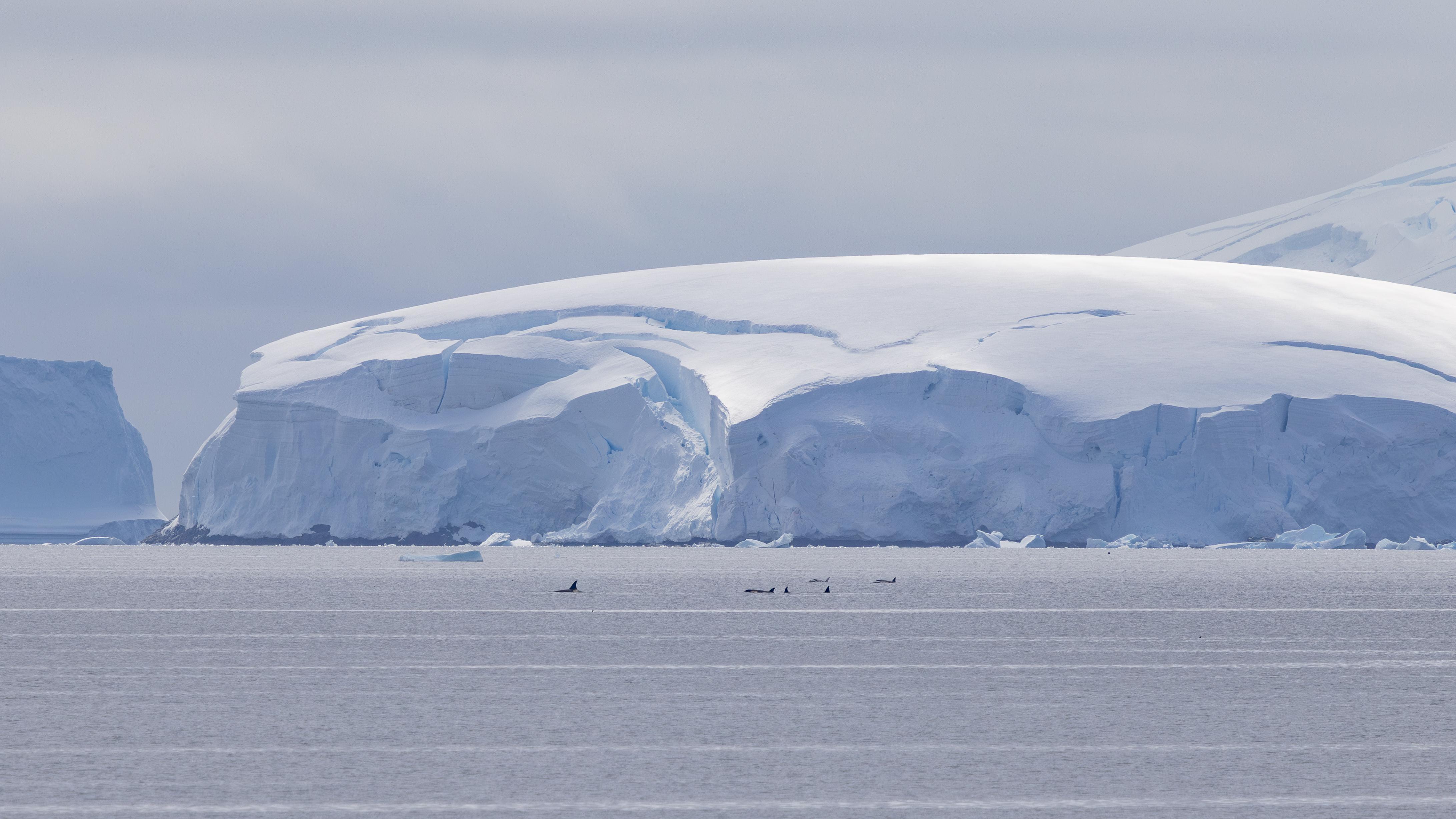
Picture by unknown photographer
The question of Bellingshausen, Bransfield, or Palmer
Unknown to Bellingshausen, at the same time, the British naval officer and explorer Edward Bransfield was also exploring the sub-Antarctic on a mission to survey the newly discovered South Shetland Islands. In February 1819, these far-flung islands were first sighted by British captain William Smith, after his vessel was blown off course during stormy weather at Cape Horn. Bransfield took formal possession of many of the South Shetland Islands for the British crown before entering what is now known as the Bransfield Strait, the body of water that separates the Antarctic Peninsula from the South Shetland Islands. On 30 January 1820, Bransfield sighted land on the modern-day Trinity Peninsula, reporting high mountains covered with snow, one of which was named Mount Bransfield in his honor.
Yet, just two days earlier, on 28 January, Bellingshausen reported his sightings of ice shelves in his expedition journal. Had he beaten Bransfield to the punch? The debate rages to this day. Undoubtedly, Bransfield sighted solid rock and the Peninsula itself. By contrast, Bellingshausen's sightings were of continental ice shelves, and not explicitly land.
Into the mix is added the American sealer, Nathaniel Palmer. While searching for seal rookeries in November of 1820, Palmer, aboard the sloop Hero, sighted the Antarctic Peninsula. Later, during the second half of Bellingshausen's circumnavigation, he and Palmer met on Deception Island. During that time, a conversation between the two men may have confirmed in Bellingshausen's mind that he had indeed sighted the Antarctic continent many months previously. Whatever the case, Palmer's claim to have been the first to discover Antarctica has been widely refuted. He was, however, the first to discover the South Orkney Islands, alongside British sealer George Powell.
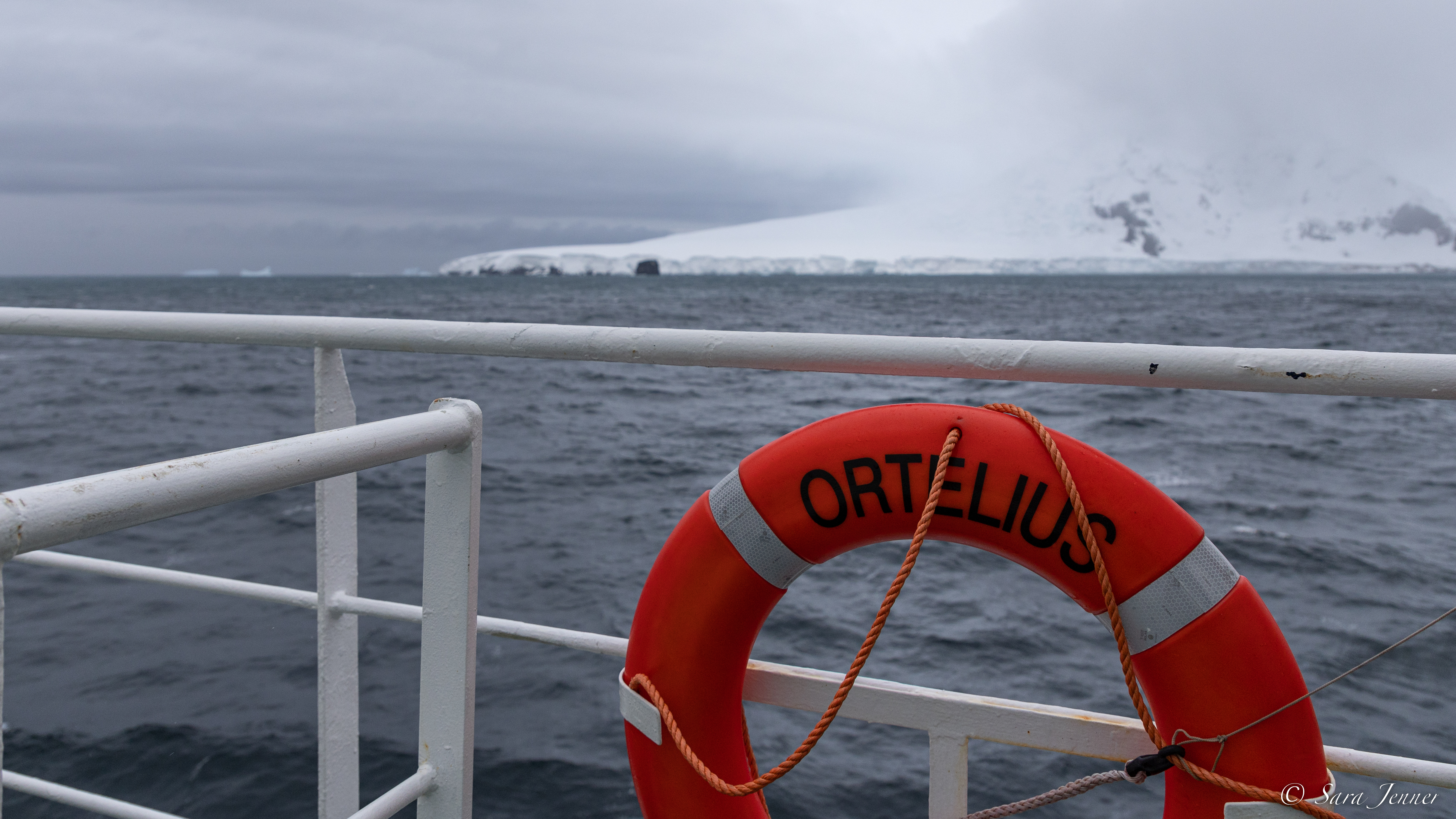
Picture by Sara Jenner
The question of who “discovered” Antarctica remains a matter of historical interpretation, largely dependent on definitions, which vary on whether discovery refers to sighting ice shelves, continental land, or an ice-free coastline. Bellingshausen himself appeared to remain cautious in his conclusions, and Bransfield may indeed have the more substantial, better documented claim. Nevertheless, modern scholarship widely recognizes the Russian expedition as one of the earliest, and possibly the first documented encounters with the Antarctic continent.
Circumnavigation completed - Peter I Island & the Bellingshausen Sea
After he sighted the Antarctic ice shelves in January 1820, Bellingshausen's expedition continued east, noting the southern lights and enormous icebergs, and taking weather and atmospheric readings. By mid-March, amid heavy seas, the expedition reached Port Jackson in Australia and, after resupply and brief excursions, left for New Zealand, using maps made by Captain Cook to explore the area around Queen Charlotte Sound. Further exploration of the Pacific followed, including much of modern-day French Polynesia, during which time Bellingshausen investigated the formation of coral islands. After a second visit to Australia, the expedition returned to the Southern Ocean.
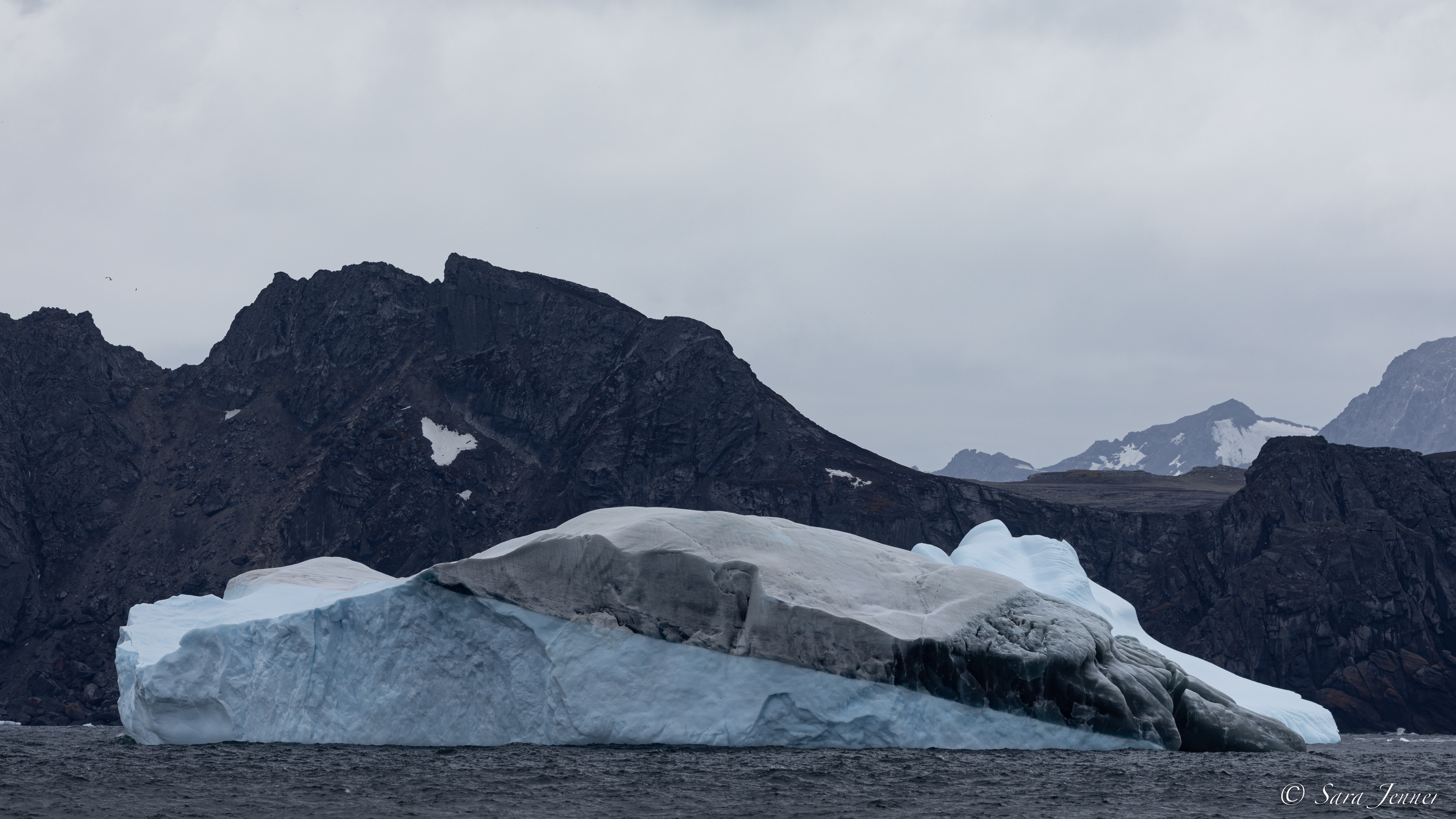
Passing Macquarie Island in November 1820, the ships encountered heavy weather and increasingly thick ice fields, which slowed progress into January 1821. In mid-January, Bellingshausen recorded sighting land - a heavily glaciated island surrounded by thick ice and featuring dramatic, vertical cliffs, which was quickly named for Peter the Great as Peter I Island. The expedition couldn't land due to heavy ice fields, and instead continued onwards, before sighting a shoreline with a soaring mountain at 68°S. Bellingshausen named it for the Russian Tsar, Alexander I. It would not be until the mid-20th century that this land was recognized as an island, Alexander I Island, the largest in Antarctica.
Picture by Sara Jenner
These two significant geographical discoveries are among the biggest successes of Bellingshausen's voyage, the greatest perhaps being his successful circumnavigation of the Antarctic continent, and an uncertain sighting of the Antarctic coastline. The body of water to the west of the Antarctic Peninsula, which contains Peter I Island, is today known as the Bellingshausen Sea. It was through these waters that the expedition continued, before reaching the South Shetland Islands, where the meeting with Palmer awaited.
Bellingshausen’s expedition produced detailed charts, coastal observations, and scientific records that were widely circulated in Europe after their publication. His work influenced later explorers and contributed to Antarctic geography long before the so-called Heroic Age of exploration. Many scientific drawings and detailed information on sub-Antarctic species and locations collected during the expedition were used in the 20th century, both within Russia and across Europe.
Visit Antarctica and uncover Bellingshausen's legacy
After returning to Russia in July 1821, Bellingshausen spent the rest of his career in senior naval roles, eventually reaching the rank of Admiral following service in the Russo-Turkish War of 1828-1829. His name remains permanently associated with Antarctica, not only through geographic features but also through his establishing the continent as a real and definable part of the world map.
Today, Bellingshausen’s voyage provides historical context for several expedition cruise itineraries to Antarctica. Unique voyages venture into the Bellingshausen Sea, often overlooked by standard operators, such as our one-off voyage scheduled for the 2026-2027 Antarctic season, which will voyage to Peter I Island. These exploratory adventures into the Bellingshausen Sea and surrounding regions follow routes first navigated and pioneered over two centuries ago, linking contemporary expedition cruising with the earliest systematic exploration of Antarctica.
The best part? You can be part of our return to this special and rarely-visited region of Antarctica.
Main image by Public domain


