• Home
  • Triplogs
  • OTL11-24, trip log, Spitsbergen - Northeast Greenland - Aurora Borealis, Including Long Hikes

OTL11-24, trip log, Spitsbergen - Northeast Greenland - Aurora Borealis, Including Long Hikes

by Oceanwide Expeditions

Logbook

Day 1: Longyearbyen, Svalbard - Embarkation

Longyearbyen, Svalbard - Embarkation
Date: 29.08.2024
Position: 78°15.6’ N - 015°24.0’ E
Wind: S8
Weather: Overcast
Air Temperature: +8

Finally! The day had come, it was time for us to board our new home for our newly starting expedition, the Ortelius! We arrived at the Coal Harbour port in Longyearbyen with calm waters. Some of us only had landed a few hours before and now we were about to start our adventure onboard M/V Ortelius. Most of our luggage arrived together with the most of us. While we waited at the pier and got acquainted with some other passengers and taken the first photos of our new ‘home’ for the next two weeks, the Expedition Team brought all our luggage on board. Shortly after we made our way up the gangway.

We were warmly welcomed by all the crew and staff who assisted us in finding our cabins. With some time left, we explored the ship and get our bearings and grab a tea or coffee in the bar. Once everyone was onboard, it was time for the mandatory ship safety video and briefing presented by Expedition Leader Florence and Chief Officer Sjoerd. We were given all the information we needed such as moving safely around the ship, the things we could and could not do, and how to put on our emergency life jackets. Having learned this, it was then time for an abandon ship drill so after hearing the seven short and one long blast of the ship’s horn we went to our cabins, got our lifejackets, and went to our muster station in the bar. Then we were led to our lifeboats so we would know where to go in case of a real emergency.

After the drill we headed to the bar where Hotel Manager Karolina and Expedition Leader Florence gave a welcome. With briefing formalities concluded, it was time to join Captain Per in the bar to raise a glass in celebration of the voyage. Then it was time for our first evening meal, with a delicious buffet selection provided by Chef Heinz and his galley team served by our friendly dining room staff. After dinner we were given our muck boots which we would use for going ashore; comfortable but also, very importantly, waterproof for our wet zodiac landings!

After a long day of travel for most of us it was time for bed to get some rest. We sailed out of Isfjorden, heading north along the west coast of Spitsbergen.

Day 2: Lilliehöökbreen & Ny-Ålesund

Lilliehöökbreen & Ny-Ålesund
Date: 30.08.2024
Position: 79°08.2’ N - 011°41.7’ E
Wind: E6
Weather: Overcast
Air Temperature: +9

We woke up on our first day on board M/V Ortelius with the nice and soft voice of our Expedition Leader Florence. The ship slowly navigated into the much calmer waters of Krossfjorden in the northwest of Spitsbergen. During the night a little storm had hit the western coast of Svalbard, and we witnessed some rolling and uncomfortable movements. Now inside the protected waters of the western fjords of Spitsbergen, the navigation was much more pleasant.

Fog and low clouds covered the higher peaks that dotted the shoreline, giving a surreal and eerie atmosphere. Soon breakfast was served, and we quickly ran outside to get some pictures of the first glaciers and mountains of our trip. On the starboard side, we passed by Fjortende Julibukta, with its tidewater glacier ending its run onto the frigid waters of Krossfjorden.

A morning of briefings awaited us where we learned about the AECO regulations in the Arctic, Polar Bear safety and Zodiac operations. After that we could finally enjoy nice views from the outer decks when we reached the end of the fjord. Right in front of our eyes, the extensive wall of Lilliehöökbreen glacier was covering the entire landscape around the ship. This massive glacier front is composed of different flows that connect the upper part of Isachsenfonna and discharge glacier ice into the fjord's mouth. Clearly visible in front of us were the different medial moraine with their impressive amounts of sediments that were carried like conveyor belts under the steady, but slow movement of the glacier. With a front of 7 kilometers wide and 40 to 50m high, this massive river of ice is one of the most impressive of this side of the Arctic archipelago.

M/V Ortelius navigated the fjord in a clockwise direction, before resuming her course south towards the entrance of Kongsfjorden. Certainly, another iconic place of Svalbard is well-known for its historical aspects and still holds its scientific importance up to these days.

Ny-Ǻlesund was founded in 1917 as a mining settlement mainly for coal extraction and it acquired its importance during the second part of the 1920s. The place was used by Roald Amundsen in its first failed attempt to fly over the North Pole in 1925, using two Dornier Wal flying boats. A year later the famous Norwegian polar explorer returned to the northernmost settlement of Svalbard with a different aircraft. The Norwegian government had made a deal with an Italian company led by the aeronautical engineer Umberto Nobile, who had designed and built the first airship of its kind called N1. American adventurer Lincoln Ellsworth had provided the finance to lead the expedition which would attempt the first flight over the geographical North Pole.

The three men met on the 11th of May 1926 in the little mining settlement where a hangar had been built to host the airship and the 35-meter mast that we could still observe today. The airship was rechristened Norge and was ready to take off to make history. In 72 hours, the Norge flew over the North Pole pushed by favourable winds and good weather. Above the geographical North Pole, the flags of Italy, Norway and the USA were dropped. No landing was made, and the airship reached Teller, Alaska without any issues. Amundsen had made history by being the first man to both have reached the South and North Pole.

A couple of years later Nobile and his men came back to Ny-Ǻlesund with a second airship, the N2 which took the name Italia. This time the expedition went through some unfortunate events and the Italia crash-landed on the pack ice north of Svalbard, near Nordaustlandet. In an attempt to rescue his fellow colleague, Amundsen took off from Tromsø with his airplane and was never seen again.

Today Ny-Ǻlesund still bears the sign of its historical past. The little train with few carriages for coal transportation welcomed us near the pier and as we walked into town and passed by the museum, we ended up near Amundsen’s bust, commemorating this important Norwegian explorer. Some of us enjoyed pictures at the Yellow River Chinese station, while others had a stroll outside the settlement limits accompanied by two armed guides all the way to the mast that, over a hundred years ago, had held the Norge before its historical voyage over the North Pole.

A lovely afternoon before making our way back to the ship for the first daily recap, followed by dinner and the first sign that the crossing toward Greenland had begun

Day 3: Sea day across the Fram Strait

Sea day across the Fram Strait
Date: 31.08.2024
Position: 77°39.1’ N - 005°54.5’ W
Wind: WNW6
Weather: Partly Cloudy
Air Temperature: 0

Today we left Svalbard with MV Ortelius for our trip across the Fram Strait to Greenland. After the vessel has left the fjord, one can already begin to feel the swift currents and stronger swells. When breakfast opened, a few of us were still in our staterooms trying to get used to the swaying of the ship. Luckily the dining room was filled with most of us being very proud of our non-seasick physiques.

After breakfast, Marco presented an insight about Greenland with its Northeast National Park and Scoresby Sund to our international passengers in the bar. He passionately shared his knowledge about geology, geography, and glaciology. Everyone felt so excited about the next destination, we were about to visit, so let’s rock! Meanwhile, in the lecture theatre, Rao introduced Mandarin-speaking passengers to the process of sea ice formation and its importance in the climate and ecosystem. Many of us who were very shy to ask questions at the beginning of the voyage began to open our minds after listening to the lectures. Slowly we became more interested in our environment and began to see and think about it from a different perspective.

We had a lot of photo enthusiasts on this voyage with their long lenses, and Martin brought new inspiration and angles for them to shoot from. From landscapes to wildlife, from polar bears to seabirds. In the afternoon, the harsh sea breeze from the Arctic Ocean could already be felt outdoors. Although there was only an ocean in sight, some sensitive and curious people noticed that we were not too far from the ice.

As the intensity of the surge eased in the afternoon, and Elizabeth gave her lecture on marine mammals for all of us, it was clear that more people were adjusting to the frequency of the vessel's oscillations. It was great to have an afternoon where people went from not knowing anything about cetaceans to asking all sorts of novel questions and new ideas about their understanding. After the lecture, people clamored to the bridge and outdoor decks to join us as we tried to find unusual “whale tracks” and “sea fountains” at the surface.

Of course, at this point, bird lovers were not to be outdone as they followed Martin on the helideck at the back of the ship. Where they observed and photographed the fulmars' glide marks and the busy feeding Kittiwakes. In the evening before dinner, we had a recap and plan briefing for tomorrow. After Florence announced the program for the following day, Martin and Rao brought the thermohaline circulation action in the Shearwaters and Forward Strait to the fore.

Day 4: Drifting Pack Ice

Drifting Pack Ice
Date: 01.09.2024
Position: 76°46.1’ N - 016°28.4’ W
Wind: Variable 1
Weather: Overcast
Air Temperature: 0

The morning began with an almost surreal stillness. We woke up to find ourselves surrounded by a vast expanse of sea ice, the world outside painted in shades of white and blue. There was an electric excitement in the air, even before the official wake-up call a polar bear had been spotted on the ice!

We rushed outside, our breath visible in the crisp Arctic air, eager to catch a glimpse of this majestic creature. The ship was moving slowly, carefully, not wanting to disturb the bear as it lay sleeping on a floating piece of ice. From our vantage point, we watched as the bear occasionally lifted her head, giving us a sleepy glance before settling back down. She seemed almost playful, rolling onto her back, and lazily showing us her enormous paws as if she knew she had an audience.

Time seemed to stretch as we watched her, every moment filled with awe. But then, something remarkable happened—the bear became curious. Slowly, she began to move towards the ship, her powerful body cutting through the ice with ease. As she approached, our excitement grew. She came closer and closer until, at one point, she was so near that we couldn't see her anymore from where we stood on the deck. It was a moment of pure connection, as if the bear had decided to greet us on her own terms.

For four hours, we remained transfixed, sharing in this extraordinary encounter. It was a privilege, an experience that left us all elated and deeply moved. Just when we thought the day couldn't get any better, an announcement crackled over the PA - hot chocolate and Baileys were being served on the helideck. We laughed in disbelief, could this day truly be real?

The afternoon brought more than just relaxation. Charlotte, our bear specialist, gave a lecture on polar bear biology and anatomy, her passion for these incredible animals shining through every word. It was fascinating to learn more about the bear we had just observed, deepening our appreciation for her strength and resilience. As the day ended, we gathered for a recap, eager to hear the plans for tomorrow's adventures. Another delicious dinner followed the perfect end to a day that felt like a dream. But this was no dream—this was the Arctic, in all its wild, breathtaking glory. And we were fortunate enough to be part of it, even for just a little while.

Day 5: Greenland Sea

Greenland Sea
Date: 02.09.2024
Position: 74°41.5’ N - 015°41.7’ W
Wind: NW3
Weather: Fog
Air Temperature: +1

Today was a slow start, we looked out of our windows and fog lined the horizon, so we ambled to breakfast to fill up on coffee. After breakfast Beth gave us a fascinating lecture on the geology of Northeast Greenland. After lunch, we had a wonderful lecture from Martin about the birds of the Arctic. He really is an expert on his topic. The expedition team put on a documentary for us on the Polar regions accompanied by popcorn! A few of us were feeling seasick unfortunately, so we slept and tried to make ourselves feel better. We finished the day with recap and another delicious dinner.

Day 6: Fleming Fjord & Solfalsdal

Fleming Fjord & Solfalsdal
Date: 03.09.2024
Position: 71°44.2’ N - 022°58.0’ W
Wind: N1
Weather: Partly Cloudy
Air Temperature: +4

Today was our first day on land in Eastern Greenland! Something to celebrate as we had successfully sailed across the Greenland Sea and Fram Strait from Svalbard to Eastern Greenland. We continued our journey transiting south through Davy Sund and across the opening of Kong Oscar Fjord. We aimed for Scoresby Land, an area in Eastern Greenland named after English explorer William Scoresby, who mapped the surrounding area and fjords in detail during an expedition in 1822. Then we continued onto Fleming Fjord, named after Scottish scholar John Fleming, who was a naturalist, zoologist, and geologist. He was involved with describing many species of mollusk which is connected to Fleming fjord because of the number of fossils found there. Fleming Fjord is also known as “Fleming Fjord Formation” which in the geological world is a known formation with terrestrial sediments and a large abundance of fossil content including dinosaurs and other rocks dating back to the Triassic period.

We arose at 07:45 to the lovely sound of expedition leader Florence’s wakeup call before heading to the restaurant for a delicious breakfast. The first long hike of the trip set off early and was gifted with a sighting of the first musk ox of the trip!  

We also had a photography hike, led by expedition guide Martin, and focused on the plants and stunning colors on the hillside and beaches. The medium walks also had lovely views of the fjord at different elevations. Our beach combers, the guests who wanted to take it easy and explore the landing site were treated to a visit from a curious Arctic Fox! Once all the hikes returned to the landing site, the polar plunge began! Brave souls wearing their swimsuits hesitantly ran into the cold water and plunged themselves in for a quick dip before quickly running back to the shore. It was a great spectacle!

After lunch we moved to a different landing site on the east side of the fjord, however, the weather deteriorated. The wind and swell made a landing not safe for the afternoon and instead, we decided to use that time to head to Scoresby Sund, or in Greenlandic called “Kangertittivag”. On the top deck our expedition team held a photography workshop during our transit because although the wind was not on our side, the lighting was. Our first sight of Eastern Greenland was absolutely spectacular with the mountain peaks being illuminated by the sun. Next on the agenda, 180 miles to Scoresby Sund and more adventure awaiting!

Day 7: Vikingebugta & Charcot Havn (Milne Land)

Vikingebugta & Charcot Havn (Milne Land)
Date: 04.09.2024
Position: 70°27.8’ N - 025°09.1’ W
Wind: E3
Weather: Overcast
Air Temperature: +3

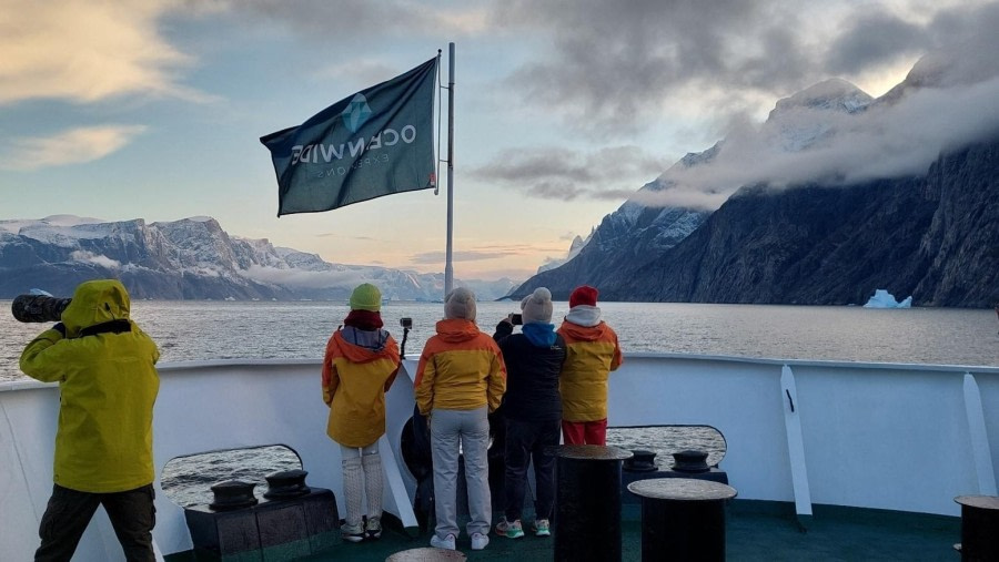
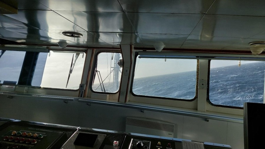
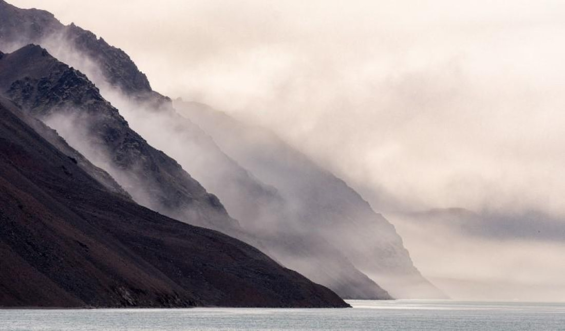
After a night sailing ‘outside’ at sea, with some movement to put us gently to sleep, we went into the biggest fjord of Greenland, Scoresby Sund, where the waves died down. The first hours the fog was still hiding the beauty of our new destination from today. Later, as the ‘white veil’ lifted, the majestic high peaks of the fjord came into view on the port side of the vessel, revealing a stunning landscape. We even spotted some blue sky and a lot of us were on deck to take photos of the amazing landscape that we’d just entered. In the far distance, but slowly but surely creeping closer, the first massive icebergs came into sight. The sun peaked through the clouds and shed a beautiful orange glow on the mountainsides and the ice. What a way to start this day.

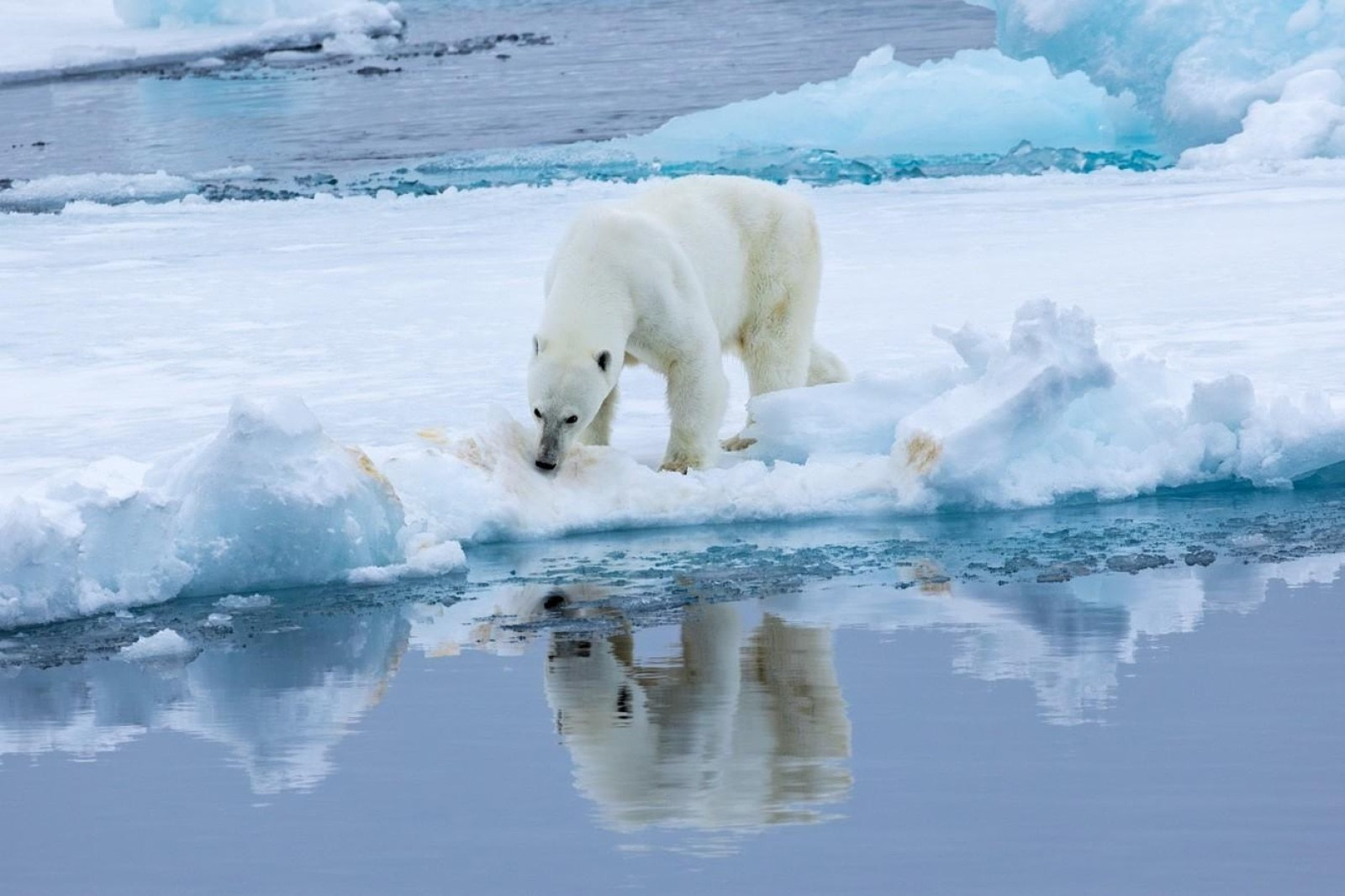
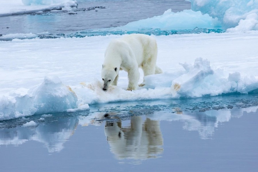
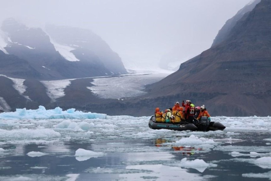
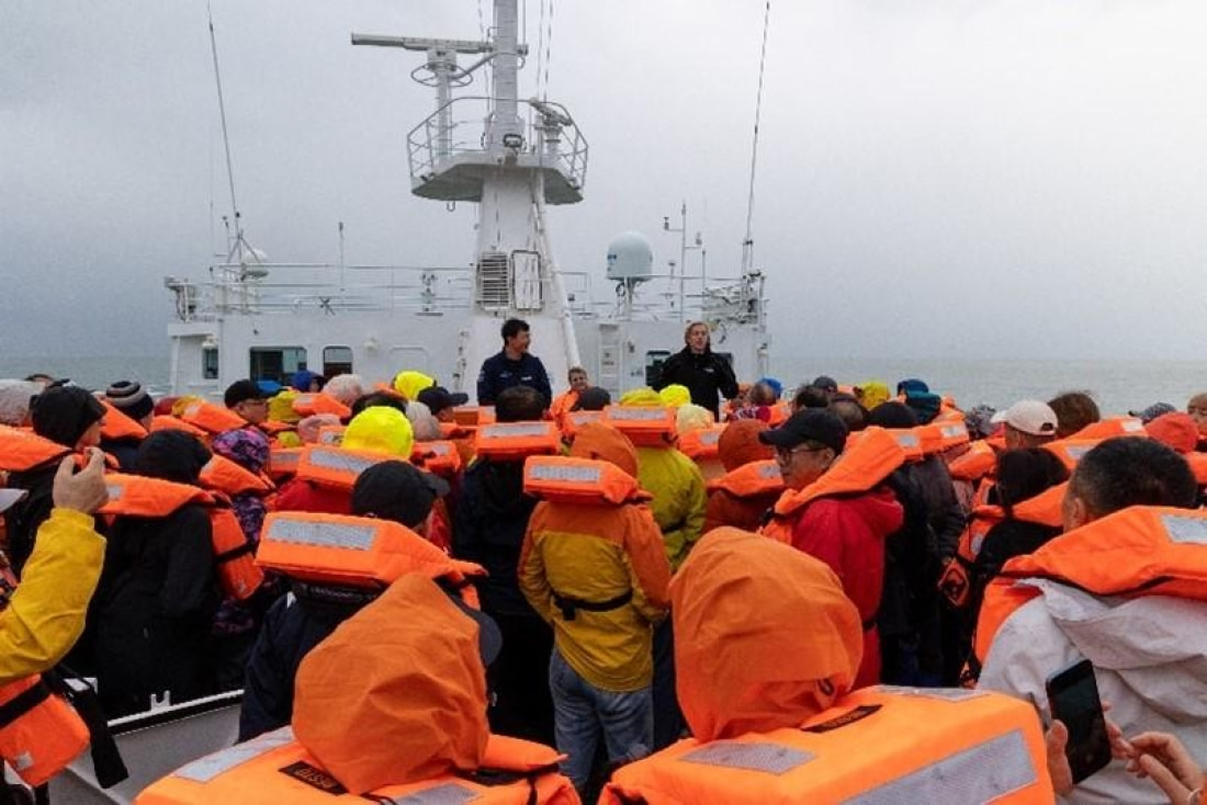
We all went for breakfast at 08:00, while the captain and his team were approaching the anchorage site for this morning. Around 09:00 we dropped anchor, and the crew were lowering all eleven zodiacs onto the water. This morning, we were doing a full ship zodiac cruise into Vikingebugta with its magnificent glacier at the end. While we were waiting at the gangway the guides were in their zodiacs, scouting the vicinity for interesting objects. One of them spotted a polar bear in the bay north of Vikingebugta and of course, we decided to make a detour first and head right to the end of that bay. The bear was slowly moving on the dark moraine, so although it was a little further away it was easy to spot as it stood out with its yellowish fur. The ride in, and back to our original starting point of this cruise was already beautiful. We were surrounded by high peaks, some up to 15:00 meters, with different geological features, such as sedimentary layers and some waterfalls.

Right at the entrance of Vikingebugta, at the northside of the bay, we watched a spectacular phenomenon caused by volcanic activity. A whole wall of amazing basalt columns. As the lava slowly cooled, these straight, regular hexagonal shaped columns were formed. Some seemed like they were glued next to each other straight against the rock wall. Others looked like pencils stuck into the mountain, only showing their 6-sided underside sticking out. Due to the movement of the tectonic plates, there were columns that were bent curves or curled up. Even if you are not into geology, it was hard not to appreciate this beautiful geological art.

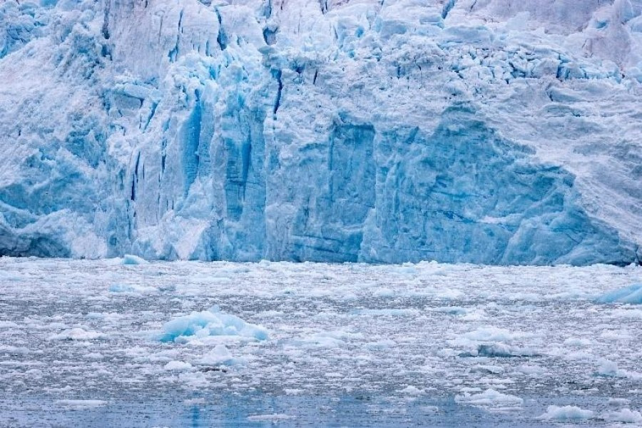
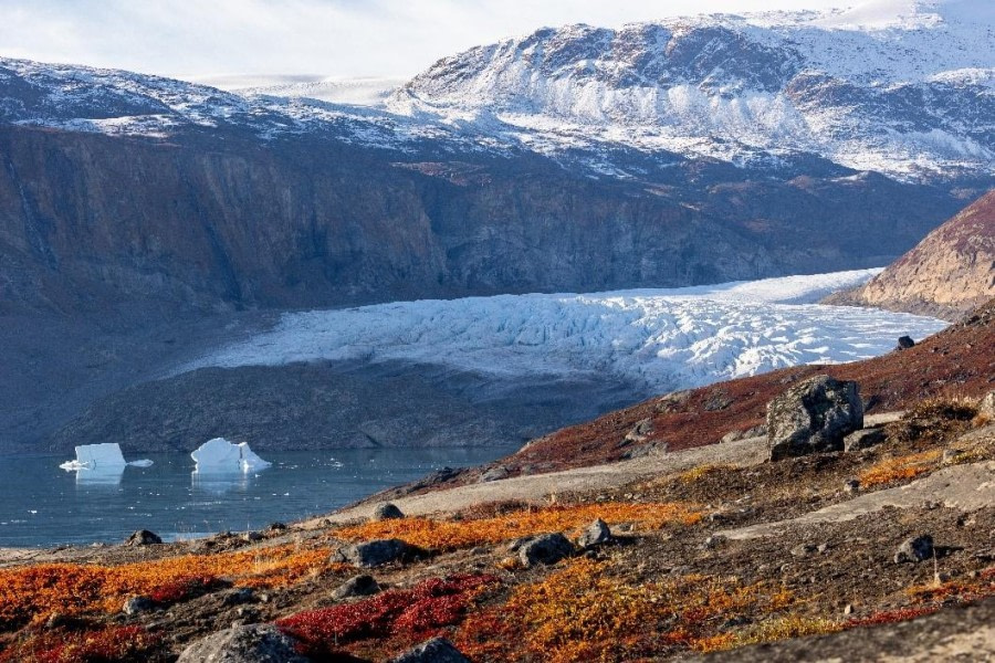
We moved along and drove into the fjord to go and have an up-close look at the glacier. From the ship the Brede Gletscher (Broad Glacier) looked not too far away, but it was four miles. We entered the brash ice, small pieces of ice broken up from larger bergy bits and icebergs clotting the bay. The soft crashing sound when we drove in was cool. We also saw the first signs of sea ice forming. That first phase is called ‘grease ice’ and was probably formed overnight. When the ice would have been disrupted, and the temperature would have dropped more then ‘pancake ice’ would have formed, or as Marco would say “pizza” ice. This is when small plates of ice bump into each other and the edge would ‘curl up’, looking like a pancake or pizza. Although the sun wasn’t out, the light gave a somewhat mystical feel to our first acquaintance to the breathtaking scenery of the Scoresby Sund.

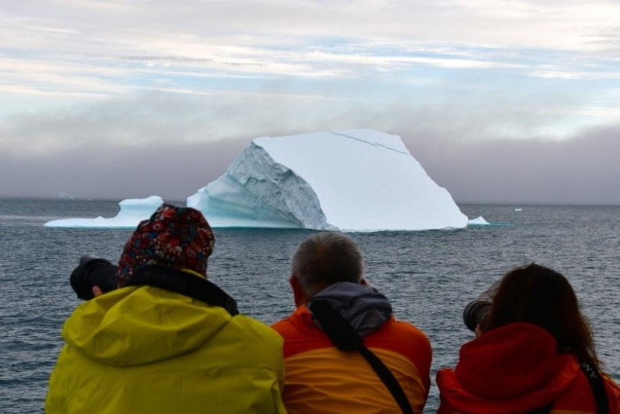
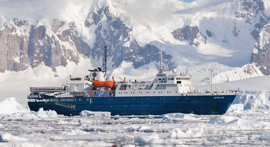
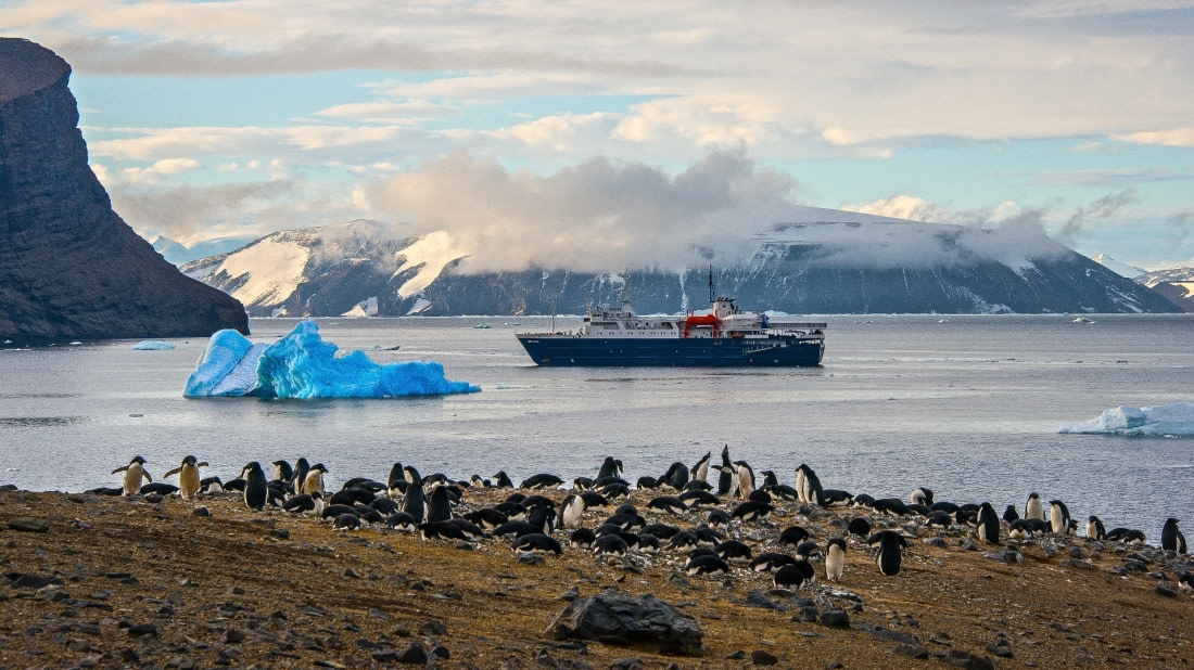
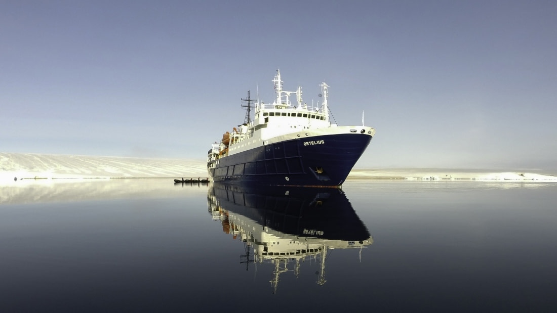
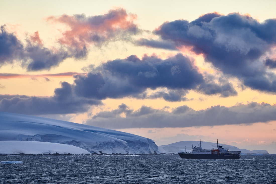
Back on board, we witnessed a massive iceberg, an astounding 600 meters across, floating serenely in the cold, clear water, along our ship. The size of these gigantic icebergs is hard to grasp with nothing to compare it with. Only Ortelius, which is 100 meters long, but it is still hard to believe what nature produces in these waters. Over lunch and during the afternoon we transferred to a bay further north of Vikingebugta, called Charcot Havn. We cruised the ‘ice giants’ in the broad Hall Bredning Fjord of Scoresby Sund. These gigantic icebergs spill out from the from the Daugaard – Jensen Gletscher.

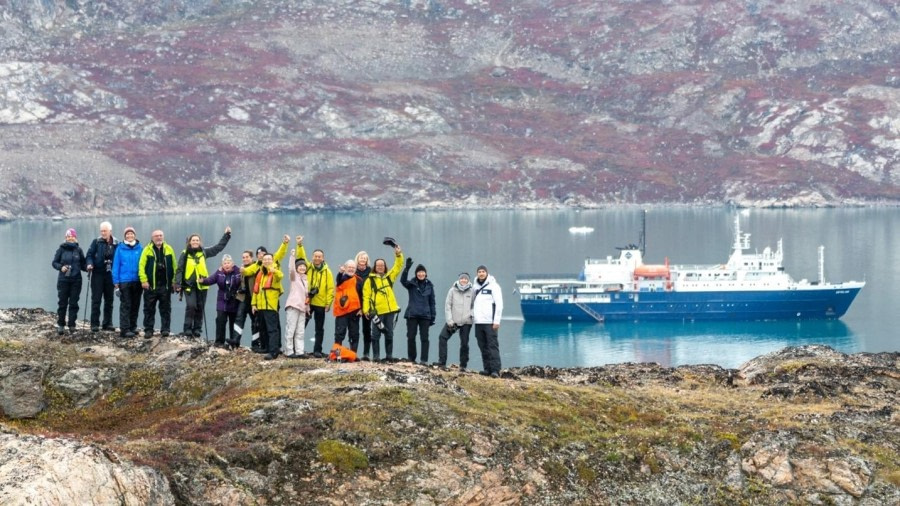
To get to Charcot Havn took us about four hours. Therefore Florence had arranged an earlier dinner for all of us, so we could do a nice evening landing. The guides were already on land, where they had scouted for polar bears and set a perimeter where we could freely roam and take pictures. Driving to the landing site we passed some enormous icebergs again. Compared to which we were just little dwarfs. Because of the shallow coastline and the low tide, the zodiacs could not get us right on the beach and therefore we had to wade through calf-deep water. Some of us were taken on the back, to prevent the lower small-sized boots from flooding. There was so much to photograph. The array of colors of the different vegetation was amazing. Dark red leaves of the Mountain Bearberry, the yellow and light brown Dwarf Birch bushes, the last surviving flowers from the Purple Saxifrage, and the coloring leaves from the Arctic Bell Heather, together with the light-colored boulders. Just beautiful.

What an unforgettable day and evening this was, in such a remote part of the world!

Day 8: Immikkeertikajik (Little Island) & Sydkap

Immikkeertikajik (Little Island) & Sydkap
Date: 05.09.2024
Position: 71° 16.4' N - 025° 04.1' W
Wind: SW2
Weather: Rain
Air Temperature: +2

The ship glided into the peaceful island of Immikkeertikajik (Little Island). We could see high up on the hill, two Arctic Hares on the tundra, their white coats almost glowing against the vivid reds and golds that carpeted the ground. It felt like stepping into another world—vast, untouched, and completely still.

We walked through gullies, the landscape rolling beneath our boots, heading to a viewpoint where the skeleton of a musk ox lay. The bones, bleached by time and weather, were a silent reminder of the wild nature of this place. Surrounded by the emptiness of the tundra, we felt small and far from the rest of the world.

After lunch, we landed at Sydkap, where two old Inuit hunting huts stood by the shore, worn by time, but full of history. Some of us set off on a long hike up to the high ridge, determined to conquer the challenging terrain. As they climbed, a sudden blizzard rolled in, shrouding everything in a mystical blanket of snow. Yet, through the swirling whiteness, the hikers spotted Arctic Hares, blending perfectly with the storm. The hares lingered, almost as if they, too, were captivated by the quiet magic of the moment.

Meanwhile, the rest of us walked across the tundra, marveling at the icebergs that stretched across the ocean. Their towering forms seemed to float endlessly, the vast expanse of white and blue fading into the horizon. The steady rain began to fall, drenching us, but it didn’t matter—we were all mesmerized by the beauty surrounding us.

By the time we returned to the ship, cold and soaked, the warmth inside was a welcome relief. We huddled in the bar with chocolate cake, recounting our adventures with excitement and awe. The day had been long and full of surprises, but none of us could have predicted what came next.

As the evening light began to fade, we gathered at the bar and looked out the windows. Huge, jagged mountains loomed outside, their peaks cutting into the darkening sky. The ocean shimmered below, reflecting the golden light of the setting sun. In that moment, the Arctic felt both infinite and breathtakingly close—a place where the wilderness ruled, and we were just lucky enough to witness it.

Day 9: Harefjord (Vindue Gletscher) & Rødefjord (Rødepynten)

Harefjord (Vindue Gletscher) & Rødefjord (Rødepynten)
Date: 06.09.2024
Position: 70°57.0’ N - 028°18.2’ W
Wind: Calm Sea State
Weather: Partly cloudy
Air Temperature: +4

The morning began with the brilliance of a deep blue sky reflecting off the ocean’s calm surface, a perfect start to the day. After a quick breakfast aboard the ship, we boarded the zodiacs and made our way ashore to Harefjord. The air was crisp, and the scene that greeted us was almost otherworldly: a massive glacier, wedged between towering valley walls.

Splitting into small groups, we set off on different paths for a morning of exploration. Some of us, eager for a panoramic view, hiked upward, scaling the rocky slopes to a viewpoint that promised breathtaking vistas. Others stayed on the moraine, content to stand beside the glacier’s edge, watching in awe as it groaned and shifted, the sunlight bouncing off its icy surface. The sun seemed to lift everyone’s spirits; there wasn’t a single face without a smile, as though the weather itself had gifted us a perfect day.

After lunch, the adventure continued as we set out on a zodiac cruise towards Rodepynten, a towering sandstone mountain famous for its striking, deep red colour. The fjord was littered with icebergs, each one unique in shape and size, some as large as small buildings, others intricate and fragile. As we weaved between them, their sharp edges reflected perfectly in the way. And then, in a mesmerizing twist, sea ice began to form on the surface of the water, thin sheets crackling and shifting around us—another spectacle of nature, so subtle yet profound.

Just as we thought the day couldn't get better, the expedition team spotted something on the slopes above—a herd of musk oxen grazing on the rocky terrain. We quietly steered the zodiacs closer, careful not to disturb them, and there they were, magnificent and wild, completely in their element. Time seemed to slow as we watched them, each of us entranced by the sheer beauty of the moment.

As the sun dipped lower, painting the sky with hues of gold and pink, we returned to the ship for our evening recap. The day’s adventures played back in our minds as we shared stories, laughter, and a fantastic dinner. With hearts full and the sense of wonder still fresh, we drifted off to sleep, overjoyed by the day.

Day 10: Rypefjord (Rypenaes) & Øfjord

Rypefjord (Rypenaes) & Øfjord
Date: 07.09.2024
Position: 70°57.7’ N - 027° 36.4’ W
Wind: Variable 2
Weather: Partly Cloudy
Air Temperature: +4

The usual “Good Morning” call woke us up and Florence's voice invited us to move immediately outside to have a look at the most charismatic land mammals of Greenland: The Musk Ox!! We had been searching for these massive bovids all around Scoresby Sund in the last few days and eventually, our search paid off yesterday when some of us could enjoy them grazing and trotting on the verdant slopes at Rødepynt, whilst cruising amongst the ice mélange in Rødefjord.

Today perhaps we could have a chance to see them close by in their natural habitat, the lush tundra of Eastern Greenland. The morning was misty and low clouds were still covering the summits of the mountains surrounding Rypefjord.

This 30-kilometer ling body of water branches out northwest off the northern shore of Øfjord; it is roughly 2.5 kilometers wide at the entrance and then widens out to 5 kilometers at the end, where the Eielson glacier flows down from the Greenlandic Ice Sheet. The fjord names derive from a family of birds, the grouse, to whom the iconic Rock Ptarmigan that we had seen a few days back belongs.

While having breakfast the guides were out scouting the area around the peninsula of Rypenaes and despite the extreme low tide they managed to find a place to land in the shallow waters of this protected bay. Soon the familiar noise of the zodiacs appeared around the vessel and first the long hikers, followed by the medium and beach dwellers were shuttled on shore.

Meanwhile, the weather had improved, and off we were on our muck boots across the lush tundra which covered a beautiful hummocky terrain full of small hills and ridges, where often small streams and ponds thrived. As the morning progressed the sun peered out from the clouds and the vibrant fall’s colours were in full display; the yellow hues of Arctic willows alternated with the intense reddish tinges of the Bearberry, whilst the small orange leaves of the Dwarf Birch carpeted the ground.

Divided into small groups, each of us could explore the area at our own pace. Some of us could walk quite far from inland, allowing unique chances to spot Muskoxen and even Arctic hares from a close distance. Others ventured out towards the west of the peninsula, into a broad valley filled up with water, where other small herds of Muskoxen and waterfowl were spotted. For the short hikers, more time was dedicated to stops and contemplation of the magnificent views across the fjord to the south and towards Eielson glacier.

Back on board, the anchor was lifted and MV Ortelius started her way East, navigating the pristine waters of one of the most scenic fjords in the inner Scoresby Sund. Øfjord is a sound with a fjord morphology that connects the Northwestern corner of Hall Bredning with Rødefjord. It stretches for about 60-kilometer Northeast to Southwest, and it is 5 kilometer wide on average. Imposing mountain walls fringe the northern and southern shore of the fjord, making the navigation quite impressive.

That is probably why most of us dedicated quite some time on the outer decks right after lunch. Keen landscape photographers were marveled by the vertical cliffs often interrupted by hanging valleys in which small mountain glaciers discharged iceberg into the frigid waters of the fjord. We felt small and insignificant in front of this massive sculpture of Nature. Layers upon layers of sediment deposited during the late Proterozoic on a shelf of what geologists called the supercontinent Rodinia, had been subjected to pressure and temperature metamorphism when the Caledonian orogeny event of the early Paleozoic created a long mountain chain that connected Scandinavia, East Greenland, Scotland, the Appalachians, and the Atlas Mountains of northern Africa. Today the result of such a behemoth tectonic event was clearly visible on colourful stripy layers of gneiss dotted by granitic intrusions of the Krummedal sequence that is the highlight of this fjord.

The afternoon went by with Martin’s presentation about Conservation Photography”, followed by Florence presenting the plan for tomorrow, Saskia sharing her passionate knowledge about swimming and smelly musk oxen, closed by Charlotte with the Arctic Hare.

Dinner was served whilst MV Ortelius entered the protected waters of the Bjøneøer where she found a good anchorage for the night. While the light faded away, we could see the beautiful silhouette of the mountains that awaited us for the next day.

Day 11: Ikaasakjiip (Milne Land) & Bjørneøer

Ikaasakjiip (Milne Land) & Bjørneøer
Date: 08.09.2024
Position: 71°02.9’ N - 025°39.7’ W
Wind: Variable 1 (3)
Weather: Overcast
Air Temperature: +5

This morning was a slightly earlier morning for us as we tried to capitalize on the morning light over the mountains of Renland. We traveled all night east through Øfjord towards Bjørneøer, the “Bear Islands”. These islands are located off northeast Milne Land, which would be the landing site for the morning. This area was explored in 1891 by an expedition under the leadership of Carl Ryder where a polar bear was shot during the expedition, hence the name.

We started the morning at Milne Landing with a group of long hikers heading out first. The goal was to gain as much elevation as possible to get a good overview of Øfjord and the mountains on the north side. The stunning mountain peaks have names such as Grundtvigskirken, Trio Grand, Labyrinth Glacier, Commandment Peak and Consolation Point. Our medium hiking groups also attempted various routes to reach the overlooks of the surrounding areas. The hike reached a beautiful plateau and walked past lakes and ponds with stunning reflections of the mountains. All in all, the hikes ranged from about 2 – 6 kilometers.

In the afternoon we repositioned the ship within the Bear Islands, or the Greenlandic name of Nannut Qeqertaat. Each island is numbered I to XI and named: Qalikattooq, Sulussuut, Taseertit, Nanuaraq Kangitteq, Iserartiit, Nanuaqquat Kittiit, Amaarteq, Nanuaraq Avannarteg.

We headed out for our first split landing and zodiac cruise. Half of the passengers went ashore for a short hike and half of the passengers went on a zodiac cruise. The zodiac cruise saw around 10 Musk Ox from the water and different bird species. Some of the cruisers even circumnavigated the island, cruising for up to 15 kilometers. While onshore the guests split into smaller groups and roamed around the island. More muskoxen were seen with the beachcombers getting a nice close encounter. When we all got back onboard, Flo introduced the plans for tomorrow which would be our last full activity day in Scoresby Sund. Beth gave a recap about the various mountaineers who attempted to summit the mountain peaks around the area. Most interesting was the peak called “Grundtvigskirken” or nicknamed “The Cathedral”. A lovely evening underway sailing through Hall Bredning towards the entrance of Scoresby Sund. After sunset, the day was not over yet with the northern lights quickly seen just after midnight. The guests who had the energy to go out on deck greatly enjoyed it!

Day 12: Ittoqqortoormiit

Ittoqqortoormiit
Date: 09.09.2024
Position: 70°37.3’ N - 022°27.8’ W
Wind: NNW8/10
Weather: Overcast
Air Temperature: +3

After 11 days of sailing through the wilderness areas, we finally arrived at the only human settlement on the east side of Greenland — Ittoqqortoormiit!

This town of just over 350 residents, and its name translates as “those who live in the big houses”. The closet neighboring town in Greenland is Tasiilaq about 800 kilometers away to the southwest. In 1924, a Danish explorer Ejnar Mikkelsen, left Copenhagen with building materials, provisions, and a winter party of 7, and started their settling project. About 85 Greenlanders arrived in the next year, and it started to be a real home for east Greenlandic hunters.

During breakfast MV Ortelius dropped anchor. Soon after we all were waiting eagerly at the gangway. Boarding the zodiacs, we were full of curiosity and anticipation, to see what it is like to live in this isolated place. There were many places open, that could be visited by us like the supermarket, the church, and the visitor center where a lovely local Inuit was happy to take a photo with some of us and tell a little bit about the life he was living here. Also to be visited were some memorial statues and a residential facility. We walked and discovered the whole town to figure out how people could live here.

A little group of us even discovered a bit more of the mountainous area behind the town, with a nice view of the bay and the delta from the northeast of town. The new snow on top of the mountains showed winter is coming soon and the lifestyle of Greenland is going back to the ice.

In the afternoon we had expected to head to Hurry inlet for the final landing of the voyage, but the strong winds off Scoresby Sund were already evident in the bay outside the town. As MV Ortelius sailed through the fjords in strong winds, two of the master photographers among the passengers showed us and shared their wonderful photos and ideas for photographic compositions taken on this trip. This sharing session both took us back to those moments of our journey and provided us with a more innovative perspective on what we were looking at and photographing.

Before dinner, Elizabeth told us about the secrets of Inuit architectural colors, and the captain was helping all the passengers to mentally prepare for the 6-meter waves that we would be facing as we crossed the Denmark Strait, as well as some of the safety precautions that passengers need to be aware of when in rough sea conditions. How can we go on a polar journey without some rough sea?

Day 13: Sea day at Denmark Strait

Sea day at Denmark Strait
Date: 10.09.2024
Position: 67°26.0’ N - 019°18.4’ W
Wind: N7
Weather: Overcast
Air Temperature: +4

It’s a sea day today crossing the Denmark Strait. The sea was a little rough, with about 5-to-6-meter waves. Serving the meals has been a little tricky with a couple of incidents. The morning has been relaxing. Some of us were in the bar on deck 6, going through our pictures and Sue was again working on a beautiful painting. Others were on the bridge watching the swell and waves. There were documentaries from the Frozen Planet series, shown in the bar during the first half of the day.

In the afternoon, at 15:00. Lyn made a beautiful presentation about Iceland to give us a little more information about Iceland and some of the attractions. We had made it safely across the Denmark Strait and reached Iceland. We anchored in the bay of Eyjafjordur for the night. No more waves, so a last good rest before we disembark tomorrow after a wonderful trip. 

At 20:30, Captain Per hosted the captain’s cocktail and farewell. The flag and a small float were auctioned off. Martin prepared an amazing slideshow showcasing pictures and videos of the trip, that we all could take home.  

Day 14: Akureyri - Disembarkation

Akureyri - Disembarkation
Date: 11.09.2024
Position: 65°41.9’ N - 018°04.62’ W
Wind: N5
Weather: Overcast
Air Temperature: +5

At 05:30 we heaved the anchor and sailed into the port of Akureyri, Iceland, the third and final country of our voyage. After almost two weeks it is unfortunately time to say goodbye. But the memories we made will live with us forever. We were asked to put our luggage outside our cabins at 0730, ready for the staff and crew to take down the gangway, while we enjoyed our last breakfast on board. After saying goodbye to the dining room crew, we grabbed our hand luggage and walked down the gangway onto the pier. Then it was time to say farewell to the expedition team before we boarded the buses and left for our onward travel. Unfortunately, our adventure was over. Some of us had planned a few more nights in Akureyri before heading home. Which could only have been a good decision to stay and enjoy this beautiful island a little more.

Thank you all for such a memorable voyage, for your company, good humor, enthusiasm, and patience when the weather decided to change our plan A or B. We hope to see you again in the future, wherever that might be!

Northernmost position: 79°21.42’ N - 011°40.24’ E

On behalf of Oceanwide Expeditions, Captain Per Andersson, Expedition Leader Florence Kuijper, Hotel Manager Karolina Guziejko and all the crew and expedition staff, it has been a pleasure travelling with you! We look forward to seeing you again on one of our ships for another adventure.

Details

Tripcode: OTL11-24
Dates: 29 Aug - 11 Sep, 2024
Duration: 13 nights
Ship: m/v Ortelius
Embark: Longyearbyen
Disembark: Akureyri

Have you been on this voyage?

Aboard m/v Ortelius

The ice-strengthened Ortelius is thoroughly outfitted for polar exploration and, when necessary, helicopter flights.

More about the m/v Ortelius »
Loading