• Home
  • Triplogs
  • OTL30a26, trip log, Antarctica - Uncharted Islands of the Deep South

OTL30a26, trip log, Antarctica - Uncharted Islands of the Deep South

by Oceanwide Expeditions

Photo gallery

Logbook

Day 1: Embarkation Day, Ushuaia

Embarkation Day, Ushuaia
Date: 18.03.2026
Position: 54°50.9’S; 068°06.4‘W
Wind: N-4
Weather: Overcast
Air Temperature: +8

The day of embarkation unfolded under nice conditions in Ushuaia, with mild temperatures, overcast sky and an unusual calm in the air, with no wind in the Beagle Channel. These rare conditions set a positive tone for the beginning of the voyage.

The long-awaited day of embarkation to the Great White Continent had finally arrived, and after a morning filled with last-minute preparations and excited reunions with fellow expeditioners, we finally had the first sighting of our ship, M/V Ortelius. This was not just a cruise, but the beginning of a unique adventure and a once-in-a-lifetime experience.

Once we were all aboard, the ship’s mandatory safety procedures were carried out, including a comprehensive safety briefing and drill. This ensured everyone on board was familiar with emergency protocols and prepared for departure. Following the drill, Captain Per formally welcomed guests and introduced them to the voyage ahead. The Expedition Team—our guides and mentors for the coming days — were then introduced. Their collective experience in marine biology, oceanography, photography, and polar operations was impressive.

The evening continued with a relaxed buffet dinner, offering an opportunity for us to meet one another, reconnecting after our travels, and beginning to settle into life on board. As the ship completed her final preparations and the lines were readied for departure, the atmosphere on board was filled with anticipation for the adventures awaiting us in the southern waters.

Day 2: Southbound towards Antarctica

Southbound towards Antarctica
Date: 19.02.2026
Position: 58° 02.7’ S; 066°45.9‘ W
Wind: NW-8
Weather: Overcast
Air Temperature: +7

We woke up excited to experience our first full day of the expedition. Expedition Leader Chris woke us up to tell us how the weather was today. We could already feel from our beds that it was a little bumpy, but as far as the Drake Passage goes it was considered quite nice weather conditions.

Many people were up early on the bridge to see if there were any interesting birds or marine mammals around. We could see some black-browed albatross and giant petrels soaring over the waves and enjoying the uplift from the wind. A snowy sheathbill also landed on the deck to take a rest. We enjoyed a nice breakfast and shortly afterwards all the people scuba diving in Antarctica were invited to a briefing in the bar with Jerry and the diving team. They then spent some time sorting out all their equipment and getting ready for their dives. After this Jess gave a lecture in the bar informing us about the whale and dolphin species that we could possibly see on our journey. She explained why Antarctica is so good for seeing whales at this time of year and showed us how they feed and migrate huge distances to come here each year.

We enjoyed a nice lunch before the kayakers were called to the bar for their briefing with Nick the kayak guide. They also spend some time getting their drysuits and equipment ready. Later in the afternoon Koen gave us a visually beautiful lecture where he gave his top ten tips to improve your photography in Antarctica. Koen loves to photograph wildlife, and he shared with us many beautiful pictures he had taken during his career.

In the early evening, we gathered for the first of our daily recaps. Before dinner the expedition team give more information about what has been seen during the day and give us the plans for tomorrow. We went to dinner, yes, more food! Before heading to relax in the bar.

Day 3: At Sea in the Drake Passage

At Sea in the Drake Passage
Date: 20.02.2026
Position: 63°06.6’ S; 067° 06.2‘ W
Wind: NE-5
Weather: Part. Cloudy
Air Temperature: +3

Today’s programme was dedicated to our final preparations before reaching Antarctica, and excitement could be felt everywhere on board. Our third day at sea began with Expedition Leader Chris’s cheerful “Good morning!” wake-up call, welcoming us into another adventurous day as we continued crossing the legendary Drake Passage. The ocean gave us a true Drake experience, with rolling waves and lively conditions that reminded us we were sailing toward one of the most remote and extraordinary places on Earth.

After breakfast, we attended one of our final mandatory briefings covering IAATO guidelines and Zodiac operations. With every instruction and explanation, the reality of our destination felt closer — Antarctica was finally within reach, and our anticipation continued to grow.

Soon after, Chloe invited us to the lounge for a fantastic lecture about penguins. Learning about these charismatic and resilient animals made us even more eager for our first wildlife encounters, and the room was filled with smiles and excitement as we imagined seeing them in their natural habitat.

Later in the morning, we headed to Deck 3 — the famous “Boot Room” — where we were fitted with our warm, waterproof muck boots, ready for all upcoming landings and Zodiac adventures. Trying on our expedition gear made everything suddenly feel very real.

Just before lunch, we enjoyed our first Navigational Workshop from the Bridge. Second Officer Nino introduced us to the ship’s navigation instruments and explained how the crew safely guides the vessel through polar waters. It was fascinating to gain insight into the daily work happening behind the scenes.

After another delicious lunch, many of us spent time outside on deck or visiting the Bridge, watching the vast Southern Ocean unfold around us while spotting seabirds gracefully gliding alongside the ship across the South Atlantic.

The afternoon brought one of the most important preparations of the expedition — our biosecurity check. Together, we carefully cleaned and inspected all the gear and clothing we would take ashore, ensuring that we would help preserve Antarctica exactly as we found it. It was a meaningful reminder of our shared responsibility as visitors to this pristine environment.

Later, Marco welcomed us back to the lounge for a comprehensive introduction to Antarctica. His presentation deepened our understanding of the continent’s geography and landscape, building even more excitement for the adventures awaiting us.

Throughout the day, the Drake Passage continued to show its character, with winds reaching up to 50 knots, energetic waves, and occasional rain offering us a thrilling preview of the polar conditions ahead — a true expedition experience that we embraced with enthusiasm.

In the late afternoon, we gathered once again for our daily recap. Chris presented the plans for the following day, heightening our anticipation. Adam shared stories about his upcoming restoration work with the UK Antarctic Heritage Trust team at Stonington Island, and Valeria concluded by sharing helpful photography tips and creative advice to help us capture the unforgettable moments ahead.

Day 4: Lallemand Fjord and The Gullet

Lallemand Fjord and The Gullet
Date: 21.02.2026
Position: 67º 03.5’ S; 066º 33.7’ W
Wind: N-7
Weather: Overcast
Air Temperature: +3

As we edged closer to Antarctica, we crossed the Antarctic Circle at 4am this morning. Guests were invited to come up to the bridge to witness the moment, though for many, sleep understandably won over the early wake-up call.

In the early hours, some of the expedition team boarded two Zodiacs with staff from UK Antarctic Heritage Trust and headed ashore at Detaille Island to assess and collect equipment. Unfortunately, the winds and swell were not in our favour, making a guest landing unsafe. Instead, we made the decision to sail further south in search of a more sheltered location for our first afternoon operation.

After enjoying a delicious breakfast on board, we prepared to explore our new destination: Salmon Cove. This beautiful bay, framed by dramatic glacier-clad mountains, offered a breathtaking introduction to the Antarctic landscape. Spectacular icebergs surrounded us, their brilliant whites contrasting beautifully against the dark, moody skies — perfect conditions for striking photographs.

The day began with a Zodiac cruise and kayaking excursion. The weather kept us on our toes, shifting from calm, sunlit moments to sudden gusts and choppy waters. Despite the changing conditions, everyone thoroughly enjoyed their time on the water.

Wildlife encounters made the experience even more extraordinary. Some Zodiacs were treated to the incredible sight of spy-hopping humpback whales, while others were visited by a curious minke whale that approached right alongside the boats. Several humpbacks were feeding in the area, and many guests captured stunning images of flukes raised high against a backdrop of brilliant blue glaciers.

A spectacular first day in Antarctica concluded with our evening recap and briefing, followed by a delicious à la carte dinner — the perfect end to an unforgettable introduction to the White Continent.

KAYAK

Our long southward journey from Ushuaia took us across the Drake Passage, beyond the Antarctic Circle, and deep into the isolated depths of the peninsula. We arrived in Lallemand Bay, where the cold wind brought sleet and snow to the ship’s decks. Our first team of hardy kayakers braved the unsettled conditions to explore the glaciated waters between McCall Point and Salmon Cove.

Our commitment was quickly rewarded with a close encounter of a feeding Humpback whale, as we lay beneath the shelter of the icy shoreline. Enchanted by this dramatic Antarctic greeting, we continued SE through rafts of brash ice as an increasing breeze blew down from the Solch glacier. Our excellent paddlers coped admirably with the challenging wind and waves, slaloming between icebergs and gradually approaching closer to our Ortelius home. After two hours of unforgettable kayaking adventures we returned to the ship, chilled and soaked but delighted with our amazing experiences.

Day 5: Horseshoe and Blaiklock Islands

Horseshoe and Blaiklock Islands
Date: 22.02.2026
Position: 67º 48.1’ S; 067º 16.8’ W
Wind: NE-5
Weather: Part. Cloudy
Air Temperature: +3

Today we explored two remarkable sites along the Antarctic Peninsula: Horseshoe Island in the morning and Blaiklock Island in the afternoon. Calm conditions and light winds made for excellent operations throughout the day, with overcast skies occasionally opening to patches of blue.

Our morning landing at Horseshoe Island offered a fascinating glimpse into both Antarctic history and geology. Guests visited the historic British base hut, preserved much as it was during its years of operation, providing insight into the realities of life and research in this remote environment. Nearby, striking green rock formations, rich in copper minerals and resembling malachite, added vivid color to the landscape.

A long hike led us around a partially frozen lake and across exposed rocky terrain. With surprisingly little snow cover for this time of year, walking conditions were excellent. Along the shoreline, several Adélie penguins were observed in the final stages of their annual moult, standing quietly as they waited for their new waterproof plumage to grow in.

KAYAK

Conditions remained unsettled as we anchored close to Horseshoe Island in the north corner of Marguerite Bay. Beneath a grey sky of scudding clouds, we took a short Zodiac ride into the partial protection of Sally Cove on the NW side of the island. Here we entered our kayaks and began to explore the perimeter of the bay beneath the impressive steep flanks of Mount Searle.

A journey took us on a fine adventure among grounded icebergs, resting Crabeater seals, and a scattering of Adelie penguins. As we headed north towards Homing Head, the increasing wind brought steeper waves that challenged our attempts at upwind progress. Switching plans, we crossed the mouth of the bay towards the abandoned buildings of an old British research base. Tucked into protected waters again, we rested a while before navigating a narrow channel that led into open water on the bay’s west side. Here we paddled through steeper waves, threading an exciting route between small grounded icebergs before riding downwind back into the bay. Despite the cold wind, we felt the rewards of committing to this fine Antarctic kayaking adventure.

In the afternoon, we continued to Blaiklock Island, a landing site new to all members of the expedition team, an exciting opportunity for guides and guests alike. We set out on another extended walk over mostly snow-free ground, following rocky ridges and gentle slopes.

Here we visited the small Base Y refuge hut, a small emergency shelter historically used to support sledging journeys between Detaille Island and Horseshoe Island. The hut stands as a reminder of the logistical challenges and isolation faced by early Antarctic field parties. Wildlife encounters included several Weddell seals resting near the shoreline, while numerous skuas patrolled the area overhead and occasionally voiced their objections to our presence as we passed near their nesting territories.

The day’s soft light, calm seas, and expansive rocky landscapes created a serene atmosphere, offering a different perspective of Antarctica, one defined not by deep snow and ice, but by exposed geology, history, and quiet wildlife moments.

We finished the day with our daily recap, where plans and adventures for the following day were shared, followed by dinner served in the restaurant. An enriching and memorable day of exploration.

Detaille Island and Horseshoe Island. The hut stands as a reminder of the logistical challenges and isolation faced

KAYAK

A small team of paddlers ventured out into the wide glacial fiord on Blaiklock Island’s NW side. We followed a wild rocky coastline towards an impressive cirque of tidewater glaciers at the head of the inlet, enthusiastically paddling against the moderate N wind that blew down from the mainland mountains. En route, we encountered a wonderful scene, two dozen resting Crabeater seals that dozed on the flat shingle shoreline. Pressing on, we found refuge beneath the low snout of a broad glacier, where a meltwater torrent cascaded down the ice cliff into the fiord. Crossing towards the middle of the inlet, we admired the grand glacial landscape of the far SE-facing shoreline.

Mid-crossing, we switched to a downwind route towards our now-distant Ortelius home, passing numerous small floating icebergs. As we savoured this fantastic open water adventure, a Skua paid us close attention, circling our kayaks almost within touching distance. We marvelled at its mastery of the conditions before continuing our adventure, finally arriving back within 100m of the ship. Delighted with our afternoon of kayaking exploration, we returned to our safety Zodiac and home - with amazing paddling memories from this wild Antarctic coast.

Day 6: Stonington Island and Marguerite Bay

Stonington Island and Marguerite Bay
Date: 23.02.2026
Position: 68° 11.2’ S; 067° 01.2‘ W
Wind: NE-5
Weather: Part. Cloudy
Air Temperature: +3

The plan for this morning was to land at Stonington Island and possibly witness the history of Antarctic scientific and political exploration of the 20th century. However, when we woke up, the wind was howling outside, and from the bridge the anemometer was measuring a steady 25–28 knots, with gusts up to 35–38 knots. A potential reason to change our plans.

To ensure it was safe to proceed, members of the expedition team, right after breakfast, went ashore to assess the conditions on land and at the gangway. Meanwhile the provisions and the material that the members of the United Kingdom Antarctic Heritage Trust were slowly shuttled ashore by the experienced Zodiac drivers. After their evaluation, they confirmed that the landing could be carried out safely, and arrangements were made for guests to go ashore. No one wanted to miss the opportunity to visit such a legendary landing site.

On Stonington Island, two historic research stations stand as reminders of the heroic age of twentieth-century Antarctic exploration. The American East Base was established in 1940 during the United States Antarctic Service expedition led by Richard E. Byrd. It served as a base for scientific research and aerial exploration along the Antarctic Peninsula before being abandoned in 1941 due to the outbreak of World War II. A few years later, in 1946, the British established Base E as part of Operation Tabarin, later continued under the Falkland Islands Dependencies Survey. Base E became a key center for surveying, meteorology, and geological research in the region and was occupied until 1950. Today, the remaining buildings of both stations are preserved as Historic Sites and Monuments, symbolizing an important chapter of scientific ambition and geopolitical presence in Antarctica.

After successfully disembarking on the eastern side of the island well protected from the morning wind and swell, everyone was free to roam around the island and could pay a visit to the historical sites and witness history at first hand. Many of us left messages in the commemorative book. Not only was the historical part interesting, but also the rich geological diversity of the island with beautiful intrusive mafic dykes cutting across more felsic plutonic rocks, and of course the immense views which spanned from the two peaks of Neny island across the channel, to the immense front of the Eastern glacier tumbling down directly from the Antarctic Peninsula Ice Sheet. Several calving events in shallow waters produced massive waves which washed more and more brash ice ashore during the course of the morning.

In the afternoon, many people participated in the expedition team's navigational workshop lead by Loel, learning about navigation techniques; followed by expedition guide Aitana who gave a thorough introduction to sea ice and glaciers. Through her lecture, we learned that ice plays a vital role not only in the poles but also in global climate regulation. However, the ongoing melting of glaciers worldwide is a problem that humanity can no longer ignore. It is closely related to every person on Earth, and environmental protection is of utmost urgency.

Eventually in the evening, the expedition team gathered everyone for a recap of the day and a briefing on the plans for tomorrow’s adventures. Dinner was then served, offering a welcome opportunity to relax and reflect on the historic landing. As the night settled in, the MV Ortelius continued her navigation through the scenic Faure Passage, making her way toward Lazarev Bay, where new discoveries awaited with the coming day.

Day 7: Uncharted Islands

Uncharted Islands
Date: 24.02.2026
Position: 69° 29.2’ S; 072° 09.9‘ W
Wind: E-1
Weather: Part. Cloudy
Air Temperature: +1

We arrived in the stunning Lazarev Bay, where we were woken up a little earlier than expected, due to our first sighting of an emperor penguin! So up we got, dressed in our warm layers and cameras at the ready to witness one of Antarctica’s most prized creatures. As we ventured up to the bow, we were welcomed with not only the emperor penguin posing on an iceberg, but the most spectacular sunrise painting the sky with oranges, pink and purple hues. It was magic! (and well worth the wake-up call!)

It was so special to witness the elusive emperor, standing there in all its regality. It truly is astonishing how these birds thrive and survive down here in the Antarctic winter, and we were just so thrilled to have had the chance to see this animal with our own eyes, as we have been told just how rare these encounters can be. After breakfast, we got ready to venture out into the bay, in the hopes of spotting more wildlife and exploring these uncharted islands dotted in the distance.

We were blown away by the sheer magnitude of the icebergs here. Chris referred to this bay as an ‘iceberg jail’ rather than an ‘iceberg graveyard’, as these humungous bergs had been trapped inside the bay, unable to drift away due to the water depth. We had never seen so many icebergs in our lives! They were everywhere we looked, some resembled ancient castles, some exquisite gems, and some even faces! We meandered our way through the ice towards some protruding jagged isles. As we arrived, we noticed a few people were in fact standing on these small islands!

Our Zodiac drivers got us ashore where we were welcomed by some of the staff and crew. These islands were uncharted and off the maps, meaning we were the first people to ever set foot on them! What a surreal feeling! We climbed up on the first ledge and smiled with the Antarctic and Oceanwide flag in hand, beaming with joy.

We continued cruising around in the zodiacs, spotting more wildlife such as crabeater seals, Antarctic terns, brown and south polar skuas and the odd Wilson’s storm petrel. Some of us counted over seven seals! We ventured closer to a larger one of the few uncharted islands, and we were reminded just how remote and far away from the ‘normal’ Antarctic itinerary we were.

After another scrumptious lunch in the dining room, we were treated to another zodiac cruise outing, this time in the east side of Lazarev Bay. The conditions were calm, the lighting was phenomenal and the wildlife was in full force. We spotted numerous seals, mostly crabeaters and a few Weddells, and one lucky zodiac even had an encounter with a leopard seal! It was an amazing afternoon spent in paradise. The Antarctic land and seascape will never cease to amaze us!

KAYAK AM

We reached the most southerly extent of our Antarctic Peninsula expedition at Lazarev Bay, close to the Wilkins ice shelf and at almost 70° South. Here the day dawned still and sunny, glassy waters surrounding the ship while an armada of enormous icebergs lay strewn around the vast glacial bay. We launched our kayaks and began an other-worldly journey between these icy behemoths, as Ortelius gently sailed further south into the Antarctic wilderness.

Tracking a parallel course to our ship, we played hide and seek as it regularly disappeared behind towering icebergs. After two hours of unforgettable kayaking adventures, we reluctantly returned to our vessel, marvelling at the amazing adventure we had enjoyed.

KAYAK PM

A new team launched once again into Lazarev Bay, where conditions were idyllically still beneath a bright blue afternoon sky. Our group of novice kayakers experienced perhaps the most remarkable introduction imaginable, as we gently paddled towards a cluster of uncharted rocky islets, our route wandering between fantastically-sculpted ice formations. All the while Ortelius followed in our wake, as we led our ship on a journey of exploration.

We encountered two resting Crabeater seals, on a low flat ice floe that permitted our team to quietly approach to observe these beautiful animals at close quarters. we stayed a while, delighted to enjoy this precious wildlife encounter. The time finally came for us to return to our ship, as the end of a superb day of Antarctic kayaking, in a truly isolated corner of the Antarctic Peninsula.

Day 8: Exploring Lazarev Bay

Exploring Lazarev Bay
Date: 25.02.2026
Position: 69° 28.6’ S; 072° 07.5‘ W
Wind: SW-2
Weather: Cloudy
Air Temperature: +0,5

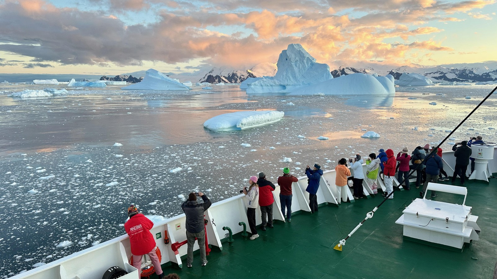
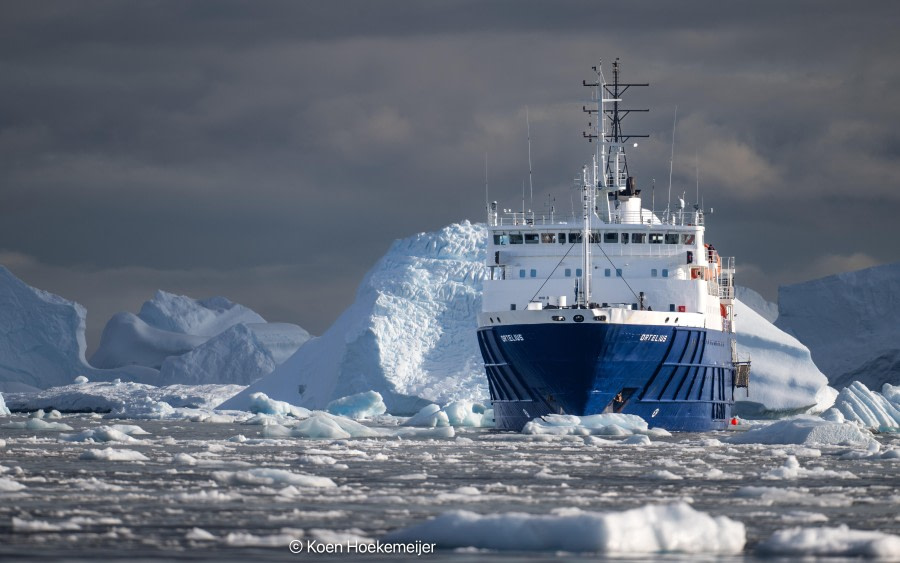
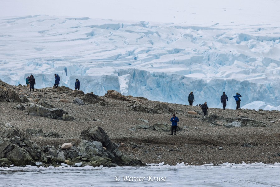
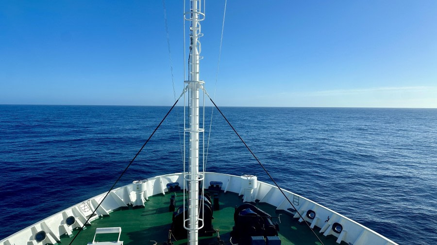
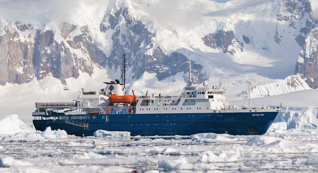
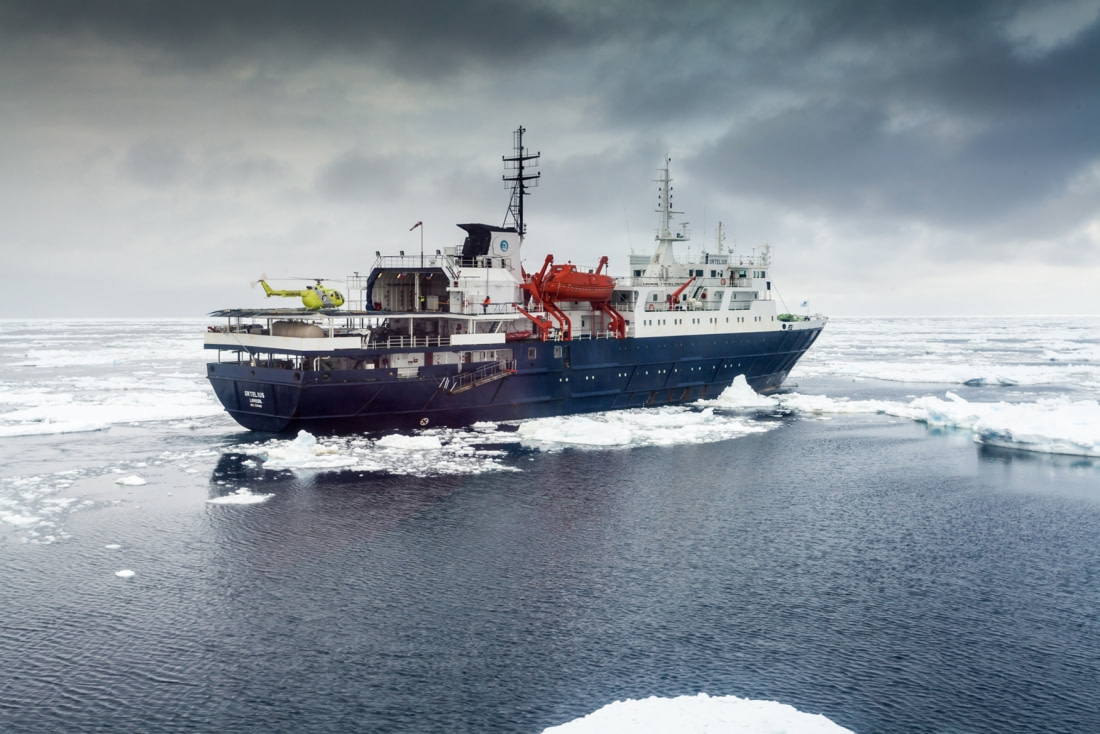
Ortelius remained in the calm, ice-laden waters of Lazarev Bay overnight. Captain Per had found an uncharted anchorage near some uncharted islands the evening before but was forced to move his ship in the small hours following an endless barrage of icebergs. Although slow moving, some of the frozen giants were a real menace for the ship and more open waters had to be found where we could drift and the officers on watch could take avoiding action when icebergs came close.

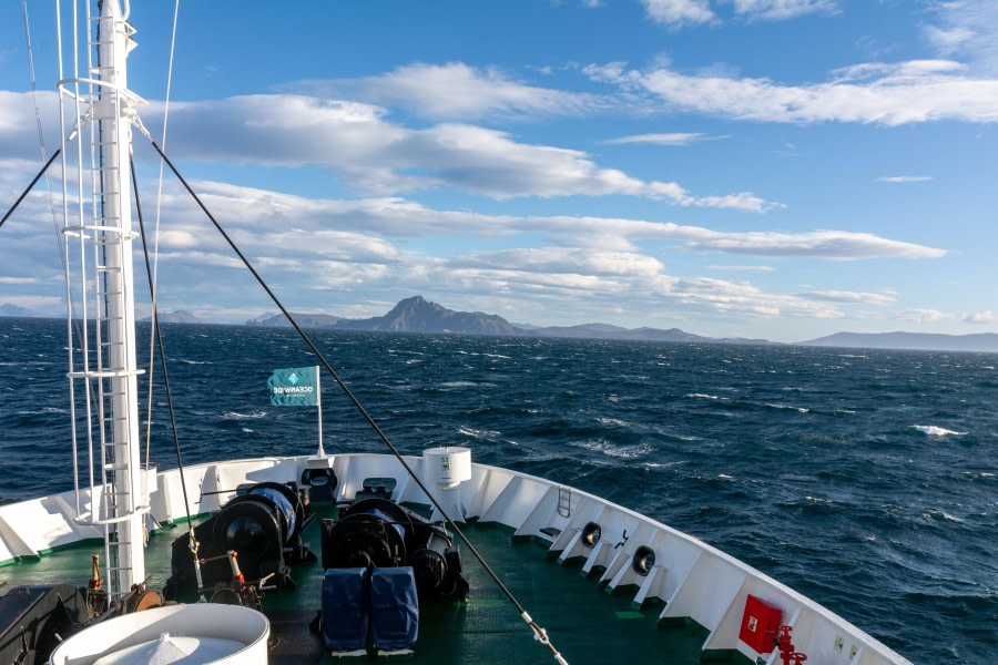
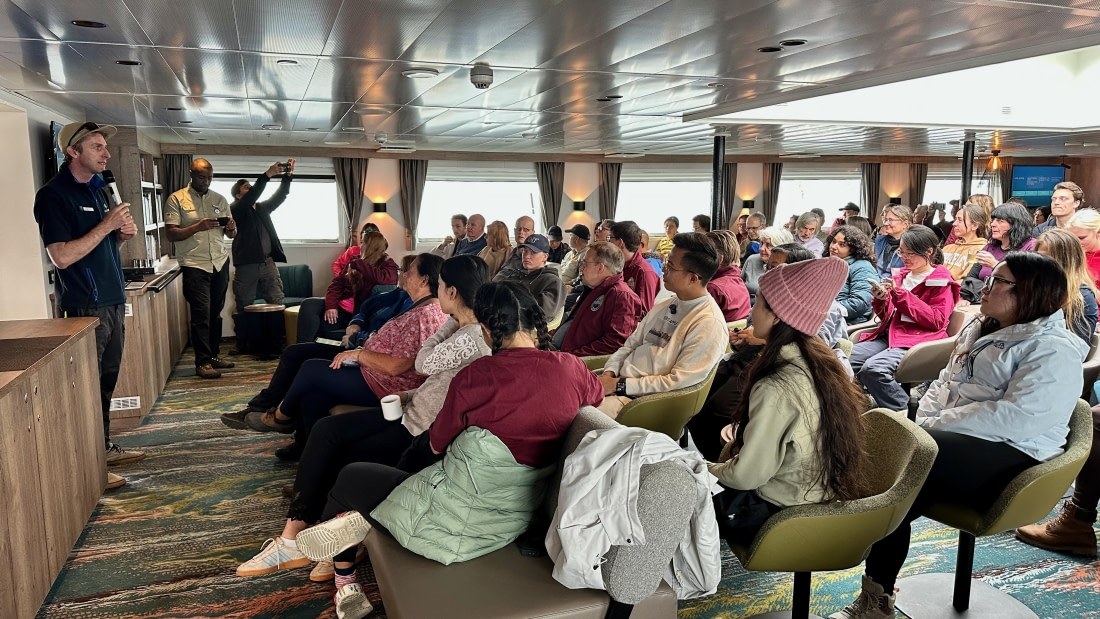
Many of us were already up when Chris made his wake-up call at 07:15. His summary of the weather revealed that it was a very different day outside compared to yesterday. The blue skies and sunshine had been replaced by low clouds and variable visibility. Nevertheless, it was still spectacular. The sea was glassy calm with dramatic reflections of the icebergs all around us, and the dark skies created a very moody atmosphere.

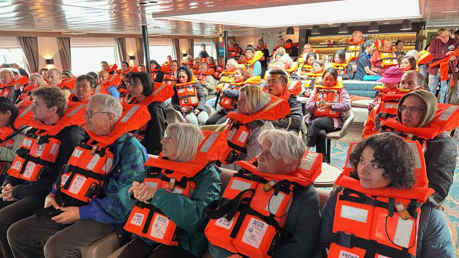
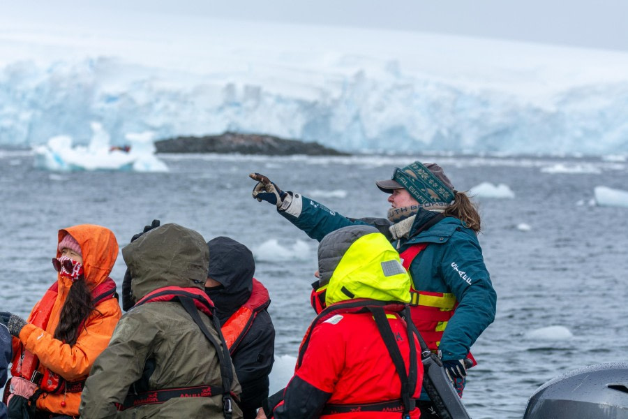
Chris’s announcement was something of a call to arms, as if rallying his troops before embarking on an important mission. It was a reminder that straight after breakfast we would be heading off in the Zodiacs on a long-range exploration of the most southerly, uncharted waters of Lazarev Bay. The goal was to try and reach the Wilkins Ice Shelf at the south end of the bay, but we were under no illusion that this required a lot of luck with ice and weather. The outside temperature was zero degrees Celsius, and Chris emphasized the importance of wearing even more layers than normal, and taking extra clothing for back-up.

The general direction was south-south-east, and the aim was to travel as fast as possible, which meant that the drivers needed to get their Zodiacs up on the plane and running at full speed. For a few boats this required a bit of fine-tuning where a passenger or two was transferred to another boat with more power or a lighter load. Eventually, all Zodiacs were soon weaving their way through the kingdom of ice at speed, providing a thrilling and awe-inspiring experience. Many sat in quiet bewilderment, taking in the spectacular scene around us as we sped our way southwards.

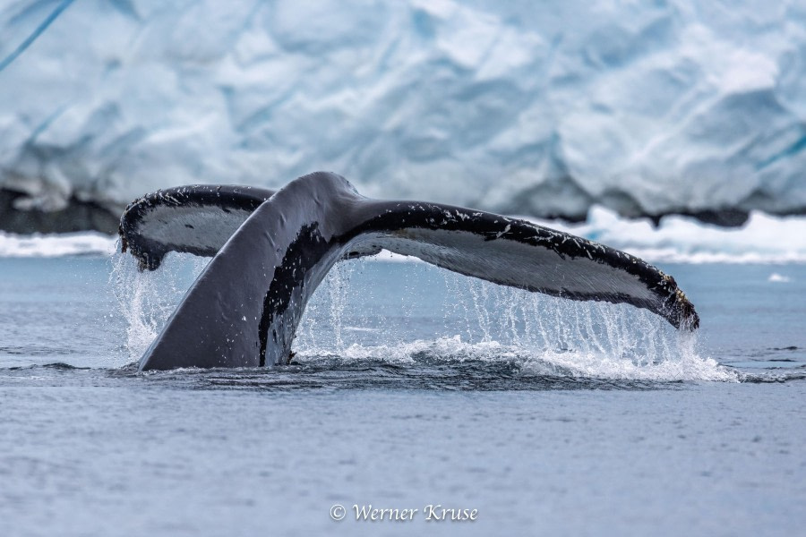
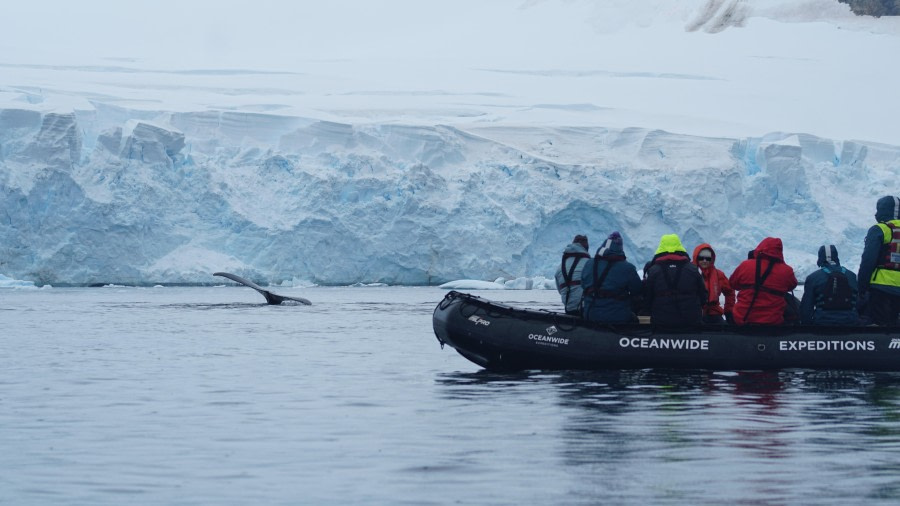
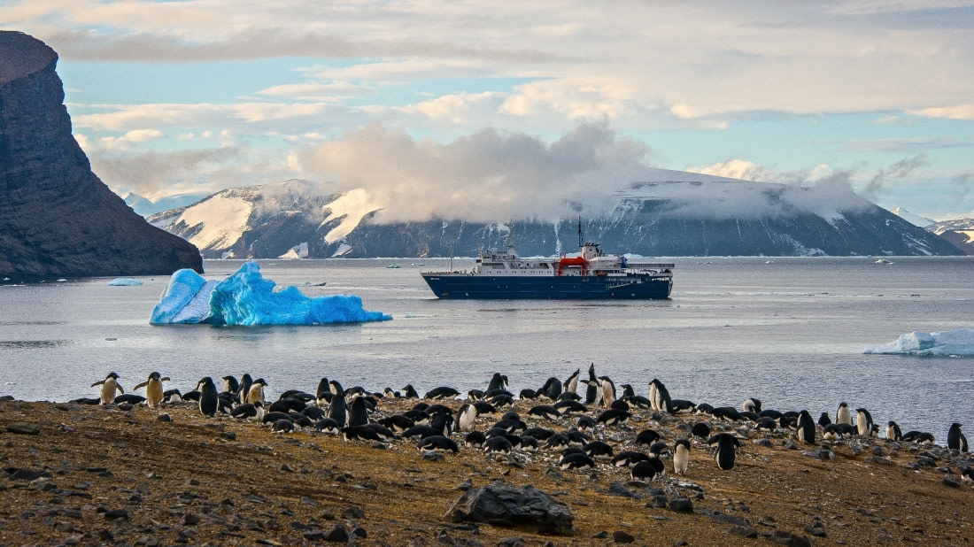
Our progress was only slowed by dense belts of brash ice or stops for wildlife. An occasional lone Crabeater and Weddell seal was encountered, but unlike the day before, it was the Leopard seals that were the more numerous seal species of the excursion. There were several memorable encounters with this apex predator. We also came across some Adelie penguins, hitching a ride on icebergs while some of them completed their annual moult. But it was the experience of seeing a few Emperor penguins standing proud on ice that will stay with us forever. Looking utterly magnificent in their perfect plumage, it was a sight that none of us will ever get tired of.

Onwards and ever southwards the Zodiacs sped, weaving their way through the frozen maze. The drivers weren’t just having fun; they were having the time of their lives. One Zodiac driver was inspired to quote English poet Samuel Taylor-Coleridge (1772-1834), with verses from his epic masterpiece ‘The Rime of the Ancient Mariner’……

And now there came both mist and snow, and it grew wondrous cold.

And ice mast high came floating by, as green as emerald.

The ice was here, the ice was there, the ice was all around.

It cracked and growled and roared and howled like noises in a swound.

Day after day, day after day, we stuck nor breath nor motion.

As idle as a painted ship upon a painted ocean.

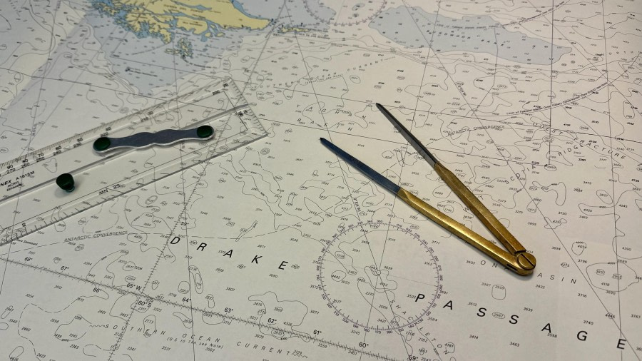
Having travelled almost 25km from the ship, the first concerns about fuel consumption were voiced by a couple of the Zodiac drivers, who felt the need to change to their second tank. Chris put out a call to all the drivers, requesting that everyone raft up. There we were, a tiny flotilla of ten Zodiacs, carabiner’d side-by-side, drifting with the ice in the vastness of Lazarev Bay. We were still quite some ways from the Wilkins Ice Shelf, but it was visible in the distance through binoculars. Chris checked the fuel state of all Zodiacs and decided to err on the side of caution. This was as far south as we would go.

A little bit of a party atmosphere developed as everyone celebrated the farthest south of the voyage. Music played in one Zodiac and many happy photos were taken while people danced a little to get the blood flowing into their cold limbs. It was decided that once our flotilla broke up, we would travel south a very short distance further to ensure we crossed latitude 69º 40’ South. In the end, the most southerly position recorded was….

69º 40.312’ SOUTH - 071º 55.904’ WEST

It was then a sprint back through the ice to Ortelius. The visibility was reduced for a time with a brief spell of snow followed by rain. Once again, some Zodiacs refused to plane and go at full speed, despite the best efforts of their drivers with shuffling guests around in search of the magic point of balance. In one boat it was unanimously decided that stops would only be made for Leopard seals, Emperor penguins and Orcas. Happily, two out of three occurred. Only the Orcas eluded us.

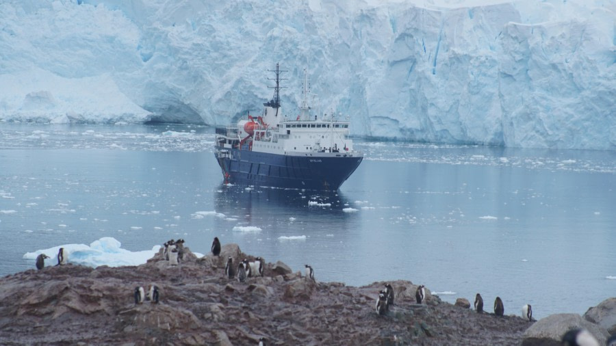
The return journey seemed to pass more quickly and at a distance of around 8km we caught our first glimpse of the ship. By then most people were starting to feel the cold and couldn’t wait to get back on board. Fortunately, the ice was really open for the final leg of the journey, and we sped swiftly towards the warmth of Ortelius. Pulling up to the ship, drivers checked their GPS devices and revealed that we had travelled over 50km. Wow! In this modern era of expedition cruising, it is extremely rare to find an Expedition Leader and team that are willing to undertake such a colossal challenge. Enormous congratulations to Chris and his team!

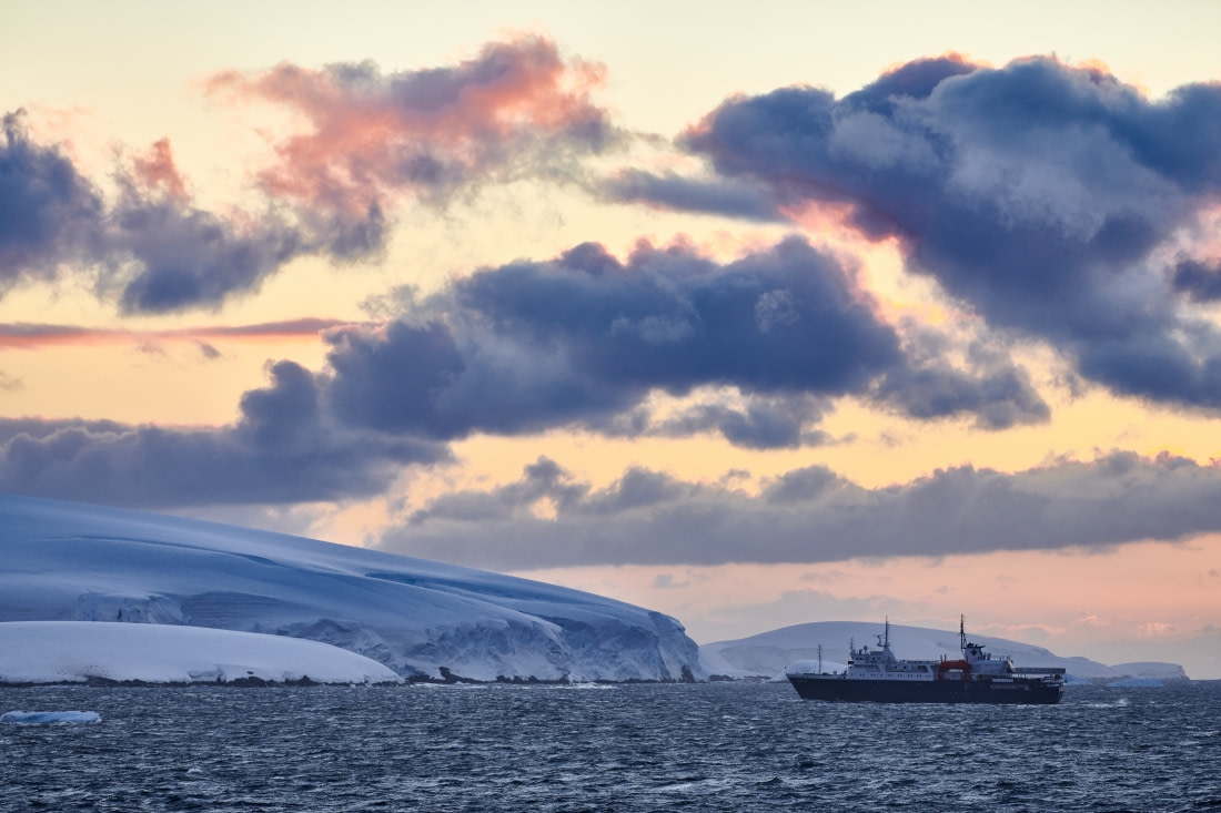
No sooner were we back onboard than the wonderful Hotel Department were announcing that a very welcome hot buffet lunch was served. Conversation in the restaurant was livelier than usual, as we reflected on the remarkable adventure just completed. This was something we would remember for many years to come. After lunch there was time to relax and enjoy one last view of Lazarev Bay as Ortelius slowly made her way northwards through the icebergs. For some, there was the irresistible urge to adopt the horizontal position and enjoy a little nap.

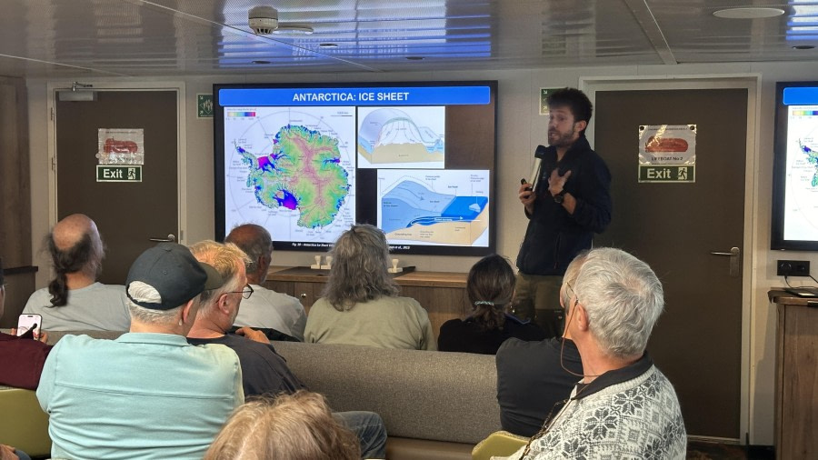
Soon, we left the sheltered bay behind, and the ship took on a gentle motion as she met the swell of open ocean. At 16:15 Chloe invited everyone to join her in the bar for a fun and enlightening lecture about Seals. Chloe’s enthusiasm and passion for these wonderful creatures was very much evident as she told us everything we wanted to know, and more, about all the seals we had encountered so far. At 18:15 we gathered in the bar for the daily recap and briefing on the next day’s activities. Then dinner was served. There were a few empty seats in the restaurant, a result of the ‘ocean motion’ that finally rocked us all to sleep. Some of us lay awake for a while, thinking about what an extraordinary day it had been. A proper adventure in an uncharted corner of Antarctica where nobody goes. It doesn’t get any better than that!!!

Day 9: Calmette Point and Millerand Island

Calmette Point and Millerand Island
Date: 26.02.2026
Position: 68° 03.4’ S; 067° 07.4‘ W
Wind: NW-4
Weather: Part. Cloudy
Air Temperature: +3

After crossing the Faure Passage and the southern part of Marguerite Bay, we found ourselves creeping through the calm waters between Pourquoi Pas and Millerand Islands. Captain Per had sent out a scouting Zodiac, maneuvered by the third officer Ian and equipped with a portable Olex on board. The device could communicate live with the ship, sending soundings of the poorly charted waters we were about to cross. Carefully advancing at 2–2.5 knots, the ship made her entrance and was set at anchor in Calmette Bay.

Right after breakfast, the expedition staff went out for yet another exploratory and exciting visit to this new landing site, and soon we joined them on land, skimming across waters filled with growlers and bergy bits. Setting foot on the mainland peninsula was quite a feeling, especially when surrounded by such beautiful scenery. To the east, the extensive Todd Glacier filled the bay, calving blue, glimmering icebergs into the water. This outlet glacier of the Antarctic Peninsula Ice Sheet reminded us of the immense power of nature at play here in Antarctica.

On land, we could freely roam, walking on ancient beach ridges formed by the isostatic rebound that the Peninsula experienced during the Holocene after the Last Glacial Maximum. Some of these ridges were located about 50 meters above present sea level — again, a testament to the impressive and relentless power of nature at work. Some of us wandered west toward a land-terminating glacier cascading from a small mountain range, while to the east a few molting Adélies and a couple of Weddell seals were peacefully photographed as they rested on the pebbly shoreline.

The highlight of the morning, however, was the polar plunge. Many of us decided to test the frigid Antarctic waters, which that morning were hovering around 1.5 – 2 °C. After a warm shower and a hearty lunch, MV Ortelius quickly moved out of Calmette Bay on her way southwest toward the northern shore of Millerand Island and another poorly charted area.

This time, our second officer Nino was in charge of leading us closer for another new landing and exploration of this rocky and mountainous island. At 3 p.m., the Zodiacs began running and brought us ashore. Briefed by Expedition Leader Chris, we once again had the chance to roam freely along the snow-free shoreline of Millerand. Once more, we observed raised beaches similar to those from the morning, and this time we were blessed with a large colony of molting Adélies, among whom a Chinstrap penguin made an appearance. Along the shoreline, Weddell and crabeater seals were scattered about, while kelp gulls and south polar skuas patrolled the sky. Although the weather had deteriorated during the afternoon, we were pleased with these new exploratory landings and walks in this unknown corner of Marguerite Bay.

Back on the ship, we quickly gathered in the bar for the usual briefing about the next operational day, after which Valeria and Marco enriched the evening with a couple of recaps about the sizes of marine mammals and the recent behavior of ice shelves on the Antarctic Peninsula. Luckily, tonight’s navigation took place in protected waters, thus avoiding the annoying swell of the previous night.

KAYAK

We relocated north to return to Marguerite Bay, where - still well below the Antarctic Circle - we explored the austere and exposed coastline of Millerand Island. In light winds, with a gentle swell, we crossed a 1km strait of open water to the Debenham Island group, where we encountered dense brash ice in the shallow narrow channels between these rocky islets. Squeezing through gaps in this icy soup, we emerged triumphantly into open water again, close to the Argentinian research station of San Martin. We paused a while to admire the impressive glacial ice cliffs close to the station, and passed by a small colony of Antarctic shags on their lonely rocky outcrop.

Our return crossing to Millerand Island followed a series of grounded icebergs, finally arriving at the shoreline 1km south of our launch point. We paddled a course parallel to the beach past a sleeping Weddell seal, finally returning to the rocky reefs that marked the start of our adventure. We celebrated our absorbing afternoon of Antarctic paddling that combined a wonderful variety of memorable encounters.

Microplastic Sampling on M/V Ortelius

Throughout the Uncharted Expedition, Dr. Victoria Fulfer from the 5 Gyres Institute conducted microplastic sampling of the air, water, and sediment to assess how microplastics travel, settle, and persist in remote Antarctic regions. Using a manta tow at 4 different locations, Victoria collected microplastics from the surface water, finding a high number of microfibers as well as some small fragments. Thanks to the assistance of SCUBA divers on the expedition, benthic sediment samples from beneath the ocean were collected, along with intertidal sediment samples from landing shorelines.

Throughout the voyage, Victoria sampled microplastics from the air both inside and outside of the ship. These samples will be compared to the fibers found in the environment. 5 Gyres would like to thank the entire crew and expedition team on Ortelius for making this science possible.

Day 10: Crystal Sound and Fish Islands

Crystal Sound and Fish Islands
Date: 27.02.2026
Position: 66° 00.5’ S; 065° 27.3‘ W
Wind: NE-5
Weather: Overcast
Air Temperature: +2

During the morning we continued sailing toward our next destination under bright skies and fresh winds. The time at sea provided an excellent opportunity for learning on board, with two engaging lectures offered to guests. Loel continued his navigation workshop, sharing practical techniques for orienting oneself at sea. Guests showed great interest in understanding how mariners determine position and direction using charts, bearings, and natural cues.

Later in the morning, guest lecturer Jeff presented a talk on diving in Antarctic waters, offering insight into the challenges, unique conditions, and extraordinary marine life encountered beneath the polar surface.

In the afternoon, we launched the Zodiacs for a cruise around the Fish Islands. The day looked stunning, with dramatic light and sweeping views, though brisk winds reminded us of the region’s raw environment. The surrounding glaciers provided a striking backdrop as we began exploring the islands.

Wildlife sightings were abundant. We visited a colony of Imperial Shags, where chicks could be seen in the nests. Guests were fortunate to observe adults returning to feed their young, while skuas patrolled overhead, ever watchful for an opportunity to snatch an unattended meal. The shag nests themselves were clearly visible, carefully constructed from seaweed and marine grasses gathered from the shoreline.

We then cruised toward the glacier front and through fields of brash ice. The scenery was spectacular, and as we moved closer to the ice, the air temperature dropped noticeably. The subtle crackling and popping of melting ice added a quiet soundtrack to the experience, while guests took in the sensation of being surrounded by floating ice.

Continuing around Prospect Point, we passed the site where the British Base J station once stood. Although the station itself no longer remains, remnants and equipment from earlier operations can still be seen, offering a glimpse into past Antarctic fieldwork in this remote area. Guests thoroughly enjoyed the cruise despite the cold, embracing the rare opportunity to experience the Antarctic environment from water level among ice and wildlife.

We concluded the day with the daily recap, where plans for the following day were shared, followed by dinner served in the restaurant.

Day 11: Ferguson Channel and Cuverville Island

Ferguson Channel and Cuverville Island
Date: 28.02.2026
Position: 64° 53.9’ S; 062° 54.9‘ W
Wind: SW-3
Weather: Overcast
Air Temperature: +2,5

Excellent progress had been made during the night crossing of the Grandidier Channel and Bismarck Strait. As the first light of morning began to rise, MV Ortelius was navigating the southern Gerlache Strait on her way toward Paradise Harbour, our destination for the morning Zodiac cruise.

While breakfast was being served in the restaurant and the ship was gliding into the Ferguson Channel, the bridge team and many staff members observed a significant presence of Humpback whale. A quick “Plan B” was therefore put into action. The ship was positioned in the channel between Bryde Island and the mainland peninsula, 11 Zodiacs were deployed, and the expedition staff efficiently escorted everyone on board for a morning whale-watching activity.

Despite the drizzle that persisted throughout the morning, we were blessed with an abundance of humpback whales busily engaged in feeding. Every two to four boats had their own group of whales consistently lunge feeding at the surface. Lunge feeding is a dramatic hunting technique used by certain baleen whales, such as humpbacks. In this method, the whale accelerates toward a dense patch of prey such as krill or small fish, then opens its mouth wide and engulfs an enormous volume of water and food in a single gulp.

Pleated grooves along the throat expand like an accordion, allowing the mouth to balloon outward. The whale then closes its mouth and pushes the water out through its baleen plates, trapping the prey inside before swallowing. This high-energy strategy enables whales to consume vast amounts of food quickly to sustain their massive bodies.

The cold and humidity did not matter, as halfway through the morning Ingrid and her cheerful staff approached us with the “Chocolate Boat,” warming our hearts and bodies and giving us the boost of spirit needed to continue the Zodiac cruise for an extra hour.

Back on board, it was time to take off our outer layers and dry ourselves while the ship repositioned toward our afternoon destination, Orne Harbour. As we cruised through Paradise Harbour, we could see in the distance the Argentine research station Base Brown, followed by the Chilean “González Videla” Station located in the Aguirre Channel. Lunch was served, and despite our good progress, there was yet another change of plans. As we approached the Errera Channel and Orne Harbour, the wind increased to gusts of up to 50 knots. Our Expedition Leader, Chris, wisely decided to seek shelter in the southwestern corner of Cuverville Island. The anchor was dropped and, after a short delay, the Zodiacs were quickly ready to shuttle us ashore on this rocky island, partially covered by a small ice cap at its summit.

The shoreline was wet and slippery as we landed in the intertidal zone; however, the amount of wildlife around us was overwhelming. A dozen Antarctic fur seals were playing with each other on the shingle areas, and as we slowly moved through the penguin rookery, hundreds of curious chicks approached us inquisitively.

The Gentoo penguin is easily recognized by its bright orange bill and the wide white stripe that stretches like a bonnet across the top of its head. Agile both in the water and on land, it is one of the fastest-swimming penguin species, feeding mainly on krill and small fish. On Cuverville Island, large rookeries of these penguins crowd the rocky shoreline, filling the brisk Antarctic air with a lively, almost musical chorus.

It was a day filled with unexpected changes of plans, yet rich in wildlife and exciting activities as we continued our journey north along the western coast of the Antarctic Peninsula.

Citizen Science Projects

Citizen Science Coordinator Susan Copelas, an Explorers Club member and Society of Women Geographers, conducted three experiments to study the correlation between underwater sound reception, visibility and salinity. Hydrophone recordings, water visibility and salinity tests were performed on three occasions from a zodiac and discovered that the clearer the water, and the more wildlife that was found, equalled better. recordings. The location in the bays could have been a factor as well but was not tested. iNaturalist and eBird apps were strongly encouraged and downloaded by passengers and used to ID, unknown to us, species. Extensive sitings-Happy Whale- found min of two whales that have not been identified in the past along with a baby!

Day 12: Neko Harbour and De Gerlache Strait

Neko Harbour and De Gerlache Strait
Date: 01.03.2026
Position: 64° 48.9’ S; 062° 37.8‘ W
Wind: NW-2
Weather: Overcast
Air Temperature: +1

Another morning in paradise! We were woken up by Chris a bit earlier today, as we sailed through the brash ice towards our morning’s destination of Neko Harbour. The sea was glassy, speckled with bergy bits and whale blows in the distance. We couldn’t believe how many whales we had seen in the space of 24 hours! This area sure must be productive with krill! Captain Per safely anchored the Ortelius in the Harbour, where we got a spectacular view of the surrounding glaciers with towering ice cliffs dotted with crevasses and dazzling blue ice. Wilson’s storm petrels danced on the surface, gentoo penguins porpoise amongst the brash ice and the odd southern giant petrel soared above. The wildlife down here never ceases to amaze us.

Our morning’s activity would sadly be our last excursion, consisting of a landing adjacent to a very active glacier. This meant that as soon as we landed, we had to head up to higher ground in case of large waves flooding the shore from the nearby calving ice cliffs. Upon arrival, we were also greeted with the pungent smell of penguin guano, which comprised the fishy-smelling Antarctic krill that the penguins had been feasting on. The colour of the rocks were stained pink from this krill, and soon enough our boots (and even our pants!) were covered in the muck. Nonetheless, the scenery was absolutely incredible, especially as we hiked higher up the mountain to a magnificent viewpoint on the less pink-stained snow.

It was super special to feel the snow crunch underfoot, as this time of year in Antarctica it is normal to see more bare rock due to warmer temperatures and snow melt. It truly felt like we were in Antarctica today! The stars of the show here, however, were the cute gentoo penguins, undergoing their annual moult, where they acquire new feathers for the upcoming winter. There was a mixture of adult penguins, ‘teenager ‘penguins, and chicks from this season that had almost lost all their fluffy down and into their more ‘adult plumage’.

They were so curious, waddling straight up to us at times making the five metre distance extremely difficult! What goes up must come down, and we carefully treaded back down the slippery guano covered rocks down to the Zodiacs, where the expedition team helped us scrub the guano off our boots and trousers with none other than toilet brushes from the ship! (luckily unused ones!). Hopefully the smell would come off too, but only time will tell…

Back on board and after lunch the Ortelius continued to sail through some incredible scenery, through the Gerlache Strait and Fournier Bay where we spotted numerous humpback whales, porpoising penguins and even the odd seal hauled out on an ice floe. It was sad to say goodbye to Antarctica as we headed out into open water, but we knew we would be leaving with a mind full of memories, new friendships made and no doubt memory cards almost out of storage!

We were joined by Loel for a final navigation workshop in the bar, and treated with some scrumptious treats by the galley team for our afternoon sailing out into open sea. Hopefully some more seabirds on our way back through the Drake Passage tomorrow!

KAYAK

On our final morning before sailing north, we launched into the magnificent waters of Neko Harbour, a superb paddling venue beneath the towering coastal mountains of the Arctowski Peninsula. In windless conditions, we paddled towards the middle of the inlet, through dense brash ice that finally proved too closely packed for easy progress. Returning towards the shoreline SE of the landing site, we were rewarded with a magical moment - four slow-moving Humpback whales surfaced only a few metres from our kayaks. we watched in awe for several minutes as these majestic animals breathed regularly in the still air, before diving again into the icy depths. Stunned into silence, we paddled on in awe at our good fortune.

Our journey back to Ortelius’ anchorage included a final visit with the wonderfully comic Gentoo penguins, and a last adventure through the brash ice. The time finally arrived for our return to the ship and the start of our voyage home - this final kayaking adventure was the perfect way to end our amazing Deep South Antarctica expedition.

Southern Cross - A Low Earth Orbit Satellite Navigation Project: Researcher David Marsh, a graduate student at Georgetown University and member of The Explorers Club, conducted a navigation experiment onboard in coordination with the Ohio State University. Using a series of antennas and software-defined radios set up on the helipad, he gathered signals from Starlink and OneWeb satellites passing overhead, at approximately 600 kilometers in altitude (known as Low-Earth Orbit). Using a new methodology, these signals will be used to calculate the position of the ship, and this calculated position compared against a GPS ground track to determine overall accuracy of the method. This technique is intended to become an augmentation or replacement for Global Navigation Satellite Systems to help enhance navigation in polar regions. A future demonstration will test the system in space, proving a method for navigating on the lunar or Martian surface.

Expedition Radio Scientist and Antarctic Scuba Diver

During the voyage aboard the M/V Ortelius, I installed a WSPR (Weak Signal Propagation Reporter) transmitter at the stern near the helipad and transmitted beacon signals continuously throughout the journey to study HF propagation under Antarctic maritime conditions. I also conducted scientific scuba dives with the expedition team to collect settlement substrates for microplastics analysis and fauna collection in support of the Head of Collections at the Natural History Museum. In addition, following an initial hypothesis by Captain Per, I collaborated with the Chief Engineer to investigate and experimentally confirm that Starlink transmissions were triggering the vessel’s fire alarm system; I subsequently prepared and submitted a formal technical report of our findings to the Captain.

Day 13: Drake Passage Northbound

Drake Passage Northbound
Date: 02.03.2026
Position: 60° 18.9’ S; 065° 12.4‘ W
Wind: NNE-3
Weather: Sunny
Air Temperature: +4,5

Today we crossed the legendary Drake Passage… and it behaved beautifully. No wake-up call, no chaos — just a calm, rolling Southern Ocean and a bright, sunny sky greeting us when we chose to emerge from our cabins. So much for Shackleton’s “violent confusion”! Instead, we enjoyed what can only be described as a gentleman’s Drake.

Breakfast on Deck 4 came with sunshine pouring through the windows and only the gentlest motion underfoot. Outside, grey-headed albatrosses escorted us in effortless arcs, barely moving their wings as they skimmed the calm swells. We leaned on the rails (confidently, for once) and admired their mastery of the air.

The morning lectures kept us happily busy. Koen transported us to Iceland and Tonga with tales from his whale-watching adventures, and Chris shared stories of life at Scott Base — giving us a glimpse into what it truly means to call Antarctica home. Then came lunch… and just as we were settling in, forks poised and plates full, the call went out: ORCAS! In true expedition style, we abandoned our meals and rushed outside. There they were — sleek dorsal fins cutting cleanly through the calm sea, surfacing gracefully under the sunshine as if perfectly scheduled for our entertainment. After a proper appreciation session (and plenty of photos), we returned inside, slightly windblown but triumphant, to finish lunch with excellent excuses for cold food.

In the afternoon, Dr. Victoria Fulfer guided us through the complex and important world of microplastics research. She explained the different scientific projects she and her team had been conducting during our time in Antarctica, reminding us how interconnected even the most remote corners of the planet truly are.

Dr. Tania Pineda then introduced us to the fascinating diversity of echinoderms. Sea stars, brittle stars, and other wonderfully spiny creatures took center stage as she presented photos from the thousands of specimens collected during this voyage. Most exciting of all, she showed us two potential new specimens discovered during their research — science happening in real time, right onboard with us.

At recap, Chris shared plans for tomorrow, keeping us all curious and hopeful. Allan entertained us with stories linking Iron Maiden, poetry, and Metallica’s legendary performance aboard Ortelius — the only band to perform on all seven continents. Chloe tested our seabird knowledge with a delightfully chaotic “Guess the Bird” quiz, complete with some very creative photographs. Confidence levels varied.

The Captain spoke about Cape Horn and our attempt to set a record for the number of people visiting the bridge — a challenge we are clearly taking very seriously.

As the day drew to a close, the calm Drake rewarded us with a truly beautiful sunset. The sky softened into golds and pinks, the sea reflected every shade, and we gathered on deck in quiet appreciation. It was one of those evenings that reminds us exactly why we are here.

A sunny, calm Drake, orcas at lunch, albatross overhead, science, stories, rock legends, and a glowing sunset — not a bad way to spend a day at sea.

Day 14: Nearing Cape Horn and the Beagle Channel

Nearing Cape Horn and the Beagle Channel
Date: 03.03.2026
Position: 55° 42.4’ S; 064° 35.8‘ W
Wind: NE-8
Weather: Part. Cloudy
Air Temperature: +11

Our second day at sea was much rougher than the previous one. During the night, a pressure system moved eastward closer to Patagonia, and this morning we woke up to strong northeasterly gales blowing at 35–40 knots. The MV Ortelius was listing to the port side, and in the distance, the clear sky allowed us to savor our first glimpse of the South American continent and the archipelago of the Wollaston Islands.

Cape Horn is a rugged and windswept headland at the southern tip of South America, located on Hornos Island in Chile’s Tierra del Fuego archipelago. Where the Atlantic and Pacific Oceans meet, the waters around Cape Horn are famous for their powerful currents, towering waves, and fierce storms, making it one of the most challenging maritime passages in the world. Before the construction of the Panama Canal, ships traveling between the east and west coasts of the Americas often had to brave this treacherous route. Today, although modern vessels rarely need to round the Horn, it remains a legendary milestone for sailors and a symbol of endurance, exploration, and the raw power of nature.

Captain Per manoeuvred the ship closer to the Horn until the lighthouse and the Albatross Monument were visible through binoculars from the deck. Around us, flocks of Black-browed Albatrosses, Sooty Shearwaters, Imperial Shags, South American Petrels, and the occasional juvenile Snowy Albatross soared effortlessly in the powerful wind. Right after breakfast, we were invited to gather on the bridge in an attempt to set a “world record for the most crowded bridge” while nearing the Horn. In the end, we managed to squeeze in just under 140 passengers. As we admired the green slopes of the southernmost of the Wollaston Islands, Chris shared some information with us and recited Baudelaire’s Albatross poem.

Cheers were raised and photos taken from Deck 7 and the bow before we resumed our course to the northeast toward the entrance of the Beagle Channel. Allan delivered a captivating talk about Admiral Byrd, followed by a Q&A session with Captain Per regarding the ship and crew who had accompanied us over the past couple of weeks.

Lunch was served, followed by the final two presentations of the voyage. First, Koen introduced Oceanwide’s destinations in the polar regions, and then Marco presented historical, anthropological, geological, and conservation projects from Patagonia, where he has lived for the past decade. Soon it was time to dress up for the Captain’s cocktail, the auction of the voyage flag, and the slideshow presentation led by Jess—an incredible way to wrap up the memories of this unique expedition to the extreme southern latitudes of the Antarctic Peninsula.

Day 15: Ushuaia, disembarkation

Ushuaia, disembarkation
Date: 04.03.2026
Position: 54°48.6’S; 068°17.8‘W
Wind: NE-1
Weather: Overcast
Air Temperature: +6

The final wake-up call was delivered by Chris, with instructions to place large luggage in the corridors by 07:30 for transport to the pier. The past days had passed remarkably quickly. After breakfast, we said farewell to the dining room staff who had taken such good care of everyone throughout the voyage. Disembarkation followed, with heartfelt goodbyes exchanged with the crew, expedition team, and newly made friends.

Some of us travelled directly to the airport, while others continued their journeys in Ushuaia and Patagonia. The expedition offered unforgettable experiences and a powerful reminder of the scale, beauty, and raw nature of Antarctica—memories that will remain long after the journey ended.

On behalf of Oceanwide Expeditions, Captain Per Andersson, Expedition Leader Chris Long, Hotel Manager Ingrid van de Loo and all the crew and staff of M/V Ortelius, it was a great pleasure and a privilege travelling with you!

Total distance sailed on our voyage: 2540.9 nautical miles

Most southern point sailed: 69° 40.3’ S; 071° 55.9’ W

Details

Tripcode: OTL30a26
Dates: 18 Feb - 4 Mar, 2026
Duration: 14 nights
Ship: m/v Ortelius
Embark: Ushuaia
Disembark: Ushuaia

Have you been on this voyage?

Aboard m/v Ortelius

The ice-strengthened Ortelius is thoroughly outfitted for polar exploration and, when necessary, helicopter flights.

More about the m/v Ortelius »
Loading