Svalbard a Disneyland for geologists
Svalbard is located in the north-western corner of the Eurasian plate. For a long period Svalbard was part of a large continent that included North America, Greenland and Eurasia. At one time both Northeast Greenland and Svalbard were submerged under the depths of the ocean before surfacing again.
It is because of this geological history that Svalbard is a geologist’s heaven. In fact it is one of the few places in the world with so much geological diversity within a relatively small area. Despite most of the archipelago being covered in glaciers Svalbard is home to easily accessible sections of geology that represent most of Earth’s history enabling scientists to not only study past geological events but also watch current geological processes unfold.
Three main geological periods in Svalbard
According to scientists, Svalbard has three main geological divisions:
- First, there is a basement that comprises the oldest materials on the island that was formed during Precambrian to Silurian times (from 4.6 billion years ago all the way to 443.8 million years ago), which consists of igneous and metamorphic rocks that have been folded and altered over time.
- Second, unaltered sedimentary rocks formed in the Late Palaeozic to Cenozoic times (during this time life rapidly progressed on Earth with arthropods, amphibians and other species evolving until the extinction of dinosaurs and the rise of mammals and humans today).
- Third, unconsolidated deposits from the Quaternary period that are associated with the last ice age).
The basement of Svalbard
At the basement of Svalbard, in geological terms, are rocks from the earliest stages of Earth’s history. These rocks show periods or folding and metamorphism during the major mountain-building period around 400 million years ago. Because of weathering and erosion only the remnants of these rocks can be found day, mainly along the west coast and the northern part of Spitsbergen as well as on Prins Karls Forland and Nordauslandet.
The areas these rocks are found in are mainly alpine landscapes with jagged mountains. In the southern part of Spitsbergen, the basement consists of phyllite, quartzite, limestone, dolostone and conglomerate as well as minor traces of volcanic rocks. Tillite is also found, which comes from deposits from glaciers that covered Svalbard around 600 million years ago. Beneath the tillites are beds of limestone containing stromatolites, which are small fossil age algae colonies.
Meanwhile in the northwestern part of Spitsbergen the most common rocks are shale, limestone, dolostone and tillite. In addition, granite is found there which has been dated around 411 million years old.
The sedimentary period
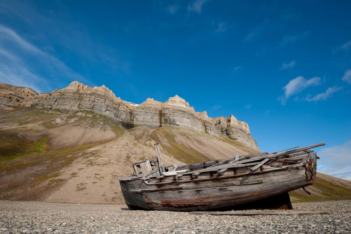
During the sedimentary period, erosion of the mountain chain started, resulting in large quantities of sand, gravel and mud being deposited on alluvial plains and in the sea. Later on new deposits were added eventually resulting in limestone. Around 40 million years ago sandstone-shale deposits were laid down.
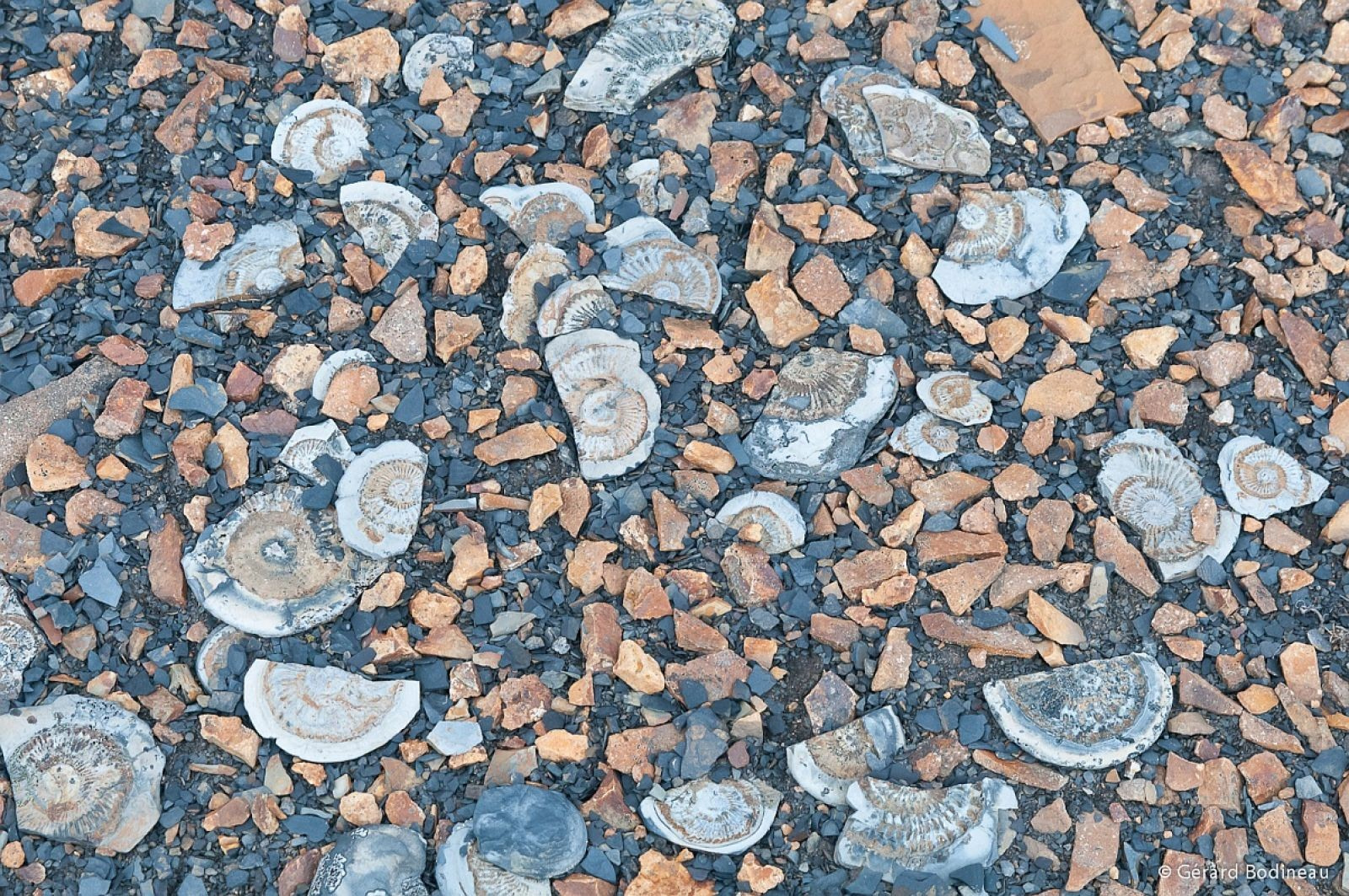
Of interest to geologists is that the depositions indicate a period of dry, desert-like climatic conditions followed by fresh or brackish water, lagoons and rivers flowing through. During this period of water, known as the Age of Fishes or in geological terms the Devonian period, primitive fish swam in waterways and the sea.
In fact the first known vertebrates were found in Svalbard. At the same time the first terrestrial plants evolved with fossils of plant spores that grew in river plains and shallow lakes found in Svalbard.
Dinosaurs roaming the land
Late on, Earth entered the Triassic and Jurassic period with geologists finding evidence of a temperate and rather damp climate in Svalbard. While most of Svalbard was covered by sea periods of uplift resulted in alternative marine and terrestrial sedimentation. During this period, often called the Age of Reptiles, swan-necked reptile species lived in the sea while dinosaurs roamed the land.
Following this geological time-line was the Cretaceous period, was known for large amounts of volcanic activity and faulting. Magma rose to the surface through fractures and bedding surfaces. On Kong Karls Land magma forced its way to the surface and solidified as dark basalt lava.
New mountain ranges form
In the Early Tertiary period, a new mountain range formed along the west coast of Spitsbergen, but much smaller than the older Caledonian mountain belt that had formed 470-400 million years ago when the North American plate – Laurentia – collided with the North European plate – Baltica – resulting in continental crust on both sides being compressed and folded and large sheets of rock thrusted on top of one another (the remnants of this mountain chain is still present in Svalbard today as well as in mainland Norway, Scotland and East Greenland). During this period rocks of all ages were folded and large sheets of rocks were thrust eastwards.
Remnants of past mountain-building
Today geologists can see thrust sheets in many mountain sides in Wedel Jarlberg Land and Oscar II Land. Geologists speculate that these movements could have been due to the Greenlandic continental plate pressing towards Svalbard as Svalbard slid past the northern part of Greenland. At the same time as this was occurring the North Atlantic and Arctic Ocean was being formed by seafloor spreading.
Just east of the new mountain rain the land subsided and formed a large north-south trending bay. In this area sandstones and shale were deposited in what is called the Central Tertiary Basin. Deposits found in this basin include numerous plant fossils as well as coal deposits. At the same time, a new volcanic phase occurred in the north Atlantic region with lava flows from this time preserved in Andrée Land, with the basalt lava forming hard caps on some of the highest peaks in the region.
Entering the Ice Age
At the start of the Quaternary period the climate began to get colder with the Earth entering a new Ice Age. During which large parts of North America and North Europe covered in thick ice kilometres-thick. During this period Svalbard was covered in a vast ice sheet. Between each warming period lasting from 10,000 to 20,000 years there was similar vegetation to the present type. Scientists believe that there was between 20 to 30 ice ages each with warmer interglacial periods have taken place over the last two to three million years. There are traces of past glaciation periods in Svalbard however the most recent glaciation removed most of the earlier deposits.
Completely covered in ice
During the Ice Age Svalbard was completely covered, except for a few mountain peaks, by a vast ice sheet. The sheet was most thickest near Kong Karls Land in the eastern part of Svalbard. Because of the enormous weight of the ice sheet, the land mass of Svalbard was pushed down with depressions forming where the ice was most thickest. As the temperatures started to rise and the ice began to melt the land rose again. In fact Kong Karls Land has risen around 130 metres relative to sea level since the end of the Ice Age about 10,000 years ago. An interesting discovery was made when scientists found ancient pollen that suggested that the climate during some of the periods after the last Ice Age was milder compared to today.
