Pourquoi Pas Island

A mountainous Antarctic island off the west coast of Graham Land

Pourquoi Pas Island

Region: Antarctica

Destinations: Antarctic Peninsula

The size, place, and neighbors of Pourquoi Pas Island

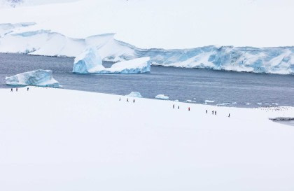
Roughly 27 km (17 miles) long and anywhere from 8 to 18 km (5 to 11 miles) wide, Pourquoi Pas Island is situated between Bourgeois Fjord and Bigourdan Fjord off western Graham Land, Antarctica.

Pourquoi Pas Island’s discovery, exploration, and namesake

Pourquoi Pas was discovered by the French Antarctic Expedition of 1908 – 1910, led by Jean-Baptiste Charcot, then fully charted by the British Graham Land Expedition of 1934 – 1937, under Australian explorer John Rymill, who named Pourquoi Pas Island after Charcot’s ship, the (you guessed it) Pourquoi-Pas.

Related cruises

Antarctica – Uncharted islands of the Deep South

18 Feb - 4 Mar, 2026

Tripcode: OTL30a26

On this extraordinary journey, we navigate the unexplored waters around Lazarev Bay and the mysterious Glinka Islands, a region where old aerial photographs (1939–1941) serve as reference for existing charts. Ice and daylight permitting, we will be aiming...

Deep South Basecamp experience

4 Mar - 17 Mar, 2026

Tripcode: OTL30b26

The Deep South Basecamp experience offers you a myriad of ways to explore and enjoy the Antarctic region. This expedition allows you to (long) hike, snowshoe, kayak, and even camp out under the Southern Polar skies.

Bellingshausen Sea / Peter I Island + Ellsworth Land - incl. helicopters

14 Jan - 7 Feb, 2027

Tripcode: OTL27-27

This adventurous expedition offers a unique opportunity to discover very rarely visited places, deep South along the coast of Antarctica to the Bellingshausen Sea, along the coast of Ellsworth Land and even to Peter I Island.

Loading