PLA26-26, trip log, Antarctica - Discovery and Learning Voyage

by Oceanwide Expeditions

Galería de fotos

Bitácora

Day 1: Ushuaia, Embarkation Day

Ushuaia, Embarkation Day
Fecha: 09.01.2026
Posición: 54°52.7’S / 067°54.4’W
Viento: W-3
Clima: Partly Cloudy
Temperatura del Aire: +11

The day began with a light drizzle in Ushuaia, but it didn’t take long for the weather to improve. Soon, calm conditions settled in: perfect for the start of our long-awaited expedition to Antarctica.

It was a very busy day at Ushuaia’s pier. Out in the middle of it all, our beloved Plancius sat gracefully alongside, waiting for us.

Members of the expedition team greeted us at the pier and on board the ship. We boarded Plancius with a good mix of emotions: excitement, nerves, and eagerness.

Once on board, we settled into our cabins and took some time to explore the ship. This was followed by the mandatory safety briefing and drill, preparing us for the journey ahead.

Later, we gathered for the Captain’s welcome, where we met our captain, Matei, along with the hotel manager, expedition leader, and the rest of the expedition team. Together, we raised a toast to a fantastic journey to Antarctica.

Dinner followed, and shortly after, we began sailing out of Ushuaia through the Beagle Channel. The views were stunning, with beautiful landscapes all around and birds filling the sky.

Some of us headed straight to bed while others enjoyed a drink at the bar, still taking in the peaceful scenery of the Beagle Channel as we sailed onward. The Drake Passage isn’t expected to be too rough, but we’re mentally prepared for whatever movement comes our way.

It was a calm, exciting first day, exactly the start we hoped for. We’re ready for the adventure.

Let’s go!

Day 2: On the Drake towards Antarctica

On the Drake towards Antarctica
Fecha: 10.01.2026
Posición: 56°46.3’S / 065°30.6’W
Viento: NW2
Clima: Partly Cloudy
Temperatura del Aire: +8

After a quiet first night onboard, we heard the voice of our expedition leader Rustyn, coming over the ship’s PA system, giving us a wakeup call. Entering the Drake Passage during the very early morning hours felt like quite a privilege, a reminder that even the most notorious stretches of ocean can reveal a gentler side. The sea greeted us in unusually calm spirits, with long, rolling swells instead of the fierce waves for which this passage is famous. Soft sunlight filtered through scattered clouds, illuminating a horizon that seemed endless and serene. Many of us sat outside on deck and enjoyed the unusual sunshine on the Drake.

In between the sunbathing, there were some mandatory briefings to attend to, these included our Zodiac, IAATO, and Biosecurity Briefing. All three are a crucial part of our journey to Antarctica. After we learned more about how tourism is managed here and what the role of the IAATO is – the International Association of Antarctic Tour Operators, we also understood why it is so important that we take necessary bio security measures. After we got our mug boots – the guides swear that they are the best boots we could possibly be using down here – we had to bring all our waterproof and outer layers of clothing and luggage into the lounge for them to be inspected and potentially cleaned by the guides so they would pass the bio security check.

The ship moved steadily southward, its rhythm almost meditative. Seabirds accompanied us for hours—wandering albatrosses gliding effortlessly above the water, their vast wingspans barely touching the air. An unforgettable introduction to the southernmost waters of the world.

Day 3: Drake Passage

Drake Passage
Fecha: 11.01.2026
Posición: 60°55.7’S / 063°05.1’W
Viento: NE-5
Clima: Foggy
Temperatura del Aire: +4

The sea state of the notorious Drake Passage remained unchanged, still no wind and our Plancius moved gently with the little swell. Since we crossed the Antarctic Convergence during the night, the temperature difference between water and air changed and with that, we lost the sunshine and we experienced foggy and partially quite wet air, a usual situation as our expedition team said. The Antarctic Convergence is an area in the ocean where cold water from Antarctica meets warmer water from the north. When these waters meet, they mix and cause lots of nutrients to rise to the surface. This makes the area very rich in sea life, like fish, birds, and whales.

During the morning hours our expedition team invited us for some briefings to get prepared for the coming operational days. Yesterday we heard the more general things, now we focussed more on our trip. Beside the “normal” landings on this trip we had the possibility to join kayaking, camping and hiking. Within our expedition guides there were experienced activity guides, Julien, the leader for kayaking, Brenya and Juan for camping and Georg for hiking. Each of them gave an explanation talk to their activity. We were all looking forward to starting the next day. Later during the day, the team offered us lectures, an “Introduction to Antarctica” with interesting and fun facts about the white continent, given by Brenya and about the “Life of Penguins on the Antarctic Peninsula” given by Lucia. In the later evening hours, once we had made it across the Drake, we reached the shelf area of the South Shetland Islands, an area where upwelling of nutrients happens. These regions are an important feeding ground for whales and birds, and we all kept our eyes peeled on the waters. Our vigilance got rewarded, we spotted fin whales and spent some time with them. Even though the visibility wasn’t perfect, everybody managed to be on the right side of PLANCIUS to see them, magical moments. Another busy day at sea with a lot of information and wildlife encounters was over, looking forward to see Antarctica.

Day 4: Elephant Point & Deception Island

Elephant Point & Deception Island
Fecha: 12.01.2026
Posición: 62°46.2’S / 060°57.4’W
Viento: NW-5
Clima: Partly Cloudy
Temperatura del Aire: +4

Finally! We made it to Antarctica! Our very first landing was called Elephant Point, located on Livingston Island, which is part of the South Shetlands, an island group just north of the Antarctic continent. The point was named after its slightly unusual inhabitants: the southern elephant seals that haul out on the beach. Our first experience boarding the zodiacs on the gangway was quite adventurous due to the big swells – our drivers told us that we were very lucky to be able to land at Elephant Point because the waves are often too high to land here. Overlooking the beach there are towering rocky cliffs and, in the water, we could spot many submerged rocks. From afar we could already smell the elephant seals and penguins. Once on land we were surprised of how green this island was. The two only vascular plants of Antarctica grow here: the Antarctic hair grass and the Antarctic pearlwort.

We spent the whole morning wandering along the beautiful beach, observing our very first Antarctic penguins, the gentoos, and watching the young elephant seals practicing their fighting skills. Our guides had the theory, that this place has become much more than just a haul out for these animals. Since we spotted so-called “super weaners” (exceptionally large elephants seals at weaning age), we could almost be certain that this island has become a breeding ground for the elephant seals by now.

Another interesting encounter on the island was the tent and “fortress” of a famous Russian explorer and adventurer named Fyodor Konyukhov. He is known for his many extraordinary voyages and world records. His current goal is to spend 4 months alone in his one-man research station on Elephant Point.

While we walked along the beach, the long hiking group scrambled up the mountain with Georg and the kayakers battled the waves with Julien, before we all went back to the ship for our well-deserved lunch break.

Plancius continued her course south. Next destination: Deception Island, the caldera of an active volcano that we were going to sail into. Rustyn made an announcement when we were about to pass through the so-called “Narrows”, the collapsed rim of the volcano that led to the caldera filling up with sea water and turned it into a calm and safe harbour for ships. We landed in Whalers Bay, an old Norwegian whaling station – the perfect site for people who love photographing abandoned places. Many of the old buildings are still visible and we could walk around the eerie whaling station. It was beautiful to see how nature was claiming back the land with many nesting kelp gulls and penguins that were resting on the dark volcanic beaches. Those of us who wanted to go for a longer walk could go up to a viewpoint named “Neptune’s window” which overlooked the entire bay and allowed a view out upon the open sea.

In the late afternoon we were shuttled back to our ship where we enjoyed a small recap of the day and our first dinner in Antarctica.

Elephant Point long hike

Distance covered: 5km – 3.1mi, elevation gain: 84m – 275.6ft, duration: 2h15

Off to the first hike. After landing, we went along the Rotch Glacier through moss and mud. On the other side of the island, we saw elephant seals, who among other things watched us from a glacial lagoon. Respectfully, we turned back and climbed up a glacier moraine. By now, the group had split into a leisurely and a fast & furious group. From above, we had a great view over the Rotch Glacier! On the descent, we walked past a variety of small lakes, had a meeting with seals on the beach, passed through a narrow area, and enjoyed the penguin colony.

Kayak log Monday 12th – morning tour:

Livingston Island (South Shetlands) – Elephant Point (4km)

We left Plancius by Zodiac and slipped into the kayaks off Elephant Point, Livingston Island, with that familiar South Shetlands feeling in the air: a bit of wind, a bit of chop, and a lot of moving grey. The swell outside the point had teeth, so we made the smart call early and tucked into the bay on the east side of Elephant Point, working the sheltered water where the shoreline could do the heavy lifting for us.

At first the world was all muted tones. Low cloud pressed down on the ridges and the sea wore a steel colour, flecked by wind-ruffle. Along the beach, southern elephant seals lay in their massive stillness, scattered like boulders with breath. Every now and then a head lifted, an eye opened, and you could feel that calm, heavyweight presence watching us without really caring that we were there.

We paddled steadily along the inside of the bay, keeping the group tight and the rhythm easy, letting the chop dictate the cadence rather than fighting it. Then – almost as if someone turned a dial – the light changed. The clouds broke in places, and patches of blue sky opened above us. Sunlight slid across the water and picked out detail in the ice-blue textures of the coast. The same landscape that had looked austere minutes earlier suddenly felt crisp and alive.

Wildlife did the rest. Chinstrap penguins (the “strap” clear even at distance) animated the shore, small and busy against the scale of the beach and the seals. Between strokes we watched them porpoise and shuffle, heard the sharp calls carry over the water, and took in those classic Antarctic contrasts: sleek black backs, white faces, and that bold line under the chin that looks like it was inked on by hand.

We covered about 4 km in total, a compact morning that had everything a Shetlands paddle should: a little weather to keep you honest, sheltered water to keep it safe, and moments of pure clarity when the sky lifts and the whole scene opens up. Back in the Zodiacs, faces were bright with salt and sun—exactly the kind of half-day that reminds you why you come this far south in the first place.

Highlights: resting southern elephant seals hauled out along the beach, chinstrap penguins close to shore, active and vocal, weather shift from grey to blue sky, transforming the visibility and mood.

Kayak log Monday 12th – afternoon tour:

Deception Island (South Shetlands), Whalers Bay to Neptune’s Window

We launched from Whalers Bay under a sky that felt almost unreal for Deception Island: bright blue, a few clean-edged clouds, and the kind of calm you don’t expect inside an active volcanic ring. The water in Port Foster lay surprisingly settled, and for once the island’s usual wind tricks stayed quiet long enough to let us enjoy the place on its own terms.

Paddling north, we held a steady line with the rusting silhouettes of the old whaling station to one side, reminders of a rougher era stranded on black volcanic sand. It’s a strange contrast here: human history scattered across ash and pumice, and behind it the bigger story—we were kayaking inside a flooded caldera, the sea filling the heart of a volcano. Even on a calm day, Deception has a way of making you feel small and alert at the same time.

Just north of Whalers Bay we slipped into the shallow geothermal lagoon known as Kroner Lake. It was barely deep enough in places—exactly the kind of “kayak-only” passage where you remember how little water you truly need to keep moving. At the far end, steam rose off the warmer ground and water, a low, drifting veil that made the whole scene feel alive and slightly unreal, as if the island was quietly breathing beneath our hulls.

From there we eased back out and continued along the coast toward Neptune’s Window, the volcanic cliffs glowing with ochres and oranges where ash layers and rock bands cut sharp lines across the landscape. Chinstrap penguins dotted the shoreline in small groups, and above us Antarctic shags (the local cormorants) nested on ledges, dark birds set against bright mineral-stained rock. In the stillness you could hear wingbeats, calls, and the faint hiss of water on volcanic sand—Deception’s own soundtrack.

We finished the afternoon with roughly 4 km on the water: calm conditions, big geology, and that signature Deception atmosphere—beautiful, eerie, and unforgettable.

Highlights: kayaking within Port Foster caldera: the feeling of paddling inside an active volcano, Kroner Lake geothermal lagoon with visible steam/evaporation, Chinstrap penguins and nesting Antarctic shags on vividly colored volcanic cliffs.

Day 5: Cuverville & Danco Island

Cuverville & Danco Island
Fecha: 13.01.2026
Posición: 64°40.5’S / 062°37.2’W
Viento: NE-3
Clima: Overcast
Temperatura del Aire: +3

Over night the ship continued heading south into the Errera Channel, also known as “downtown Antarctica”, due to the many great landing sites, penguin colonies, majestic glaciers and spectacular panoramas that we find here. In the morning, we landed at Cuverville Island where we had the possibility to spend a lot of time observing gentoo penguins and their chicks. For those who wanted to walk a bit further, the guides routed out a trail that led to a beautiful viewpoint above the colonies from where we could oversee the entire bay. This included a bit of scrambling over rocks and sliding down a slippery snow track, but the view was definitely worth the effort.

The afternoon consisted of a zodiac cruise and kayak tour in the vicinity of Danco Island while the long hike led up the island that offered amazing Antarctic panoramas. On the water we were soon greeted by humpback whales that were feeding in the bay. We circumnavigated Danco Island and discovered many exciting things en route. Towering icebergs, imposing glaciers and our first sightings of different Antarctic seals. A Weddell seal was dozing on an ice flow making soft whistling sounds while sleeping. A bit further we found another type of seal and an apex predator of the area: a Leopard seal. They don’t hunt when they are resting on an ice floe and since it didn’t show any sign of disturbance, we could drift around it and get some really good views on this impressive animal.

We returned after a truly beautiful afternoon out on the water. For some of us there was time to rest now, for others the adventures of the day were not over yet. The ship relocated to Kerr Point, where approximately half of the guests went camping on the ice that night. It could not have been a better day for being out there in the night. The evening colours that surrounded us and the setting sun on the glaciated mountains were a sight we will not easily forget. It was a cold night and many of us did not get a whole lot of sleep, but this incredible experience will last us a lifetime! Sleeping in the snow under the summer sky of Antarctica…

Danco Island long hike

Distance covered: 4km – 2.5mi, elevation gain: 189m – 275.6ft, duration: 2h15

26 daring hikers climbed to the highest point of Danco Island. But first, we visited the remains of a British base. No one balked at the steep, sweat-inducing ascent, which first led up a steep snowfield. Then we went through many penguin colonies on a scree-covered path up to the highest point, a glaciated summit with a magnificent view of the mountains ahead of us. After a proper break, we descended over loose terrain, being careful and keeping distance from the sneezing penguins. A skua attack forced us to find a different route down, which again led over a snowfield.

Kayak log Tuesday 13th – morning tour:

Cuverville Island (Gerlache Strait): Full Circumnavigation (~4.8 km)

We left Plancius by Zodiac and stepped into the kayaks off the north end of Cuverville Island, the light already telling us what kind of morning it would be: soft grey skies, low contrast, and that quiet Antarctic stillness where even the smallest sound carries. With barely any wind, the sea was calm enough to let the ice do its slow drift around us—small bergs and brash pieces moving like a scattered, floating border.

We set off clockwise and almost immediately met the island’s first claim to fame: a bustling Gentoo penguin colony near the shoreline. From the water you get the best seat in the house—gentoos slicing through the shallows, popping up again like corks, then rocketing onto the beach with that unmistakable, purposeful waddle. The colony’s noise and motion filled the bay for a few minutes, and then, a few strokes later, the coast shifted and the island became something else entirely.

Cuverville’s north-west cliffs rose up in dark, vertical faces, cut by snow and stained by meltwater lines. We kept a respectful distance from the rock and any potential ice fall, letting the route breathe while still staying close enough to feel the scale. Out in the channel, the surrounding glacier fronts framed the horizon in every direction—white walls and blue crevasses—so even under a flat sky the scene had depth: ice in the water, ice on the land, ice in the distance.

As we continued around, the wildlife shifted with the geology. Farther toward the south-west side we spotted Antarctic shags on ledges, their dark shapes tucked into the cliff bands, perfectly placed above the waterline. The paddling stayed smooth and steady, the group rhythm settling into that long, quiet cadence you only get when conditions cooperate, and everyone is simply present.

The highlight was as simple as it was satisfying: we completed a full circumnavigation of Cuverville Island, roughly 4.8 km of uninterrupted shoreline perspective. Grey sky, calm water, drifting ice—and that rare feeling of having traced an entire island by paddle, one continuous line through a landscape made of glaciers and sea.

Highlights: clockwise full circumnavigation of Cuverville Island (~4.8 km), Gentoo penguins near the northern colony, calm water with scattered small icebergs and panoramic views of surrounding glaciers.

Kayak log Tuesday 13th – morning tour:

Danco Island (Errera Channel) – Brash Ice Navigation & West Coast Run (~5 km)

We were dropped off at the north end of Danco Island, and the first thing that hit us wasn’t wind or swell—it was ice. Big, sculpted bergs loomed nearby, some towering well above our heads, and the west side was partially choked with the kind of traffic you don’t argue with. With calm water and excellent visibility, it looked deceptively “easy” … until you read the lanes and realize the ice is writing the route for you.

Our initial plan was to explore the east side, hoping for a quieter line. Instead, the current had been quietly doing its work, pressing more and more brash and small bergy bits against that shore. We threaded into it anyway, easing through a maze of brash ice and loose chunks, picking careful gaps, keeping the group compact and the pace slow. It was classic Antarctic paddling: not hard, but demanding constant attention—blade placement, hull control, and the discipline to stop and reassess before a tidy corridor becomes a closing door.

We met a couple of Weddell seals hauled out on the ice, unbothered and heavy-lidded in the stillness—perfect ambassadors for a calm afternoon. But the ice kept thickening ahead, and it became clear the “easy” option was turning into an unnecessary squeeze. So, we made the call: turn back, reset, and commit to the longer, cleaner line.

From there we committed to the west coast of Danco, following the shoreline all the way toward the southern point. With the route decided, the paddle opened into a smooth, satisfying rhythm. Gentoo penguins were everywhere—on the beaches and snow-free patches, in the shallows, and commuting in and out of the water with that purposeful gentoo energy. (Danco is a known gentoo site, and it showed.)

Around us, the soundscape was pure peninsula: the occasional crack and distant boom from the surrounding glaciers, the whisper of water against ice, and the small, sharp calls of birds. Above the darker rock bands, we also noticed red snow algae staining sections of the névés toward the south—those subtle pink-red patches that feel almost unreal until you remember they’re part of the peninsula’s summer biology. (Snow algae can be extensive here in late season.)

Later in the paddle, the light finally softened. The sun broke through just enough to throw a warm sheen across the mountains and icefields to the west—Rongé Island’s high ridges, including Mount Britannia, standing out more clearly as the colors sharpened and the shadows deepened.

We finished with about 5 km on the water: a calm afternoon, technically straightforward, but shaped by good decision-making—reading the ice, adapting the plan, and keeping a safe margin around the big bergs.

Highlights: brash-ice route finding and a clean plan change when the east side tightened up, Weddell seals hauled out on ice, plus constant Gentoo penguin activity, late sunlight lighting up the western skyline toward Rongé Island / Mount Britannia.

Day 6: Andvord Bay & Orne Harbour

Andvord Bay & Orne Harbour
Fecha: 14.01.2026
Posición: 64°50.3’S / 062°40.4’W
Viento: SE-2
Clima: Overcast
Temperatura del Aire: +2

The morning was a bright, early (and cold!) one for some, with the campers awaking in their bivvy bag cocoons dusted with overnight snow at Kerr Point. The campers’ cold and tired faces eagerly awaited their zodiac chariots back to the warmth and comfort of Plancius, where some caught up on sleep, and others grazed on the fresh pastries whilst gazing out at the morning sun with their morning coffee.

After the ‘real’ wake up call for the rest of us, breakfast was served, and we soon got ready for our morning’s activities. We joined the expedition team in the zodiacs for a cruise through Andvord Bay, where we had no idea what to expect, as nature is unpredictable and we are at the mercy of the ocean. Within the first few minutes of the cruise, we were delighted with none other than the majestic humpback whale, and not one, but many, swimming straight towards us! We couldn’t believe our luck! We spent the next few hours weaving through icebergs and brash ice finding many more humpbacks. Some were even sleeping at the surface, a behaviour called ‘logging‘ (due to the uncanny resemblance of a log floating at the surface) were they rest for around 30 minutes at a time.

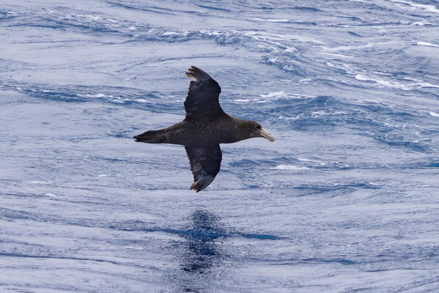
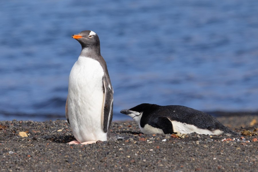
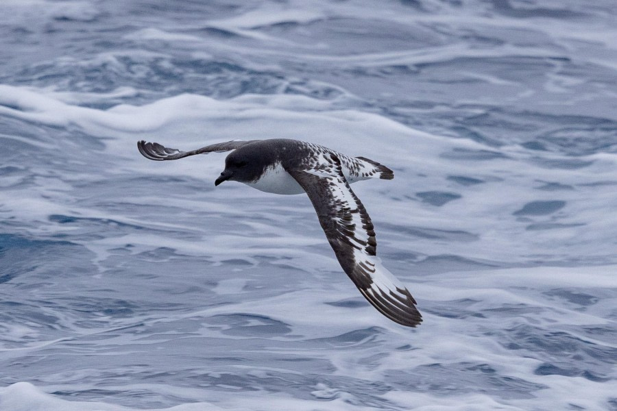
We also spotted numerous gentoo penguins on ice floes, Wilson’s storm petrels dancing on the surface and kelp gulls flying above. As we neared towards the end of our zodiac cruise, the cold started to creep in and what other way to warm up than a surprise zodiac filled with the hotel and bridge team serving rum and hot chocolate! It was the sweetest way to warm up.

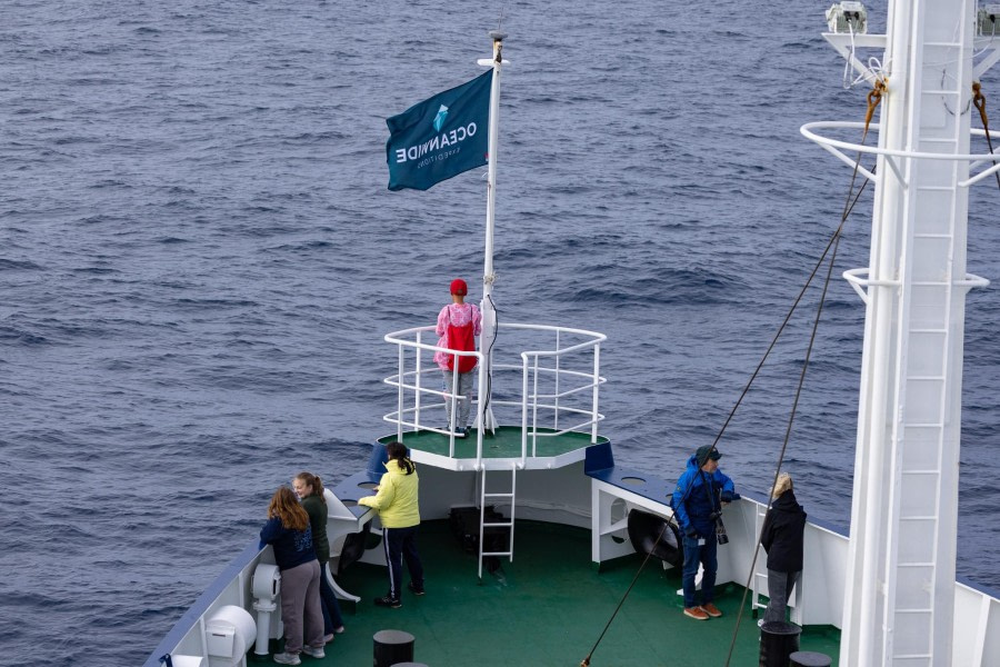
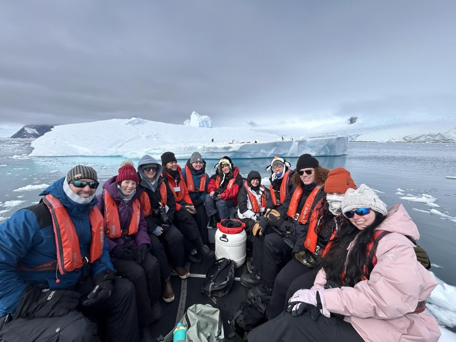
After lunch, we headed back out into the elements to Orne Harbour, with the weather turning on a show for us with some beautiful afternoon sun! The kayakers headed out into the brash ice towards the glacier, while the rest of us landed ashore, on the continent at last! Although we had visited many places already on our trip, this landing was on the actual Antarctic continent itself rather than an island, so lots of photo opportunities were had with the Antarctic flag, and lots of 7th continents were ticked off!

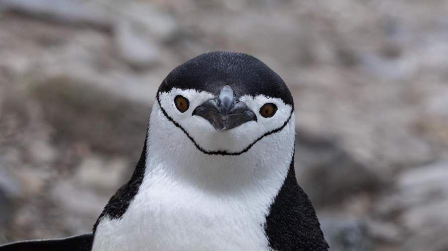
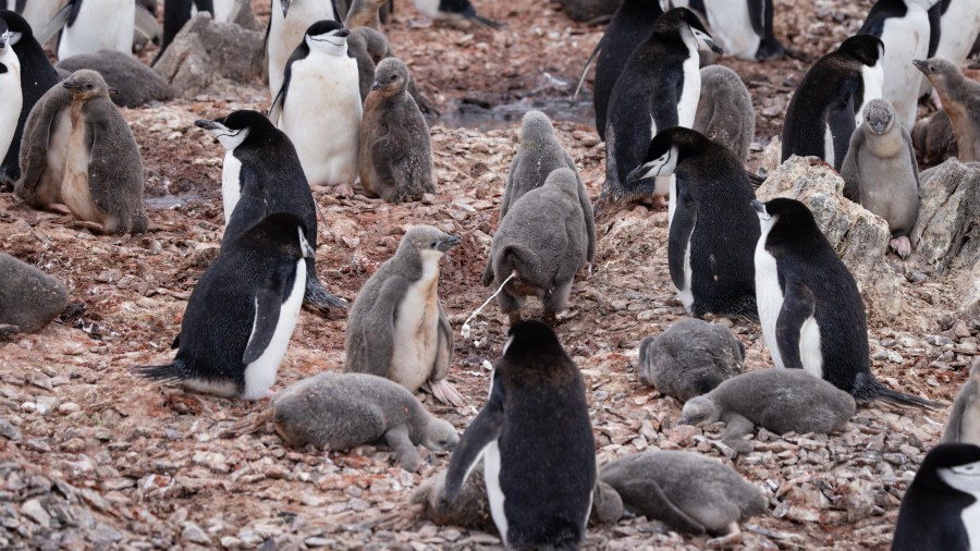
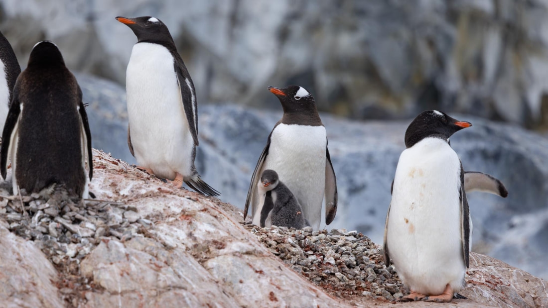
Today’s landing there was only one route - up! We visited a chinstrap penguin colony, and these little birds are often referred to as the mountaineer of penguins as they can sometimes be found nesting on rocky outcrops up to 160 m above sea level! What crazy little creatures! So upwards we went to the top of the ridge to observe the colony, with lots of switchbacks made in the snowy path to help us clumsy humans walk up easier. It was such a glorious view from the top, looking down at the bay in the glimmery afternoon sun with the chirps of chinstrap chicks in our ears.

Back on board, during Rustyn’s daily briefing and recap, we got rudely interrupted by an incredible wildlife encounter - a pod of over 20 orcas! We rushed outside with our cameras and warm clothing and witnessed a true spectacle of nature. Mixing pods of small Type B (Gerlache) killer whales had come together to socialise possibly after a successful hunt of their preferred prey, penguins. There are five ecotypes of orca down here in Antarctica, Type A, Large Type B (pack ice), Small Type B (Gerlache), Type C (Ross Sea) and Type D (Subantarctic). These are technically still all the same species, but eventually they may get divided into subspecies due to their morphological, ecological and distributional differences.

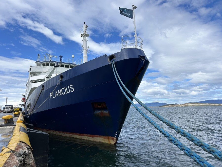
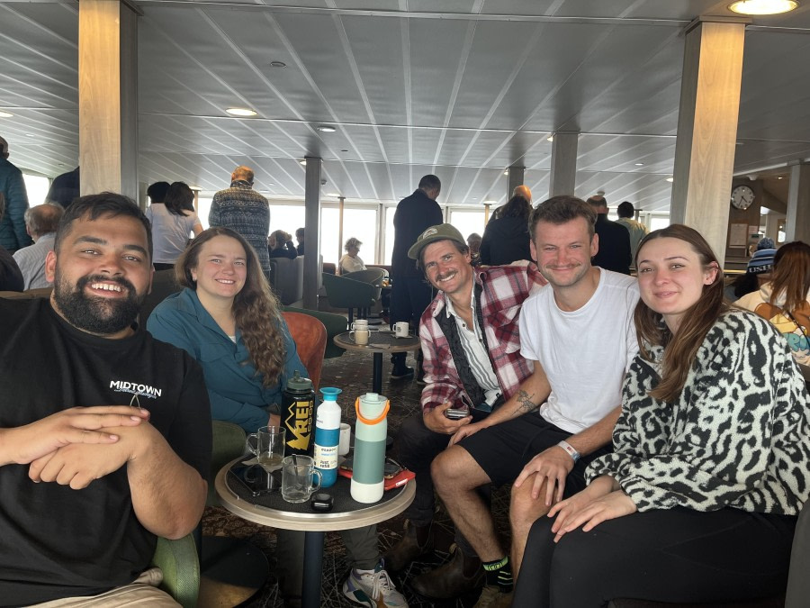
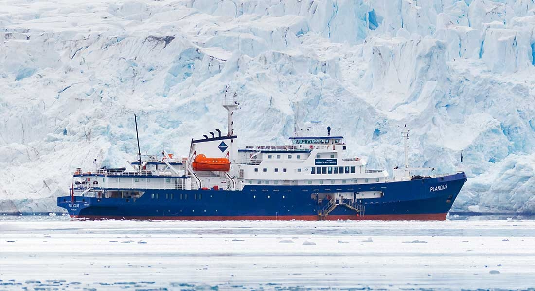
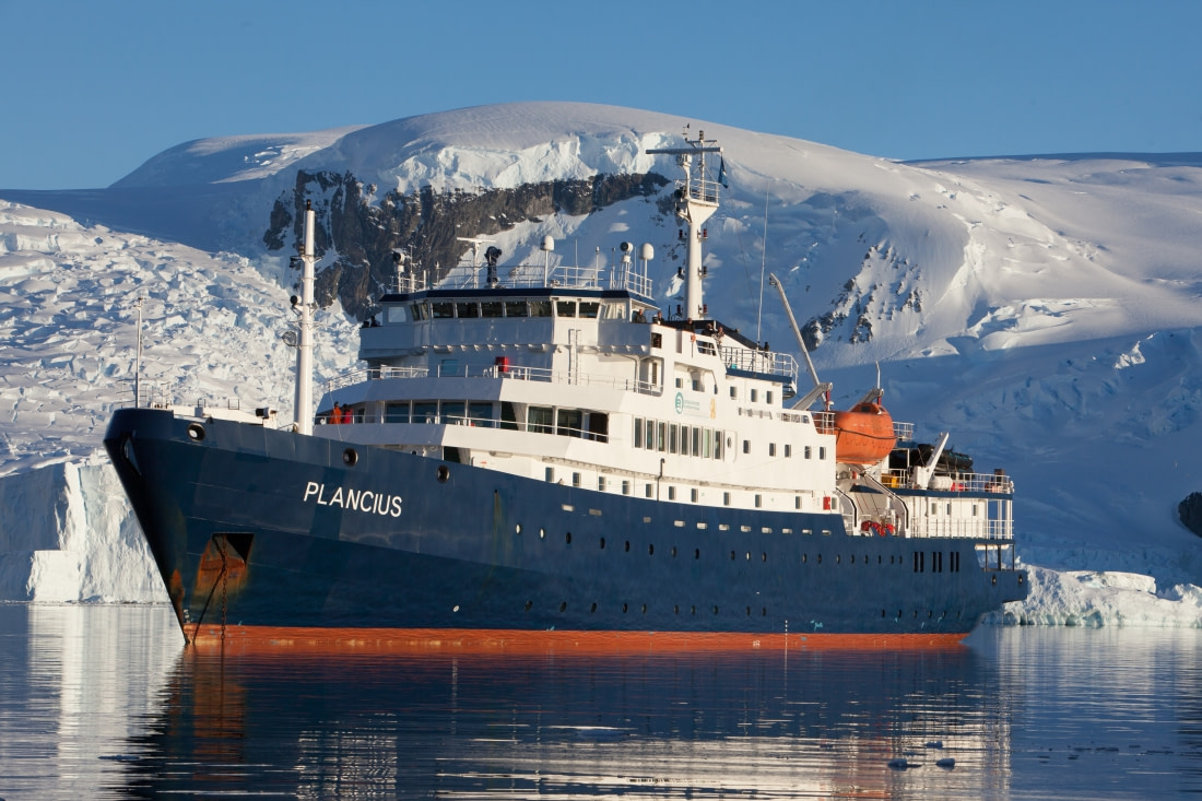
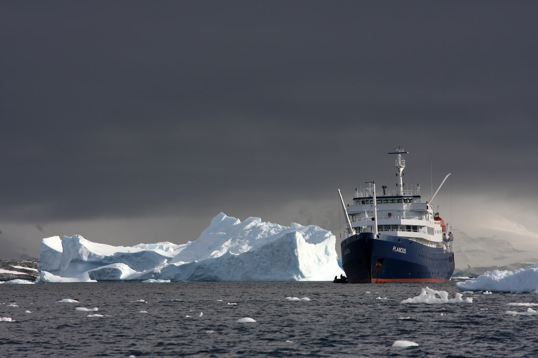
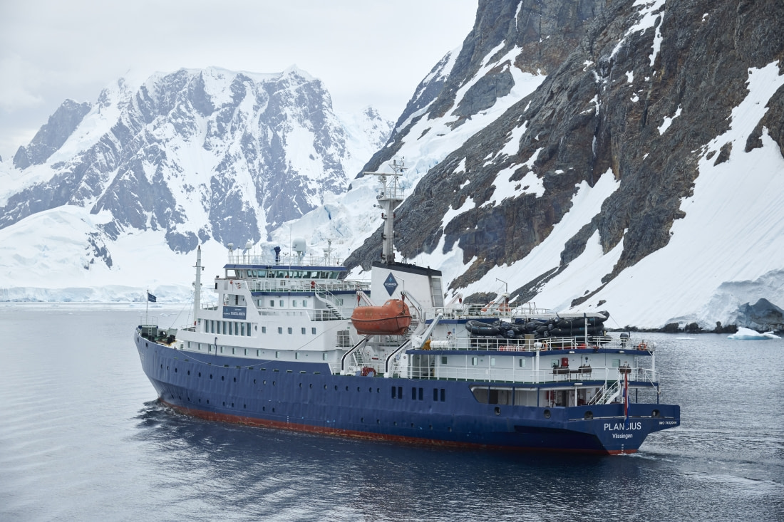
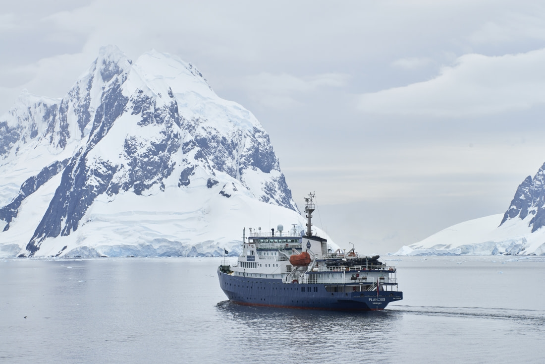
After the orca show, we were treated with another scrumptious dinner by the hotel team, and the next group of campers set off for their evening camp out at Damoy Point. It was yet another wonderful and eventful day in Antarctica, some of us headed off to bed early, others socialised in the main lounge with drinks and board games and sharing stories of our world travels and home lives. The Plancius was really becoming a home away from home.

Kayak Log Wednesday 14 – Morning tour:

Andvord Bay (Gerlache Strait) – West Shore Paddle (~5 km)

We were dropped by Zodiac onto the north-west side of Andvord Bay, the kind of quiet Antarctic morning that feels almost staged: calm sea, little wind, and a ceiling of grey that softened every edge. We launched smoothly and set a course south-east along the coastline, keeping the group tight and the pace measured, letting the bay draw us deeper into its glacial amphitheater.

At first the light was flat and cold, but Andvord doesn’t need sunshine to be dramatic. The shoreline carried that familiar mix of rock, snow, and hanging ice, with icebergs scattered like carved monuments, some small, some larger pieces with an impossible, clean blue glowing through their flanks. The soundscape was pure peninsula: the hush of paddles, the occasional crack from somewhere unseen, and the low, distant groan of glaciers settling into the sea.

Then the bay reminded us why glacier distance rules matter. Ahead, a section of front shed a serac with a sudden, heavy urgency: ice collapsing into water, the aftermath rolling out as a pulse you could feel even from where we were. We were already holding a conservative margin, and the moment turned into a powerful, real-time lesson: in Andvord Bay, the glaciers don’t give warnings; they just happen. (It’s a dynamic place, with regular calving around the bay.)

As the morning opened, the cloud began to break. Blue patches appeared between the layers, and the scene sharpened: ridges, crevasses, and the steeper faces around the bay standing out in higher contrast. Above the shoreline, the surrounding high ground—features such as Mount Hoegh and Dallmeyer Peak on the bay’s western side—gave the whole fjord a sense of scale that only grows as you move.

And then came the encounter that resets your internal compass. A humpback whale surfaced close—quiet, unhurried, passing within roughly fifteen metres of the kayaks. No drama, no rush, just a slow, deliberate presence moving through the bay as if we were the ones drifting. It lingered in the area, and in that calm water it felt very much like feeding behaviour—steady, purposeful, and completely at home.

Near the end of the paddle, as we were still absorbing everything Andvord had shown us, the day offered one more surprise: Zodiacs arrived with hot chocolate, delivered right there on the water. Warm cups in cold hands, glaciers all around, and a brief pause where everyone just looked up and listened—ice rumbling in the distance, the bay breathing, the moment perfectly placed.

We covered about 5 km in total: calm, controlled paddling with a route shaped by good judgement, big ice awareness, and the kind of wildlife encounter you don’t forget.

Highlights: serac fall / calving event observed safely at distance, close, calm humpback whale encounter, hot chocolate delivered by Zodiac in the middle of Andvord’s glacier arena.

Kayak log Wednesday 14th – Afternoon tour:

Orne Harbour (Gerlache Strait) – Sheltered Coves & Brash-Ice Slalom (~5 km)

Orne Harbour greeted us with a very Antarctic contradiction: a strong WSW breeze on the outside, but glassy water once we tucked into the protected pockets of the harbour. We launched under a huge blue sky, the wind having scrubbed the air clean and pushed the clouds into crisp, high-contrast shapes. Orne itself is a compact, steep-walled inlet on the west coast of Graham Land, famous for tight scenery and dramatic peaks rising straight from the sea.

With the wind pressing from the southwest, we kept the paddle plan conservative and worked the sheltered bays on the eastern side of the harbour, using the coastline as a windbreak. The water was littered with bergy bits and brash ice—enough to force constant micro-decisions, but not so much that it stopped us moving. We weaved through the pieces in a slow, controlled slalom, enjoying the sound that only sea ice makes: tiny air bubbles escaping with a fizzing, soda-water crackle as the ice softened in the mild surface melt.

The mountains framed everything. Spigot Peak—that dark, unmistakable spire marking the southern side of the harbour entrance—was our constant reference point, and farther along the skyline the needle-like profile of Mount Dedo (Zeiss Needle) added to the jagged, volcanic drama of the Arctowski Peninsula coast. The glaciers around the inlet looked close enough to touch, but we kept a deliberate distance off any active fronts—ice has a way of reminding you, without warning, that it is never truly still.

Toward the end of the route, we spotted Weddell seals resting on a drifting floe, relaxed and unbothered as we passed at a respectful range. The breeze stayed with us, but inside the harbour there was no swell, clean air, calm water, and that satisfying feeling of navigating through moving ice without needing to fight the sea.

We finished with roughly 5 km on the water: a bright, wind-polished afternoon where the route was shaped by good judgement, staying sheltered, reading the ice, and letting Orne Harbour deliver its best kind of Antarctic atmosphere.

Highlights: wind outside, calm water inside: classic shelter strategy in Orne Harbour, brash-ice slalom with the “soda-water” fizz of air bubbles escaping melting ice, Weddell seals hauled out on a drifting piece of ice.

Day 7: Damoy Point and Port Lockroy

Damoy Point and Port Lockroy
Fecha: 15.01.2026
Posición: 64°48.2’S / 063°29.7’W
Viento: SW-2
Clima: Overcast
Temperatura del Aire: +3

The day began very early aboard MV Plancius as we made our way into the calm waters of Dorian Bay under the soft light of the Antarctic morning. Before breakfast, the expedition team launched Zodiacs to retrieve our overnight campers, who had spent an unforgettable night ashore. As the campers were brought back onboard, tired but smiling faces told the story of a truly special experience, having slept surrounded by towering peaks, glaciers, and the unmistakable sounds of Antarctica.

Following a short break, we returned to the same landing site later in the morning. Conditions remained excellent, allowing for a smooth landing at Dorian Bay. Once ashore, guests visited the historic Damoy Hut, a former British Antarctic Survey facility, offering a fascinating glimpse into the logistical challenges and daily life of early Antarctic operations. From there, we made our way to nearby penguin rookeries, where gentoo penguins were busy nesting and commuting along well-worn penguin highways. The lively scenes provided fantastic opportunities for observation and photography.

To round off the morning’s activities, the bravest among us took part in a polar plunge. Amid cheers and encouragement from the shore, we plunged into the icy Antarctic waters, emerging exhilarated and quickly wrapped in warm towels — a highlight for many and a memory that will last a lifetime.

After an eventful morning, we returned to Plancius for a well-earned lunch and some time to warm up while the ship repositioned for the afternoon activities. Our next destination was Port Lockroy, where we went ashore to visit the historic base, museum, and famous Antarctic post office, the southernmost post office of the world! Many postcards were sent to all corners of the world today! We explored the surrounding area, enjoying close encounters with penguins and taking in the remarkable scenery.

Meanwhile, Zodiacs cruised around Jougla Point, where the shoreline was bustling with wildlife. Penguins were everywhere, moving between nests and the sea, while blue-eyed cormorants nested along the rocky outcrops. The combination of abundant wildlife, calm conditions, and dramatic ice formations made for an exceptional afternoon on the water.

As we returned to the ship, the expedition team gathered everyone in the lounge to outline plans for our final day of operations in Antarctica. With the end of the voyage approaching, the evening was a celebration of everything we had experienced together. A BBQ was held on the outside deck, where guests and crew enjoyed good food, music, and each other’s company. Dancing followed, with laughter and smiles all around, as Plancius gently sailed northwards again — a perfect ending to another incredible day in the Antarctic Peninsula.

Kayak log Thursday 15th – Morning tour:

Damoy Point & Dorian Bay (Wiencke Island) – Casabianca Island Loop (~5 km)

We began the morning a couple of kilometers north of Damoy Point, dropping into the kayaks and setting a gentle course south along the coastline. A light westerly wind was in the system, enough to raise a small chop whenever we were exposed, but most of the time the land and ice did what they do best here—offering shelter in the right places if you read the shoreline well. We kept a respectful, safety-minded distance off the glacier faces, letting the bay draw us in rather than trying to “take” it.

The sky was classic peninsula: mostly overcast, but with occasional blue breaks that turned the landscape into a theatre of contrast—dark rock, bright snow, and sudden highlights sliding across the water. Bergy bits drifted through the bay like scattered punctuation marks, just enough ice to keep us alert and weaving, but nothing that slowed the pace. Inside Dorian Bay, the feeling is always intimate: a protected bowl of water with glaciers close enough to dominate the view, but far enough away—if you keep your distance—to feel safe.

As we moved deeper toward Damoy, penguin life started to thicken. The shoreline carried the unmistakable signs before you even saw the birds: the stained rock, the tracks, and then—there it was—the smell. That warm, blunt guano tang that somehow makes the whole place feel more alive. We passed the area around the huts, with views toward the historic Argentine refuge and the simple, practical structures that speak of this bay’s long operational history. Nearby, Gentoo penguins were the most obvious presence.

From Dorian Bay we pushed out to the small, low silhouette of Casabianca Island, crossing a slightly more exposed stretch where the westerly breeze had room to build a light clapot. We rounded the island’s west side and completed a neat little loop—one of those satisfying “mini-circumnavigations” where every few minutes the view changes: rock and snow on one flank, open water and bergy bits on the other, and glaciers framing the horizon.

Back inside Dorian Bay, the morning ended in the best possible way: the group went for a polar plunge, a burst of laughter and adrenaline in a place that already feels like the edge of the world. We finished with roughly 5 km paddled—calm, scenic, and full of those small, sensory details that make Antarctica feel real: the light, the ice, the birds, and that unmistakable penguin-scented air.

Highlights: working the shoreline shelter into Dorian Bay under shifting light, close coastal access by kayak, landing options among rocks thanks to shallow draft, Casabianca Island loop and the polar plunge finale (plus the ever-present guano “perfume”).

Kayak log Thursday 15th – Afternoon tour:

Port Lockroy (Goudier Island) – Granite Channels & Historic Shoreline (~4.8 km)

We were dropped slightly west of Port Lockroy, then eased toward the shoreline where Gentoo penguins animate the rocks with constant movement. The sky stayed mostly grey, but every so often it opened just enough to throw shafts of sunlight onto the slopes above—those fleeting spotlights that make the peninsula feel like a stage set, with the scenery changing minute by minute.

The afternoon quickly became a game of precision. With little wind and calm water, we could take advantage of the kayaks’ shallow draft and work the coastline properly—threading through narrow granite channels, slaloming around low rocks and scattered ice, and using the quiet conditions to get close without feeling rushed. Low tide helped in a strange way: more rock was exposed, which made the route look busier, but it also revealed the structure of the place. And for us, it was perfect—just enough complexity to be fun, never enough to be stressful.

Among the snow patches and pale rocks, we spotted what looked like a couple of ordinary boulders—until they breathed. Weddell seals, so well camouflaged against the snowy slabs that from a distance you’d swear they were stone. We kept a respectful line and watched them do what Weddells do best: rest, unbothered, perfectly adapted to being almost invisible in their own world.

As we approached the Port Lockroy area, the human history came into focus. The famous base sat tucked against the shoreline, framed by granite and ice, and nearby the unmistakable sight of a whale skeleton lay on the rocks—skull and vertebrae clearly visible, with penguins milling behind it as if the whole scene belonged to them now. It’s one of those very Antarctic images: relics of old oceans and old expeditions sitting quietly beside today’s wildlife.

We completed a full loop around Goudier Island, taking our time along the deeply indented coast where every corner reveals another small cove, another rock garden, another fresh angle on the surrounding peaks. And then we found something unexpected: a small French sailing yacht anchored nearby. I chatted with the crew and heard their story—departing Toulon last year, overwintering in Brazil, and then crossing the Drake Passage with just two people on a roughly 10-metre boat. Brave, committed, and a reminder that Antarctica still attracts the kind of travelers who choose the hard way on purpose.

We finished with about 4.8 km paddled—an afternoon defined by calm water, intricate granite navigation, wildlife surprises, and the rare pleasure of exploring Port Lockroy’s coastline at kayak speed. Back on board, the group swapped kayak booties for muck boots and headed straight to the base to post their Antarctic postcards—an iconic end to a day that already felt like a postcard.

Highlights: low-tide granite slalom and close shoreline exploration thanks to shallow draft, Weddell seals so camouflaged they looked like rocks until they moved, whale skeleton on the shoreline, full Goudier Island loop, and the encounter with a brave French yacht crew.

Day 8: Half Moon Island & Edinburgh Hill

Half Moon Island & Edinburgh Hill
Fecha: 16.01.2026
Posición: 62°34.5’S / 059°49.6’W
Viento: SW-2
Clima: Overcast
Temperatura del Aire: +2

A late wakeup call let us rest very well facing the last day in Antarctica of this unforgettable trip that was slowly coming to an end, but we had a few hours of adventure ahead of us. We needed that extra energy today because the farewell was coming so we got ourselves prepared for some sad moments. We spent days getting to know incredible and pristine places, Antarctic flora and fauna, landscapes, icebergs never seen before, but also, we shared our time with amazing people from many different latitudes, different countries, who told us their experiences, feelings and expectations.

This morning, we visited Half Moon Island where we discovered the debris of an old whaling boat right next to our landing site, testimony of an epoch that hopefully never will come again. The long hikers followed Georg and Marcelo to the top of the hill where we saw many skuas (Stercorarius maccormick) nesting and an amazing view both sides of the island. The Argentine base called Camara Station was closed. It was built in 1953 and its original name was Moon Bay Station, but a couple of years later the name changed in honour of Lieutenant Juan Camara, an Argentine navy pilot who died in Antarctica, close to this island, on January 16th of 1955. Yes, it is great coincidence, he died 71 years ago, exactly the same day.

While the long hikers were overlooking the bay, other lucky guests got to see a King penguin (Aptenodytes Patagonicus) and a Macaroni (Eudyptes Chrysolophus), both unusual visitors in this area.

Plancius sailed to the north and during the afternoon we had the opportunity to visit Edinburgh Hill, a volcanic cliff with towering geometric columns of basalt rock that truly surprised us with their otherworldly shape. Leopard seals (Hydrurga Leptonyx) were waiting for us resting on a couple of icebergs. They looked friendly but…. keep distance, they can be quite aggressive.

Many of us passengers felt very grateful for and proud of being able to visit Antarctica, the White Continent.

At 6.15pm it was time for the recaps. Rustyn told us about the Antarctic bugs, Juan gave a magistral class about the zodiacs boat as a great driver that he is, and Charlotte explained to us many things about the leopard seals and shared incredible videos recorded under the water.

Before dinner, the picture on the bow was taken where we all came together – a strong team we built during the previous days.

But going back again to the farewell. Are farewells a sad moment? Mmmmm……I read in “Illusions”, a book written by Richard Bach that: “A farewell is necessary before you can meet again. And meeting again, after moments or lifetimes, is certain for those who are friends"

That means that farewells are not the end, they are the first step looking forward to the future, a moment or perhaps a day that is coming and that it will find us together again, maybe, forever.

Half Moon Island long hike

Distance covered: 4.5km – 2.8mi, elevation gain: 142m – 465.9ft, duration: 2h

The last hike of this trip! We started our hike today on a beautiful beach where we could see the remnants of an old whaling boat as well as several Chinstrap penguins. Our path led us over a small ridge onto another long beach where we passed a Weddell seal. We scrambled up a steep snow ridge and entered an area with many nesting skuas that we had to avoid since they don’t like it when we come too close. We enjoyed the views over the bay before we hiked back down towards the Argentine research station Camara. The zodiacs came to pick us up close by so we didn’t have to walk all the way back.

Kayak log Friday 16th – Morning tour:

Half Moon Island (South Shetlands) – South Point Slalom & West Coast Run

We launched by Zodiac into the western bay of Half Moon Island, stepping into the kayaks on water so calm it felt unreal—glassy, windless, and silent, as if the sea had decided to hold its breath for the morning. Above us the sky was grey, but the light still had that Antarctic magic: muted tones sharpening the blues in the ice and the whites in the snow, with glaciers hanging in the background like a painted backdrop.

Right from the start we set a southbound course, aiming for the island’s southern point. With no swell and no wind waves, we could work close to the shoreline safely, reading the rock shelves and small channels as they appeared. At the south tip, the coast tightened into a playful rock garden—perfect for a careful slalom. We slowed down, picked clean lines between exposed boulders and low shelves, and enjoyed that rare Antarctic treat: precise, technical paddling made easy by perfectly flat water.

From the south point, we then committed to the longer, quieter reward: a full run up the entire west coast of Half Moon Island. The shoreline opened into a series of low rocky sections and small coves, and the wildlife kept coming. Gentoo penguins dotted the shore and moved through the shallows, quick and confident in the water. Antarctic shags held the rock outcrops, dark against the snow. We also spotted Weddell seals resting—so well camouflaged they only became obvious once you caught the curve of a body or the slow blink of an eye.

One of the most memorable characters of the morning was the sheathbill—the colony’s opportunist and clean-up crew, forever patrolling the edges of penguin life and making a living from whatever the shore provides. It’s not the most glamorous bird in Antarctica, but it’s one of the most perfectly adapted, and seeing it up close always adds a little humor to the scene.

All along the paddle, the distant human footprint remained in view: the Argentine station Cámara appearing and disappearing behind points of rock, small and bright against the greys and whites. It’s a reminder that even in places that feel utterly wild, people have been coming here, working here, and enduring here for a long time.

We were eventually picked up by Zodiac along the west coast. From there, we continued the island’s circumnavigation clockwise, running up and around the north side by boat to return to Plancius. Kayaks for the close detail, Zodiac for the wider sweep—an ideal combination on a calm Half Moon morning.

Highlights: rock-garden slalom at the south point in perfectly calm water, Gentoo penguins, Antarctic shags, and well-camouflaged Weddell seals, Sheathbill sightings and a clockwise Zodiac finish around Half Moon’s north coast.

Day 9: On the Drake Passage to the North

On the Drake Passage to the North
Fecha: 17.01.2026
Posición: 59°16.6’S / 062°59.1’W
Viento: SW-4
Clima: Overcast
Temperatura del Aire: +3

Plancius sailed gently through calm seas today as we began our first full day heading north, back toward Ushuaia. It felt strange to turn our backs on Antarctica after such an intense stretch of landings and wildlife encounters, but the ocean was kind to us, staying under a metre most of the day, barely enough to notice, and the sky remained overcast and grey, a familiar Southern Ocean palette.

Our day on board focused on learning and reflection. Rustyn opened the morning with a lecture on the Antarctic Treaty, explaining how this vast continent is governed by cooperation, science, and protection rather than ownership. Hearing about the fragile balance that keeps Antarctica preserved made our journey feel even more meaningful. Fin whales appeared off the bow not long after, long and sleek, surfacing rhythmically as they moved through the water ahead of us.

Later, Chloe gave a lecture on seals, walking us through the different species we had encountered and helping us put names and behaviours to the faces we had been photographing for days. Then Marcelo shared something deeply personal: his own collection of impressive historical artifacts linked to the early Antarctic explorers. Pieces connected to the Charcot and Gerlache expeditions for example, tangible links to a time when Antarctica was still largely unknown.

As evening settled in, the ship continued steadily north, engines humming softly beneath our feet. The sea remained calm, the clouds unbroken, and conversations around the lounge carried a reflective tone. Today was less about adventure and more about rest and reflection.

Day 10: Drake Passage

Drake Passage
Fecha: 18.01.2026
Posición: 55°18.3’S / 066°15.4’W
Viento: NW-3
Clima: Overcast
Temperatura del Aire: +10

Our last day at sea. Throughout the night we got a small taste of what the Drake can be like when you actually get caught in a storm. Captain Matei ordered our little blue ship to steam northwards as fast as she could in order to avoid a so-called “purple monster” that was going to hit the Drake Passage today. Many of us didn’t sleep much last night, others really enjoyed the rocking movement of the ship as she danced through the increasing waves. By the time we went to the restaurant to enjoy our breakfast, we had almost reach the shelter of Cape Hoorn that protected us from the swell. After breakfast we came together in the Lounge to listen to George’s lecture about geology. He gave us a great overview of how the earth is formed and how Antarctica ended up all the way down south, what kind of rock it consists of and what might happen to the land once the ice is gone. An hour later, it was Esther’s turn for storytelling. We were just passing Cape Hoorn so she read out a poem that is engraved into a memorial close to the cape’s lighthouse. It is dedicated to all the sailors who lost their lives in the attempt to round the notorious Cape Hoorn.

Poem at the Cape (Sara Vial):

I am the albatross that waits for you

At the end of the world.

I am the forgotten souls of dead mariners

Who passed Cape Hoorn

From all oceans of the earth

But they did not die In the furious waves.

Today they sail on my wings

Toward eternity In the last crack Of Antarctic winds.

She then went on to tell us the story about the epic Race to the South Pole shining light on the two main characters, Roald Amundsen from Norway and Robert Falcon Scott from England, taking a closer look at their cultural backgrounds and the societies they emerged from. After this fascinating story, we enjoyed another delicious lunch in the restaurant. The early afternoon was dedicated to napping, packing and paying our bills on the ship. It slowly starts feeling like this journey is coming to an end. But there were still a few small surprises left for us.

In the afternoon it was our time to shine. Our expedition team set a time slot aside where we as guests could share some of our stories with the rest of the ship. First, we had Helen and Karin from the Oceanwide office in the Netherlands telling us a bit more about Oceanwide as a company, presented the other ships, as well as the other destinations we could travel to in the future – with a 10% off voucher for returning customers! After them, Tony came up to share some of his beautiful wildlife photos that he had taken during the tour, before Yasmine told us more about two fascinating little creatures most people don’t notice: sea angels and sea butterflies. She was followed by Cole, who gave a great explanation about how the incredible basalt columns of Edinburgh Hill have formed, and last but not least we had Rob telling us a super interesting and slightly strange story about how the American Navy brought the first nuclear reactor to McMurdo Station in Antarctica and assembled it down in the field under very harsh conditions. After these great little stories, we had some more time to sort ourselves out for tomorrow’s departure before we all came together again in the lounge for our Captain’s Farewell, where we raised our glasses to a successful and unforgettable journey.

The highlight of the evening was the incredible slide show that Katlyn and Chloe prepared for us to take home as a memory of this voyage, and of course the wonderful last dinner on board where we got to celebrate the amazing teams of the restaurant, the kitchen, the bar, the housekeeping, and the hotel management. They have all been absolutely wonderful and greatly contributed to the great success of this tour!

Day 11: Ushuaia, Disembarkation Day

Ushuaia, Disembarkation Day
Fecha: 19.01.2026
Posición: 54°50.6’S / 068°07.7’W
Viento: Light Air
Clima: Partly Cloudy
Temperatura del Aire: +12

We woke up one last time on our beloved ship, the Plancius, who had carried us into a different world where we could escape reality for 10 unforgettable days. Our bags were all packed and we left the suitcases in front of our cabins so the expedition team could take them off the ship while we were having breakfast. At 9 o’clock it was time to say goodbye. We walked down the gangway and back onto the pier of Ushuaia, looking back at the ship and the crew.

Have we really been there? Are we actually coming back from Antarctica? It will take some time to truly comprehend what we have just experienced. Many of us are missing the words. Some eyes are filled with tears. Our hearts are filled with joy and gratitude. The experiences we had throughout the last days, the memories we made, the friendships we have started on this voyage… they will last us a lifetime.

Farewell, goodbye, stay safe and fair winds until we meet again!

Total distance sailed on our voyage: 1591nm

Southernmost position: 64º49’S / 063º30’W

On behalf of Oceanwide Expeditions, the Captain, Crew and Expedition Staff would like to thank you for the great time. It has been a pleasure travelling with you.

Detalles

Código del viaje: PLA26-26
Fechas: 9 ene. - 19 ene., 2026
Duración: 10 noches
Barco: El Plancius
Embarque: Ushuaia
Desembarque: Ushuaia

¿Ha estado en este viaje?

A bordo El Plancius

Nuestro barco más antiguo, el Plancius, es un clásico para algunos de nuestros viajes polares más populares.

Más información El Plancius »
Loading