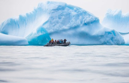
Pourquoi Pas Island

A mountainous Antarctic island off the west coast of Graham Land

Pourquoi Pas Island

Regio: Antarctica

Bestemmingen: Antarctisch Schiereiland

The size, place, and neighbors of Pourquoi Pas Island

Roughly 27 km (17 miles) long and anywhere from 8 to 18 km (5 to 11 miles) wide, Pourquoi Pas Island is situated between Bourgeois Fjord and Bigourdan Fjord off western Graham Land, Antarctica.

Pourquoi Pas Island’s discovery, exploration, and namesake

Pourquoi Pas was discovered by the French Antarctic Expedition of 1908 – 1910, led by Jean-Baptiste Charcot, then fully charted by the British Graham Land Expedition of 1934 – 1937, under Australian explorer John Rymill, who named Pourquoi Pas Island after Charcot’s ship, the (you guessed it) Pourquoi-Pas.

Gerelateerde reizen

Antarctica - Voorbij de poolcirkel - Wilkins Ice Shelf - Aurora Australis

Bezoek plaatsen ontdekt door De Gerlache tijdens zijn poolexpeditie aan boord van de Belgica

OTL32-25 De reis is een echte expeditie, een verkenning van de zeer zelden bezochte regio van de Bellingshausen Zee, Marguerite Bay en Alexander Eiland. We bezoeken plaatsen die De Gerlache ontdekte tijdens zijn poolexpeditie (juni 1887 - maart 1899) aan boord...

m/v Ortelius

m/v Ortelius

Reisdatum:

21 mrt. - 5 apr., 2025

Ligplaatsen starten vanaf:

10500 USD

Loading